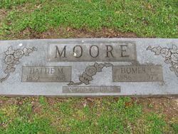
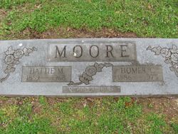
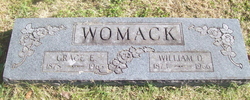
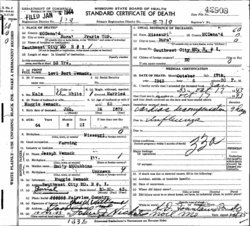
Hattie Mae Womack Moore
| Birth | : | 24 Sep 1889 Brumley, Miller County, Missouri, USA |
| Death | : | 15 Oct 1968 South West City, McDonald County, Missouri, USA |
| Burial | : | Grant Community Cemetery, Grant, Grayson County, USA |
| Coordinate | : | 36.6624180, -81.4027100 |
| Description | : | Services were held Sunday, November 3, 1968, at 2:00 pm. at the Pentecostal Church, Gospel of the Kingdom. Rev. Hugh Coyan officiated. Pallbearers were her grandsons. |
frequently asked questions (FAQ):
-
Where is Hattie Mae Womack Moore's memorial?
Hattie Mae Womack Moore's memorial is located at: Grant Community Cemetery, Grant, Grayson County, USA.
-
When did Hattie Mae Womack Moore death?
Hattie Mae Womack Moore death on 15 Oct 1968 in South West City, McDonald County, Missouri, USA
-
Where are the coordinates of the Hattie Mae Womack Moore's memorial?
Latitude: 36.6624180
Longitude: -81.4027100
Family Members:
Parent
Spouse
Siblings
Children
Flowers:
A tombstone stands among the rest;Forgotten and alone.Your name and date are chiseled outon polished, marble stone.It reaches out to all who care,it's not too late to mourne.You did not know I would exist;You died and I was born.Yet each of us are a part of you,in flesh, our blood and bone.Our hearts contrct and beat a pulseentirely not our own.Dear Ancestor, the place you filledall those years ago,Spread out among the ones you left,the ones who loved you so.I wonder how you lived and loved,I wonder if you knewThat one day I would find this spotand spend some time with you. Read less
Left by Anonymous on 14 Jul 2004

Mother-in-law of brother-in-law of stepdaughter of sister-in-law of great-uncle
Left by Anonymous on 02 Apr 2018

Left by Anonymous on 08 Dec 2019
Nearby Cemetories:
1. Grant Community Cemetery
Grant, Grayson County, USA
Coordinate: 36.6624180, -81.4027100
2. Liberty Hill Baptist Church Cemetery
Grant, Grayson County, USA
Coordinate: 36.6688995, -81.4064026
3. Pugh-Greear Cemetery
Grant, Grayson County, USA
Coordinate: 36.6552800, -81.4055330
4. Grubb Cemetery
Grayson County, USA
Coordinate: 36.6757770, -81.4072420
5. Herald Pugh Family Cemetery
Grayson County, USA
Coordinate: 36.6465111, -81.4066467
6. Charles Hoffman Cemetery
Flat Ridge, Grayson County, USA
Coordinate: 36.6673760, -81.3832750
7. Byram Ross Cemetery
Barton Crossroad, Grayson County, USA
Coordinate: 36.6817270, -81.3938530
8. Pugh Cemetery
Grayson County, USA
Coordinate: 36.6445820, -81.4199140
9. Reedy Cemetery
Grayson County, USA
Coordinate: 36.6474991, -81.3752975
10. Shelton Family Cemetery
Mouth of Wilson, Grayson County, USA
Coordinate: 36.6489000, -81.4358000
11. Young Cemetery
Mouth of Wilson, Grayson County, USA
Coordinate: 36.6333997, -81.4127455
12. Fielden Mack Young Cemetery
Mouth of Wilson, Grayson County, USA
Coordinate: 36.6333710, -81.4127510
13. Rockbridge Baptist Church Cemetery
Grant, Grayson County, USA
Coordinate: 36.6718830, -81.3635510
14. Razor Ridge Cemetery
Grant, Grayson County, USA
Coordinate: 36.6970499, -81.3873213
15. Thomas Cemetery
Barton Crossroad, Grayson County, USA
Coordinate: 36.6530310, -81.3569760
16. Bartons Crossroads Cemetery
Barton Crossroad, Grayson County, USA
Coordinate: 36.6576080, -81.3528595
17. Parks Cemetery
Grayson County, USA
Coordinate: 36.6927986, -81.3696976
18. New Hope Cemetery
Barton Crossroad, Grayson County, USA
Coordinate: 36.6580582, -81.3512268
19. Perkins Cemetery
Grayson County, USA
Coordinate: 36.6739006, -81.3525009
20. Wiley Perkins Cemetery
Barton Crossroad, Grayson County, USA
Coordinate: 36.6740960, -81.3523310
21. Wright Wingate Family Cemetery #2
Barton Crossroad, Grayson County, USA
Coordinate: 36.6482000, -81.3516000
22. Riley Preston Parks Cemetery
Grant, Grayson County, USA
Coordinate: 36.6960210, -81.3664240
23. James C A Perkins Cemetery
Mill Creek, Grayson County, USA
Coordinate: 36.6267730, -81.4382540
24. Anderson Cemetery
Grayson County, USA
Coordinate: 36.6711006, -81.3452988

