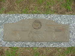
Hazel Lucille Baker Ross
| Birth | : | 30 Oct 1915 Washington County, Iowa, USA |
| Death | : | 16 Aug 2008 Washington, Washington County, Iowa, USA |
| Burial | : | Cobden Cemetery, Cobden, Renfrew County, Canada |
| Coordinate | : | 45.6171200, -76.8671200 |
| Plot | : | Garden of Devotion 257-3 |
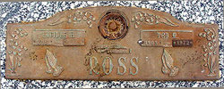
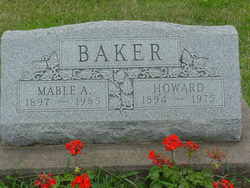
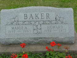
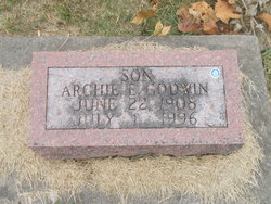
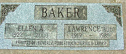
| Description | : | Also known by her middle name of "Lucille" which is shown in most public records and on her grave marker. Birth date has also been reported as "October 31, 1915." Hazel was a daughter of Howard Louis Baker (1894-1975) & Mabel Aletha Hotle (1897-1985). Hazel first married Archie E. Godwin (1908-1996) on June 14, 1935 in Washington, Washington Co., Iowa. No reported children. Marriage ended in divorce. Hazel then married Ted Milford Ross (1903-1972) on February 25, 1939 in Kahoka, Clark Co., Missouri. They had two identified children. |
frequently asked questions (FAQ):
-
Where is Hazel Lucille Baker Ross's memorial?
Hazel Lucille Baker Ross's memorial is located at: Cobden Cemetery, Cobden, Renfrew County, Canada.
-
When did Hazel Lucille Baker Ross death?
Hazel Lucille Baker Ross death on 16 Aug 2008 in Washington, Washington County, Iowa, USA
-
Where are the coordinates of the Hazel Lucille Baker Ross's memorial?
Latitude: 45.6171200
Longitude: -76.8671200
Family Members:
Parent
Spouse
Siblings
Children
Flowers:
Nearby Cemetories:
1. Cobden Cemetery
Cobden, Renfrew County, Canada
Coordinate: 45.6171200, -76.8671200
2. Pioneer Cemetery
Osceola, Renfrew County, Canada
Coordinate: 45.6231291, -76.9430902
3. Saint Pius V Cemetery
Osceola, Renfrew County, Canada
Coordinate: 45.6257000, -76.9445000
4. Beachburg Mennonite Cemetery
Cobden, Renfrew County, Canada
Coordinate: 45.6728430, -76.8527980
5. Beachburg Mennonite Cemetery
Beachburg, Renfrew County, Canada
Coordinate: 45.6751052, -76.8551953
6. Haley Cemetery
Haley Station, Renfrew County, Canada
Coordinate: 45.5722300, -76.7880700
7. Howard Cemetery
Foresters Falls, Renfrew County, Canada
Coordinate: 45.6787224, -76.7817764
8. Saint Andrew's Presbyterian Cemetery
Kerr Line, Renfrew County, Canada
Coordinate: 45.6479200, -76.7433600
9. Rosebank Cemetery
Rosebank, Renfrew County, Canada
Coordinate: 45.5251000, -76.7829110
10. Beachburg Union Cemetery
Beachburg, Renfrew County, Canada
Coordinate: 45.7300987, -76.8577194
11. St. Augustine Anglican Cemetery
Beachburg, Renfrew County, Canada
Coordinate: 45.7306000, -76.8597300
12. St. Augustines Anglican
Westmeath, Renfrew County, Canada
Coordinate: 45.7306000, -76.8597000
13. Saint Michael Roman Catholic Cemetery
Bromley, Renfrew County, Canada
Coordinate: 45.5166367, -76.9439485
14. Douglas Public Cemetery
Douglas, Renfrew County, Canada
Coordinate: 45.5119600, -76.9439500
15. Micksburg United Cemetery
Micksburg, Renfrew County, Canada
Coordinate: 45.6615600, -77.0353000
16. Saint Patricks Anglican Cemetery
Cobden, Renfrew County, Canada
Coordinate: 45.7103750, -77.0024870
17. Stafford United Church Cemetery
Cobden, Renfrew County, Canada
Coordinate: 45.7120380, -77.0029160
18. Micksburg Presbyterian Cemetery
Micksburg, Renfrew County, Canada
Coordinate: 45.6705200, -77.0462600
19. McDonald Burying Ground
Westmeath, Renfrew County, Canada
Coordinate: 45.7178231, -77.0010204
20. St. George Anglican Church Cemetery
Portage-du-Fort, Outaouais Region, Canada
Coordinate: 45.5934170, -76.6678210
21. Saint Stephen Anglican Cemetery
Micksburg, Renfrew County, Canada
Coordinate: 45.6759620, -77.0546720
22. Litchfield United Cemetery
Outaouais Region, Canada
Coordinate: 45.6309030, -76.6564860
23. Protestant Cemetery of Portage du Fort
Portage-du-Fort, Outaouais Region, Canada
Coordinate: 45.5926410, -76.6584030
24. St. James Roman Catholic Cemetery
Portage-du-Fort, Outaouais Region, Canada
Coordinate: 45.5929000, -76.6582800

