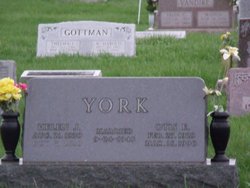
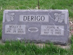
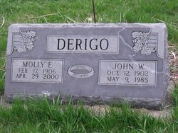
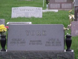
Helen Jean Derigo York
| Birth | : | 21 Aug 1930 Lancaster, Schuyler County, Missouri, USA |
| Death | : | 7 Oct 2010 |
| Burial | : | St Leonard Churchyard, Farleigh Hungerford, Mendip District, England |
| Coordinate | : | 51.3155390, -2.2884820 |
| Description | : | Helen Jean (Derigo) York, 80, of San Antonio, Texas, formerly of Lancaster, Missouri, passed away on Thursday, October 7, 2010. Helen was born on August 21, 1930 to John Wayman and Molly Elizabeth (Welch) Derigo in Lancaster, Missouri. She married Otis Ewell "Fuzz" York on September 24, 1949 and to this union two children were born, Robert Wayne York and Judy Ann York. "Otie" and Helen Jean lived most of their married life in Lancaster, Missouri where Helen Jean worked for many years as a banker at the Schuyler County State Bank. They moved to southern Missouri in 1970 where... Read More |
frequently asked questions (FAQ):
-
Where is Helen Jean Derigo York's memorial?
Helen Jean Derigo York's memorial is located at: St Leonard Churchyard, Farleigh Hungerford, Mendip District, England.
-
When did Helen Jean Derigo York death?
Helen Jean Derigo York death on 7 Oct 2010 in
-
Where are the coordinates of the Helen Jean Derigo York's memorial?
Latitude: 51.3155390
Longitude: -2.2884820
Family Members:
Parent
Spouse
Flowers:
Nearby Cemetories:
1. St Leonard Churchyard
Farleigh Hungerford, Mendip District, England
Coordinate: 51.3155390, -2.2884820
2. Farleigh Hungerford Castle
Farleigh Hungerford, Mendip District, England
Coordinate: 51.3173500, -2.2869590
3. All Saints Churchyard
Tellisford, Mendip District, England
Coordinate: 51.2997270, -2.2877180
4. St. John the Baptist Churchyard
Hinton Charterhouse, Bath and North East Somerset Unitary Authority, England
Coordinate: 51.3233330, -2.3219440
5. Freshford Cemetery
Freshford, Bath and North East Somerset Unitary Authority, England
Coordinate: 51.3379620, -2.3082970
6. Saint Peters Churchyard
Freshford, Bath and North East Somerset Unitary Authority, England
Coordinate: 51.3400570, -2.3033340
7. Norton St. Philip Churchyard
Norton St Philip, Mendip District, England
Coordinate: 51.3001680, -2.3279700
8. Christ Church Churchyard
Rode, Mendip District, England
Coordinate: 51.2861620, -2.2790890
9. St. Lawrence Churchyard
Woolverton, Mendip District, England
Coordinate: 51.2851540, -2.3021790
10. St Lawrence Churchyard
Rode, Mendip District, England
Coordinate: 51.2792750, -2.2765370
11. Holy Trinity Churchyard
Bradford-on-Avon, Wiltshire Unitary Authority, England
Coordinate: 51.3465927, -2.2538147
12. Midford Burial Ground
Bath, Bath and North East Somerset Unitary Authority, England
Coordinate: 51.3394360, -2.3391424
13. Christ Church Churchyard
Bradford-on-Avon, Wiltshire Unitary Authority, England
Coordinate: 51.3507000, -2.2493360
14. St Mary's Churchyard
Laverton, Mendip District, England
Coordinate: 51.2757380, -2.3195910
15. Holt Cemetery
Bradford-on-Avon, Wiltshire Unitary Authority, England
Coordinate: 51.3468710, -2.2352160
16. Bradford on Avon Cemetery
Bradford-on-Avon, Wiltshire Unitary Authority, England
Coordinate: 51.3468700, -2.2336400
17. St. Michael's Churchyard
Monkton Combe, Bath and North East Somerset Unitary Authority, England
Coordinate: 51.3559540, -2.3285700
18. All Saints Churchyard
Lullington, Mendip District, England
Coordinate: 51.2661940, -2.3121800
19. St George Churchyard
Beckington, Mendip District, England
Coordinate: 51.2635260, -2.2856810
20. St Julian's Churchyard
Wellow, Bath and North East Somerset Unitary Authority, England
Coordinate: 51.3240160, -2.3717630
21. Beckington Baptist Chapel Burial Ground
Beckington, Mendip District, England
Coordinate: 51.2610760, -2.2897000
22. Union Chapel
Combe Down, Bath and North East Somerset Unitary Authority, England
Coordinate: 51.3594751, -2.3443662
23. St. James' Churchyard
South Stoke, Bath and North East Somerset Unitary Authority, England
Coordinate: 51.3497220, -2.3652780
24. Jewish Burial Ground
Combe Down, Bath and North East Somerset Unitary Authority, England
Coordinate: 51.3599170, -2.3534670


