| Birth | : | 17 Oct 1921 Springdale, Washington County, Arkansas, USA |
| Death | : | 1 May 2013 Fayetteville, Washington County, Arkansas, USA |
| Burial | : | Newark-on-Trent Cemetery, Newark-on-Trent, Newark and Sherwood District, England |
| Coordinate | : | 53.0692040, -0.7988660 |
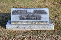
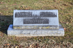
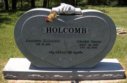
| Description | : | Henrietta K. Holcomb, age 91, longtime Fayetteville educator, died Wednesday, May 1, 2013, in Fayetteville, Arkansas. She was born in Springdale, Arkansas on October 17, 1921, daughter of Wilson Whitaker and Lydia (Reed) Kimbrough. Henrietta graduated as salutatorian of the Springdale High School Class of 1938. She received a Bachelor of Science degree in Business Administration from the University of Arkansas. After attending the University of Illinois, Urbana School of Library Science, Henrietta moved to Washington D.C., accepted a job in the U.S. Department of Agriculture, followed by several years in the Office of Budget and Finance and the Office... Read More |
frequently asked questions (FAQ):
-
Where is Henrietta K. Kimbrough Holcomb's memorial?
Henrietta K. Kimbrough Holcomb's memorial is located at: Newark-on-Trent Cemetery, Newark-on-Trent, Newark and Sherwood District, England.
-
When did Henrietta K. Kimbrough Holcomb death?
Henrietta K. Kimbrough Holcomb death on 1 May 2013 in Fayetteville, Washington County, Arkansas, USA
-
Where are the coordinates of the Henrietta K. Kimbrough Holcomb's memorial?
Latitude: 53.0692040
Longitude: -0.7988660
Family Members:
Parent
Spouse
Siblings
Flowers:
Nearby Cemetories:
1. Newark-on-Trent Cemetery
Newark-on-Trent, Newark and Sherwood District, England
Coordinate: 53.0692040, -0.7988660
2. St. Mary Magdalene Church
Newark-on-Trent, Newark and Sherwood District, England
Coordinate: 53.0766983, -0.8085000
3. Balderton Cemetery
Balderton, Newark and Sherwood District, England
Coordinate: 53.0539100, -0.7877400
4. Balderton Methodist Church
Newark-on-Trent, Newark and Sherwood District, England
Coordinate: 53.0551620, -0.7823410
5. St Giles Churchyard
Balderton, Newark and Sherwood District, England
Coordinate: 53.0553010, -0.7780750
6. All Saints Churchyard
Hawton, Newark and Sherwood District, England
Coordinate: 53.0513890, -0.8258330
7. All Saints Churchyard
Winthorpe, Newark and Sherwood District, England
Coordinate: 53.0983646, -0.7884366
8. Farndon Municipal Cemetery
Farndon, Newark and Sherwood District, England
Coordinate: 53.0606540, -0.8487310
9. St Wilfrid's Churchyard
Kelham, Newark and Sherwood District, England
Coordinate: 53.0901100, -0.8459700
10. St. Michael's Churchyard
Averham, Newark and Sherwood District, England
Coordinate: 53.0810080, -0.8549840
11. St Wilfred Churchyard
South Muskham, Newark and Sherwood District, England
Coordinate: 53.1071300, -0.8156400
12. St Laurence Churchyard
Thorpe, Newark and Sherwood District, England
Coordinate: 53.0428100, -0.8575900
13. St Michael's Churchyard
Cotham, Newark and Sherwood District, England
Coordinate: 53.0199600, -0.8174700
14. St Bartholomew Churchyard
Langford, Newark and Sherwood District, England
Coordinate: 53.1225760, -0.7743940
15. Holy Trinity Churchyard
Rolleston, Newark and Sherwood District, England
Coordinate: 53.0646500, -0.8944500
16. St Oswald Churchyard
East Stoke, Newark and Sherwood District, England
Coordinate: 53.0427727, -0.8860863
17. All Saints Churchyard
Elston, Newark and Sherwood District, England
Coordinate: 53.0237280, -0.8701810
18. St Peter & St Paul's Churchyard
Upton, Newark and Sherwood District, England
Coordinate: 53.0805800, -0.9014900
19. All Saints Churchyard
Beckingham, North Kesteven District, England
Coordinate: 53.0740990, -0.6945420
20. All Saints Churchyard
Fenton, South Kesteven District, England
Coordinate: 53.0462300, -0.6910100
21. St Denis Churchyard
Morton, Newark and Sherwood District, England
Coordinate: 53.0545100, -0.9168100
22. All Saints Churchyard
Syerston, Newark and Sherwood District, England
Coordinate: 53.0194600, -0.8884800
23. St Giles Churchyard
Cromwell, Newark and Sherwood District, England
Coordinate: 53.1449750, -0.8063850
24. St. John the Baptist Churchyard
Collingham, Newark and Sherwood District, England
Coordinate: 53.1425550, -0.7656640


