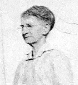
| Birth | : | 10 Sep 1856 Jamaica, Windham County, Vermont, USA |
| Death | : | 6 Apr 1929 Foster, Pierce County, Nebraska, USA |
| Burial | : | Green Hill Cemetery, Davis, Murray County, USA |
| Coordinate | : | 34.4981003, -97.1294022 |
| Description | : | The many old friends of Henry M. Davidson in Pierce County will be sorry to learn that he passed away at the General Hospital in Plainview last Saturday night. It is too bad that his life end came in the manner that it did. He was driving a car between Plainview and Breslau and as he was turning at an intersection just south of the city park, his car was struck by a truck. In this accident he received injuries, which caused his death. For many years, Mr. Davidson operated a livery barn at Foster and later he moved to Plainview, where he... Read More |
frequently asked questions (FAQ):
-
Where is Henry Milton Davidson's memorial?
Henry Milton Davidson's memorial is located at: Green Hill Cemetery, Davis, Murray County, USA.
-
When did Henry Milton Davidson death?
Henry Milton Davidson death on 6 Apr 1929 in Foster, Pierce County, Nebraska, USA
-
Where are the coordinates of the Henry Milton Davidson's memorial?
Latitude: 34.4981003
Longitude: -97.1294022
Family Members:
Parent
Spouse
Siblings
Children
Flowers:
Nearby Cemetories:
1. Green Hill Cemetery
Davis, Murray County, USA
Coordinate: 34.4981003, -97.1294022
2. Oak Ridge Cemetery
Davis, Murray County, USA
Coordinate: 34.5050011, -97.1296997
3. Howell Cemetery
Garvin County, USA
Coordinate: 34.5080986, -97.1735992
4. James Cemetery
Murray County, USA
Coordinate: 34.4601800, -97.1174670
5. Oak Ridge Cemetery
Garvin County, USA
Coordinate: 34.5127983, -97.1921997
6. Wheeler Flats Cemetery
Murray County, USA
Coordinate: 34.5614014, -97.1399994
7. Walnut Cemetery
Davis, Murray County, USA
Coordinate: 34.4427780, -97.0852780
8. Price Chapel Cemetery
Davis, Murray County, USA
Coordinate: 34.4322014, -97.0958023
9. Sandy Baptist Church Cemetery
Sulphur, Murray County, USA
Coordinate: 34.5483500, -97.0284700
10. Wynnewood View Cemetery
Garvin County, USA
Coordinate: 34.5787930, -97.1955940
11. Fort Arbuckle Cemetery
Washita, Murray County, USA
Coordinate: 34.5208330, -97.2472220
12. Dougherty Cemetery
Dougherty, Murray County, USA
Coordinate: 34.3993200, -97.0425000
13. Oaklawn Cemetery
Leeper Township, Murray County, USA
Coordinate: 34.5469017, -96.9822006
14. Oaklawn Cemetery
Wynnewood, Garvin County, USA
Coordinate: 34.6347008, -97.1575012
15. Iona Cemetery
Murray County, USA
Coordinate: 34.6181300, -97.0296800
16. Shirley Family Cemetery
Murray County, USA
Coordinate: 34.5410520, -96.9600990
17. Old Five Mile Cemetery
Murray County, USA
Coordinate: 34.5005560, -97.3077780
18. Ramer Cemetery
Sulphur, Murray County, USA
Coordinate: 34.5438890, -96.9563890
19. Buckhorn Cemetery
Sulphur, Murray County, USA
Coordinate: 34.4622002, -96.9511032
20. Five Mile Cemetery
Hennepin, Garvin County, USA
Coordinate: 34.5213585, -97.3167267
21. Cobb Cemetery
Springer, Carter County, USA
Coordinate: 34.3445560, -97.1648810
22. Lowrance Cemetery
Murray County, USA
Coordinate: 34.4602400, -96.9448800
23. Big Canyon Cemetery
Murray County, USA
Coordinate: 34.3630981, -97.0255966
24. Palmer Cemetery
Sulphur, Murray County, USA
Coordinate: 34.5668983, -96.9505997


