
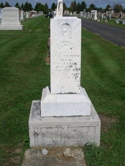
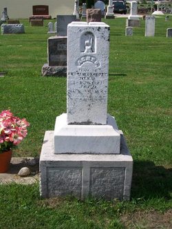
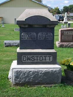
Ira T. Onstott
| Birth | : | 18 Sep 1849 Indiana, USA |
| Death | : | 19 Nov 1873 Fulton County, Indiana, USA |
| Burial | : | Pleasant View Cemetery, Athol, Smith County, USA |
| Coordinate | : | 39.7859000, -98.8982000 |
| Plot | : | Section 3, Row 1 |
| Description | : | Published in the Rochester(IN) Sentinel, Saturday, November 22, 1873 DIED, -A son of ANDREW ONSTOTT was buried at this place yesterday. The deceased was about 25 years of age, and lived with his father, five miles south of Rochester. [See Jean C. and Wendell C. Tombaugh, Fulton County, Indiana, Cemetery Inscriptions, Rochester I.O.O.F. Cemetery: IRA T. ONSTOTT, son of ANDREW and AGNES ONSTOTT, died Nov. 19, 1873, age 24yr-2mo-1da.) SOURCE: Fulton County Indiana Newspaper Excerpts - 1873 by Wendell C. Tombaugh |
frequently asked questions (FAQ):
-
Where is Ira T. Onstott's memorial?
Ira T. Onstott's memorial is located at: Pleasant View Cemetery, Athol, Smith County, USA.
-
When did Ira T. Onstott death?
Ira T. Onstott death on 19 Nov 1873 in Fulton County, Indiana, USA
-
Where are the coordinates of the Ira T. Onstott's memorial?
Latitude: 39.7859000
Longitude: -98.8982000
Family Members:
Parent

Siblings
Flowers:


Nearby Cemetories:
1. Pleasant View Cemetery
Athol, Smith County, USA
Coordinate: 39.7859000, -98.8982000
2. Saint John Lutheran Cemetery
Athol, Smith County, USA
Coordinate: 39.7269900, -98.8971600
3. Zion Cemetery
Athol, Smith County, USA
Coordinate: 39.8434100, -98.9171700
4. Meade Cemetery
Reamsville, Smith County, USA
Coordinate: 39.8680992, -98.8839035
5. Fairview Cemetery
Smith Center, Smith County, USA
Coordinate: 39.7966995, -98.7881012
6. Christ Cemetery
Gaylord, Smith County, USA
Coordinate: 39.6988100, -98.8556700
7. Saint John Lutheran Cemetery
Kensington, Smith County, USA
Coordinate: 39.7744700, -99.0308700
8. William Nelson Gravesite
Athol, Smith County, USA
Coordinate: 39.8866080, -98.8708130
9. Cedar Cemetery
Cedar, Smith County, USA
Coordinate: 39.6685982, -98.9310989
10. Germantown Cemetery
Kensington, Smith County, USA
Coordinate: 39.8292300, -99.0450800
11. Olive Branch Cemetery
Kensington, Smith County, USA
Coordinate: 39.7418800, -99.0470800
12. Gaylord Cemetery
Gaylord, Smith County, USA
Coordinate: 39.6598300, -98.8416700
13. Reamsville Methodist Church Cemetery
Reamsville, Smith County, USA
Coordinate: 39.9299500, -98.8693970
14. Reamsville Cemetery
Reamsville, Smith County, USA
Coordinate: 39.9441500, -98.8593500
15. Pleasant Hill Cemetery
Reamsville, Smith County, USA
Coordinate: 39.9510994, -98.9175034
16. Saint Francis Catholic Cemetery
Cedar, Smith County, USA
Coordinate: 39.6328011, -98.9816971
17. West Cedar Cemetery
Agra, Phillips County, USA
Coordinate: 39.8143997, -99.1136017
18. Eminence Cemetery
Thornburg, Smith County, USA
Coordinate: 39.9432983, -98.8005981
19. Agra Cemetery
Agra, Phillips County, USA
Coordinate: 39.7571600, -99.1220400
20. Spring Vale Cemetery
Washington Township, Smith County, USA
Coordinate: 39.9154700, -98.7424900
21. Fairview Stone Cemetery
Kensington, Smith County, USA
Coordinate: 39.9304330, -99.0479270
22. Custer Cemetery
Bellaire, Smith County, USA
Coordinate: 39.7350115, -98.6545141
23. Crystal Plains Cemetery
Smith Center, Smith County, USA
Coordinate: 39.6909714, -98.6730270
24. Old Harlan Cemetery
Harlan, Smith County, USA
Coordinate: 39.6153520, -98.7632390