
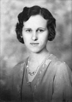
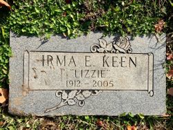
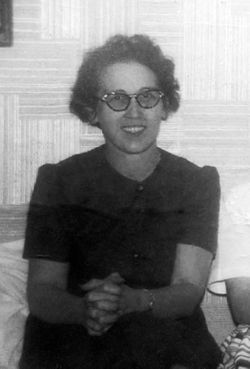
Irma Elizabeth “Lizzie” Rogers Keen
| Birth | : | 12 Feb 1912 Jewell County, Kansas, USA |
| Death | : | 23 Jun 2005 Lawrence, Douglas County, Kansas, USA |
| Burial | : | Oak Hill Cemetery, Lawrence, Douglas County, USA |
| Coordinate | : | 38.9589005, -95.2118988 |
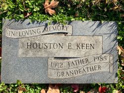
| Description | : | Services for Irma Elizabeth "Lizzie" Keen, 93, Lawrence, will be at 10 a.m. Friday at Rumsey-Yost Funeral Home in Lawrence. Burial will be in Oak Hill Cemetery. Mrs. Keen died Thursday, June 23, 2005, at Lawrence Memorial Hospital. She was born Feb. 12, 1912, in Jewell County, the daughter of Frank and Mary Atkins Rogers. She had lived in Lawrence since 1958. Mrs. Keen was a homemaker. She married Houston E. Keen on Dec. 16, 1938, in Esbon. He died April 29, 1985. A daughter, Jan Cookson, died in 2003, and a granddaughter died in 1977. Survivors include a son, Skip Keen, Baldwin; a daughter, Lee... Read More |
frequently asked questions (FAQ):
-
Where is Irma Elizabeth “Lizzie” Rogers Keen's memorial?
Irma Elizabeth “Lizzie” Rogers Keen's memorial is located at: Oak Hill Cemetery, Lawrence, Douglas County, USA.
-
When did Irma Elizabeth “Lizzie” Rogers Keen death?
Irma Elizabeth “Lizzie” Rogers Keen death on 23 Jun 2005 in Lawrence, Douglas County, Kansas, USA
-
Where are the coordinates of the Irma Elizabeth “Lizzie” Rogers Keen's memorial?
Latitude: 38.9589005
Longitude: -95.2118988
Family Members:
Parent
Spouse
Siblings

Children
Flowers:


Nearby Cemetories:
1. Oak Hill Cemetery
Lawrence, Douglas County, USA
Coordinate: 38.9589005, -95.2118988
2. Mount Calvary Catholic Cemetery
Lawrence, Douglas County, USA
Coordinate: 38.9580002, -95.2139969
3. Memorial Park Cemetery
Lawrence, Douglas County, USA
Coordinate: 38.9552994, -95.2153015
4. Trinity Episcopal Church Columbarium
Lawrence, Douglas County, USA
Coordinate: 38.9653893, -95.2373886
5. Saint Johns Catholic Cemetery
Douglas County, USA
Coordinate: 38.9437900, -95.1919600
6. Dyche Hall Natural History Museum
Lawrence, Douglas County, USA
Coordinate: 38.9584800, -95.2434800
7. Franklin Cemetery
Douglas County, USA
Coordinate: 38.9437523, -95.1869431
8. Haskell Cemetery
Lawrence, Douglas County, USA
Coordinate: 38.9353790, -95.2284241
9. Pioneer Cemetery
Lawrence, Douglas County, USA
Coordinate: 38.9528008, -95.2611008
10. First Presbyterian Church Memorial Garden
Lawrence, Douglas County, USA
Coordinate: 38.9414900, -95.2641600
11. Maple Grove Cemetery
Lawrence, Douglas County, USA
Coordinate: 39.0018997, -95.2316971
12. County Poor Farm Cemetery
Douglas County, USA
Coordinate: 38.9119400, -95.2214600
13. Adams Cemetery
Douglas County, USA
Coordinate: 38.9955400, -95.2509100
14. Kennedy Cemetery
Douglas County, USA
Coordinate: 38.9112900, -95.2269200
15. Davis Cemetery
Lawrence, Douglas County, USA
Coordinate: 38.9722500, -95.2831100
16. Blue Mound Cemetery
Lawrence, Douglas County, USA
Coordinate: 38.9046600, -95.1865400
17. Marshall Cemetery
Douglas County, USA
Coordinate: 38.9040800, -95.2446700
18. Dutton Cemetery
Douglas County, USA
Coordinate: 38.8989800, -95.2790600
19. Luckan Family Cemetery
Fall Leaf, Leavenworth County, USA
Coordinate: 38.9808500, -95.1128000
20. Cemetery Beni Israel
Eudora, Douglas County, USA
Coordinate: 38.9280128, -95.1122208
21. Southwest City Cemetery
Eudora, Douglas County, USA
Coordinate: 38.9334800, -95.1070300
22. Lyon Family Cemetery
Lawrence, Douglas County, USA
Coordinate: 38.9877440, -95.3166530
23. Corpus Christi Catholic Church Columbarium
Lawrence, Douglas County, USA
Coordinate: 38.9572250, -95.3238450
24. Richland Cemetery
Lawrence, Douglas County, USA
Coordinate: 38.8768997, -95.2630997