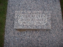
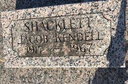
Jacob Kendell Shacklett
| Birth | : | 5 Apr 1917 Scotland County, Missouri, USA |
| Death | : | 1 Jul 1967 Washington County, Iowa, USA |
| Burial | : | Greenwood Memorial Park, Centralia, Lewis County, USA |
| Coordinate | : | 46.7372017, -122.9824982 |
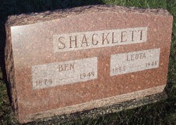
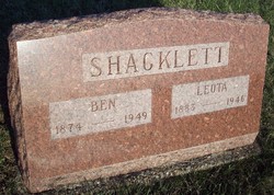
| Description | : | Former Gorin Man Drowns at Lake Darling Jacob Kendell Shacklett, son of Benjamin W. and Leota H. Shacklett, was born near Gorin, Missouri, April 5th, 1917, and departed this life July 1, 1967, near Washington, Iowa. He was married to Madeline Rickerberg October 8, 1944. To this union were born two daughters, namely Sharon Ann and Judy Kay, both of the home. Kendell farmed for several years before moving to Ottumwa, Iowa, where he was employed by John Morrell and Co., until his death. He was preceded in death by his parents and infant brother. He leaves to mourn... Read More |
frequently asked questions (FAQ):
-
Where is Jacob Kendell Shacklett's memorial?
Jacob Kendell Shacklett's memorial is located at: Greenwood Memorial Park, Centralia, Lewis County, USA.
-
When did Jacob Kendell Shacklett death?
Jacob Kendell Shacklett death on 1 Jul 1967 in Washington County, Iowa, USA
-
Where are the coordinates of the Jacob Kendell Shacklett's memorial?
Latitude: 46.7372017
Longitude: -122.9824982
Family Members:
Parent
Siblings
Flowers:
Nearby Cemetories:
1. Greenwood Memorial Park
Centralia, Lewis County, USA
Coordinate: 46.7372017, -122.9824982
2. Mountain View Cemetery
Centralia, Lewis County, USA
Coordinate: 46.7289009, -122.9843979
3. Pioneer Cemetery
Centralia, Lewis County, USA
Coordinate: 46.7290300, -122.9898100
4. Washington Lawn Cemetery
Centralia, Lewis County, USA
Coordinate: 46.7209320, -122.9606040
5. Cogdil Family Cemetery
Thurston County, USA
Coordinate: 46.7747010, -122.8826590
6. Grand Mound Cemetery
Rochester, Thurston County, USA
Coordinate: 46.8213997, -123.0199966
7. Greenwood Cemetery
Chehalis, Lewis County, USA
Coordinate: 46.6511002, -122.9389038
8. Claquato Cemetery
Chehalis, Lewis County, USA
Coordinate: 46.6469002, -123.0216980
9. Newaukum Hill Cemetery
Lewis County, USA
Coordinate: 46.6338980, -122.9768320
10. Fern Hill Cemetery
Chehalis, Lewis County, USA
Coordinate: 46.6366710, -122.9418560
11. Lincoln Creek Cemetery
Galvin, Lewis County, USA
Coordinate: 46.7604700, -123.1446600
12. Forest Grove Cemetery
Tenino, Thurston County, USA
Coordinate: 46.8254580, -122.8497110
13. Chehalis Tribal Cemetery
Thurston County, USA
Coordinate: 46.8068570, -123.1602260
14. Secena Cemetery
Oakville, Grays Harbor County, USA
Coordinate: 46.8061600, -123.1611900
15. Finn Hill Cemetery
Lewis County, USA
Coordinate: 46.7564011, -123.1919022
16. Mima Prairie Pioneer Cemetery
Mima, Thurston County, USA
Coordinate: 46.8724403, -123.0611649
17. Pleasant Hill Cemetery
Bunker, Lewis County, USA
Coordinate: 46.6088840, -123.0863790
18. Thurston County Poor Farm Cemetery
Littlerock, Thurston County, USA
Coordinate: 46.8861790, -123.0225100
19. Napavine Cemetery
Napavine, Lewis County, USA
Coordinate: 46.5817000, -122.9039000
20. Deskins Family Cemetery
Chehalis, Lewis County, USA
Coordinate: 46.6878000, -122.7530000
21. Benn Cemetery
Oakville, Grays Harbor County, USA
Coordinate: 46.8303540, -123.2239950
22. Oakville Pioneer Cemetery
Oakville, Grays Harbor County, USA
Coordinate: 46.8318939, -123.2229996
23. Oakville Final Rest Memorial Cemetery
Oakville, Grays Harbor County, USA
Coordinate: 46.8323060, -123.2240030
24. Dryad Cemetery
Dryad, Lewis County, USA
Coordinate: 46.6467667, -123.2665329

