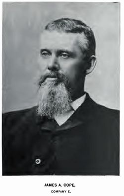
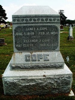
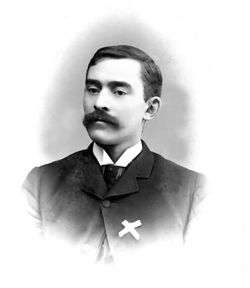
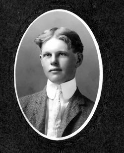
James A Cope
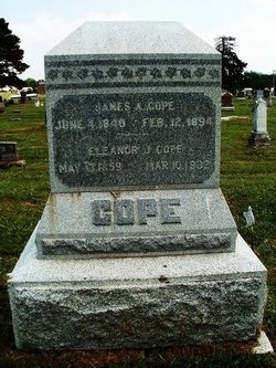
| Birth | : | 4 Jun 1840 Morgan County, Ohio, USA |
| Death | : | 12 Feb 1894 Pawnee City, Pawnee County, Nebraska, USA |
| Burial | : | McPheeters Bend Baptist Church Cemetery, Church Hill, Hawkins County, USA |
| Coordinate | : | 36.4951700, -82.7382100 |
| Plot | : | Original Section, Lot 128, Grave3 |
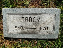
| Description | : | BIOGRAPHICAL SKETCH: James A. COPE, County Commissioner of Pawnee County, farmer and stock-raiser, section 32. P. O. Pawnee City. Mr. Cope was born and reared in Morgan County, Ohio. In 1859, he removed to Wisconsin, where he was identified with the farming industry until 1862, when he enlisted in company E, Twelfth Wisconsin, and remained in active service until the end of the war, when he was honorably discharged. In 1869, he came here and located, and has been actively connected with the agricultural and stock industry since. In 1859, he was married, in Ohio, to Miss Nancy Osborne, who... Read More |
frequently asked questions (FAQ):
-
Where is James A Cope's memorial?
James A Cope's memorial is located at: McPheeters Bend Baptist Church Cemetery, Church Hill, Hawkins County, USA.
-
When did James A Cope death?
James A Cope death on 12 Feb 1894 in Pawnee City, Pawnee County, Nebraska, USA
-
Where are the coordinates of the James A Cope's memorial?
Latitude: 36.4951700
Longitude: -82.7382100
Family Members:
Parent
Spouse
Children
Flowers:
Nearby Cemetories:
1. McPheeters Bend Baptist Church Cemetery
Church Hill, Hawkins County, USA
Coordinate: 36.4951700, -82.7382100
2. George Skelton Cemetery
Church Hill, Hawkins County, USA
Coordinate: 36.4901000, -82.7201560
3. Patterson Cemetery
Church Hill, Hawkins County, USA
Coordinate: 36.5107994, -82.7217026
4. Price Cemetery
Church Hill, Hawkins County, USA
Coordinate: 36.5186005, -82.7136002
5. Lyons Chapel Cemetery
Church Hill, Hawkins County, USA
Coordinate: 36.5213203, -82.7584076
6. Elm Springs United Methodist Church Cemetery
Church Hill, Hawkins County, USA
Coordinate: 36.5210530, -82.7675710
7. Old Union United Methodist Church Cemetery
Church Hill, Hawkins County, USA
Coordinate: 36.5312330, -82.7336420
8. Barrett Cemetery
Hawkins County, USA
Coordinate: 36.4644370, -82.7085620
9. Church Hill Memory Gardens
Church Hill, Hawkins County, USA
Coordinate: 36.5332530, -82.7153290
10. Ellis Family Cemetery
Church Hill, Hawkins County, USA
Coordinate: 36.5265300, -82.6996400
11. Christian Bend Cemetery
Church Hill, Hawkins County, USA
Coordinate: 36.4758290, -82.7904670
12. Harris Cemetery
Church Hill, Hawkins County, USA
Coordinate: 36.4431040, -82.7510830
13. Bowser Cemetery
Church Hill, Hawkins County, USA
Coordinate: 36.4800100, -82.6734980
14. Blair Cemetery
Church Hill, Hawkins County, USA
Coordinate: 36.5369150, -82.7840610
15. Wallace Cemetery
Church Hill, Hawkins County, USA
Coordinate: 36.5456390, -82.7733990
16. Wills Cemetery
Church Hill, Hawkins County, USA
Coordinate: 36.5553400, -82.7431900
17. Light Cemetery
Kingsport, Sullivan County, USA
Coordinate: 36.4496470, -82.6872370
18. Pratt Family Cemetery
Church Hill, Hawkins County, USA
Coordinate: 36.5564430, -82.7377390
19. Murray Cemetery
Kingsport, Sullivan County, USA
Coordinate: 36.4534960, -82.6797580
20. Christian Cemetery
Hawkins County, USA
Coordinate: 36.5583000, -82.7324982
21. Christian Family Cemetery
Church Hill, Hawkins County, USA
Coordinate: 36.5592630, -82.7331310
22. Crawford Cemetery
Kingsport, Sullivan County, USA
Coordinate: 36.4521640, -82.6780350
23. Solomon’s Temple Missionary Baptist Cemetery
Blair Gap, Sullivan County, USA
Coordinate: 36.4506600, -82.6776700
24. Arrington Family Cemetery
Church Hill, Hawkins County, USA
Coordinate: 36.5569649, -82.7778320

