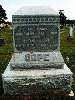
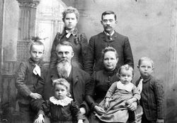
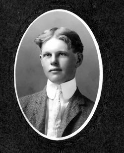
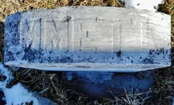
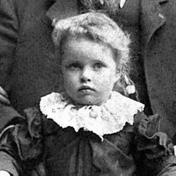
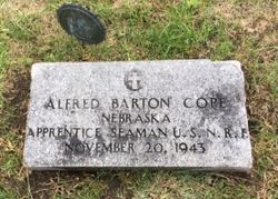
Eleanor J. Stewart Cope
| Birth | : | 13 May 1859 Union County, Indiana, USA |
| Death | : | 10 Mar 1932 Pawnee City, Pawnee County, Nebraska, USA |
| Burial | : | St Mary the Virgin Churchyard, Morcott, Rutland Unitary Authority, England |
| Coordinate | : | 52.5967800, -0.6366200 |
| Plot | : | Original Section, Lot 128, Grave 2 |
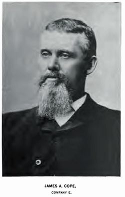
| Description | : | Burial beside James A Cope (his 3rd wife). The following is from the newspaper, "The Pawnee Republican," Pawnee City, NE, dated March 17, 1932. Mrs. E. J. Cope, for many years one of Pawnee county's highly respected citizens, died last Thursday evening at the home of her son, A. J. Cope, in West Branch precinct. She had been ill for several month. Funeral services were held Saturday afternoon at the Presbyterian church in this city,of which she had been for long an active and consistent member. The pastor, Rev. S. A.Whysong, had charge of the services. He was assisted by... Read More |
frequently asked questions (FAQ):
-
Where is Eleanor J. Stewart Cope's memorial?
Eleanor J. Stewart Cope's memorial is located at: St Mary the Virgin Churchyard, Morcott, Rutland Unitary Authority, England.
-
When did Eleanor J. Stewart Cope death?
Eleanor J. Stewart Cope death on 10 Mar 1932 in Pawnee City, Pawnee County, Nebraska, USA
-
Where are the coordinates of the Eleanor J. Stewart Cope's memorial?
Latitude: 52.5967800
Longitude: -0.6366200
Family Members:
Parent
Spouse
Siblings
Children
Flowers:
Nearby Cemetories:
1. St Mary the Virgin Churchyard
Morcott, Rutland Unitary Authority, England
Coordinate: 52.5967800, -0.6366200
2. St Mary the Virgin Churchyard
South Luffenham, Rutland Unitary Authority, England
Coordinate: 52.6067200, -0.6114100
3. St. Peter's Churchyard
Barrowden, Rutland Unitary Authority, England
Coordinate: 52.5888800, -0.6063600
4. St Nicholas Churchyard
Pilton, Rutland Unitary Authority, England
Coordinate: 52.6165200, -0.6504100
5. St. John The Baptist Church
North Luffenham, Rutland Unitary Authority, England
Coordinate: 52.6186570, -0.6211140
6. St. Andrew's Churchyard
Glaston, Rutland Unitary Authority, England
Coordinate: 52.5953628, -0.6781534
7. All Hallows Churchyard
Seaton, Rutland Unitary Authority, England
Coordinate: 52.5745730, -0.6670810
8. Church of Saint John the Baptist
Wakerley, East Northamptonshire Borough, England
Coordinate: 52.5817323, -0.5929850
9. Saint John The Baptist Churchyard
Harringworth, East Northamptonshire Borough, England
Coordinate: 52.5671000, -0.6491000
10. St. Peter and St. Paul's Churchyard
Wing, Rutland Unitary Authority, England
Coordinate: 52.6172140, -0.6814150
11. St Mary the Virgin Churchyard
Edith Weston, Rutland Unitary Authority, England
Coordinate: 52.6379100, -0.6311100
12. All Saints Churchyard
Laxton, East Northamptonshire Borough, England
Coordinate: 52.5535760, -0.5992450
13. St Peter & Paul Churchyard
Preston, Rutland Unitary Authority, England
Coordinate: 52.6122600, -0.7162560
14. St. Peter and St. Paul's Churchyard
Uppingham, Rutland Unitary Authority, England
Coordinate: 52.5873820, -0.7221660
15. Uppingham Lawn Cemetery
Uppingham, Rutland Unitary Authority, England
Coordinate: 52.5855800, -0.7229700
16. Ketton Park Burial Ground
Ketton, Rutland Unitary Authority, England
Coordinate: 52.6240570, -0.5604330
17. Church of St Mary
Duddington, East Northamptonshire Borough, England
Coordinate: 52.5969190, -0.5432540
18. St. Mary the Virgin Churchyard
Uppingham, Rutland Unitary Authority, England
Coordinate: 52.5996800, -0.7324400
19. Ketton St Mary the Virgin Churchyard
Ketton, Rutland Unitary Authority, England
Coordinate: 52.6274671, -0.5509559
20. St. James Churchyard
Gretton, Corby Borough, England
Coordinate: 52.5403000, -0.6763400
21. Holy Trinity Churchyard
Blatherwycke, East Northamptonshire Borough, England
Coordinate: 52.5514375, -0.5646654
22. Leicester Road Cemetery
Uppingham, Rutland Unitary Authority, England
Coordinate: 52.5975766, -0.7413414
23. St Andrew Churchyard
Hambleton, Rutland Unitary Authority, England
Coordinate: 52.6585060, -0.6712280
24. Collyweston Cemetery
Collyweston, East Northamptonshire Borough, England
Coordinate: 52.6115580, -0.5319430

