
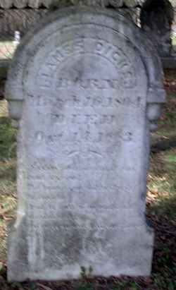
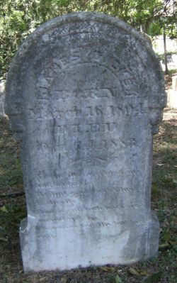
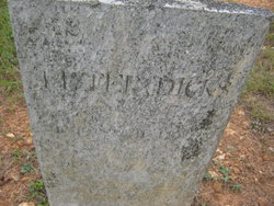
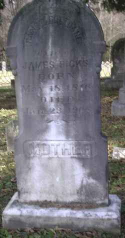
James F Dicks
| Birth | : | 16 Mar 1804 |
| Death | : | 14 Oct 1883 |
| Burial | : | St. Mary the Virgin Churchyard, Gisburn, Ribble Valley Borough, England |
| Coordinate | : | 53.9356080, -2.2605210 |
| Plot | : | Section/Row G3 |
| Description | : | Husband of Nancy Coltrane Dicks. |
frequently asked questions (FAQ):
-
Where is James F Dicks's memorial?
James F Dicks's memorial is located at: St. Mary the Virgin Churchyard, Gisburn, Ribble Valley Borough, England.
-
When did James F Dicks death?
James F Dicks death on 14 Oct 1883 in
-
Where are the coordinates of the James F Dicks's memorial?
Latitude: 53.9356080
Longitude: -2.2605210
Family Members:
Parent
Spouse
Siblings


Children
Flowers:


Nearby Cemetories:
1. St. Mary the Virgin Churchyard
Gisburn, Ribble Valley Borough, England
Coordinate: 53.9356080, -2.2605210
2. Salem Congregational Chapel Martin Top
Rimington, Ribble Valley Borough, England
Coordinate: 53.9072484, -2.2740463
3. Saint Michael's Church
Bracewell, Pendle Borough, England
Coordinate: 53.9322400, -2.2099730
4. St Peter and St Paul Churchyard
Bolton-by-Bowland, Ribble Valley Borough, England
Coordinate: 53.9399800, -2.3270300
5. Twiston Quaker Burial Ground
Clitheroe, Ribble Valley Borough, England
Coordinate: 53.8854210, -2.2838840
6. Sawley Abbey
Sawley, Ribble Valley Borough, England
Coordinate: 53.9131920, -2.3417080
7. Holden Chapel
Bolton-by-Bowland, Ribble Valley Borough, England
Coordinate: 53.9420850, -2.3500060
8. Saint Mary-le-Ghyll
Barnoldswick, Pendle Borough, England
Coordinate: 53.9279505, -2.1647004
9. Ghyll Cemetery
Barnoldswick, Pendle Borough, England
Coordinate: 53.9271100, -2.1646700
10. St. Leonard's Churchyard
Downham, Ribble Valley Borough, England
Coordinate: 53.8944340, -2.3294250
11. Salterforth Cemetery
Salterforth, Pendle Borough, England
Coordinate: 53.9123170, -2.1654010
12. St Mary the Virgin Churchyard
Thornton-in-Craven, Craven District, England
Coordinate: 53.9311350, -2.1513350
13. St Ambrose Churchyard
Grindleton, Ribble Valley Borough, England
Coordinate: 53.9061710, -2.3633270
14. Christ Churchyard
Chatburn, Ribble Valley Borough, England
Coordinate: 53.8940690, -2.3515030
15. Grindleton Methodist Cemetery
Grindleton, Ribble Valley Borough, England
Coordinate: 53.9080420, -2.3684420
16. St Peter Church
Martons Both, Craven District, England
Coordinate: 53.9522630, -2.1415720
17. St. Peter's Churchyard
Martons Both, Craven District, England
Coordinate: 53.9522064, -2.1413111
18. St. Aidan's Churchyard
Hellifield, Craven District, England
Coordinate: 54.0042070, -2.2201370
19. Earby Cemetery
Earby, Pendle Borough, England
Coordinate: 53.9189987, -2.1370001
20. St Mary's Churchyard
Kelbrook, Pendle Borough, England
Coordinate: 53.8991000, -2.1494100
21. Friends Burial Ground
Foulridge, Pendle Borough, England
Coordinate: 53.8769360, -2.1669040
22. St. Michael's Churchyard
Foulridge, Pendle Borough, England
Coordinate: 53.8734569, -2.1693508
23. St Mary the Virgin Churchyard
Long Preston, Craven District, England
Coordinate: 54.0183790, -2.2497690
24. St Bartholomew Churchyard
Tosside, Ribble Valley Borough, England
Coordinate: 54.0002500, -2.3536700