
| Memorials | : | 166 |
| Location | : | Hellifield, Craven District, England |
| Coordinate | : | 54.0042070, -2.2201370 |
frequently asked questions (FAQ):
-
Where is St. Aidan's Churchyard?
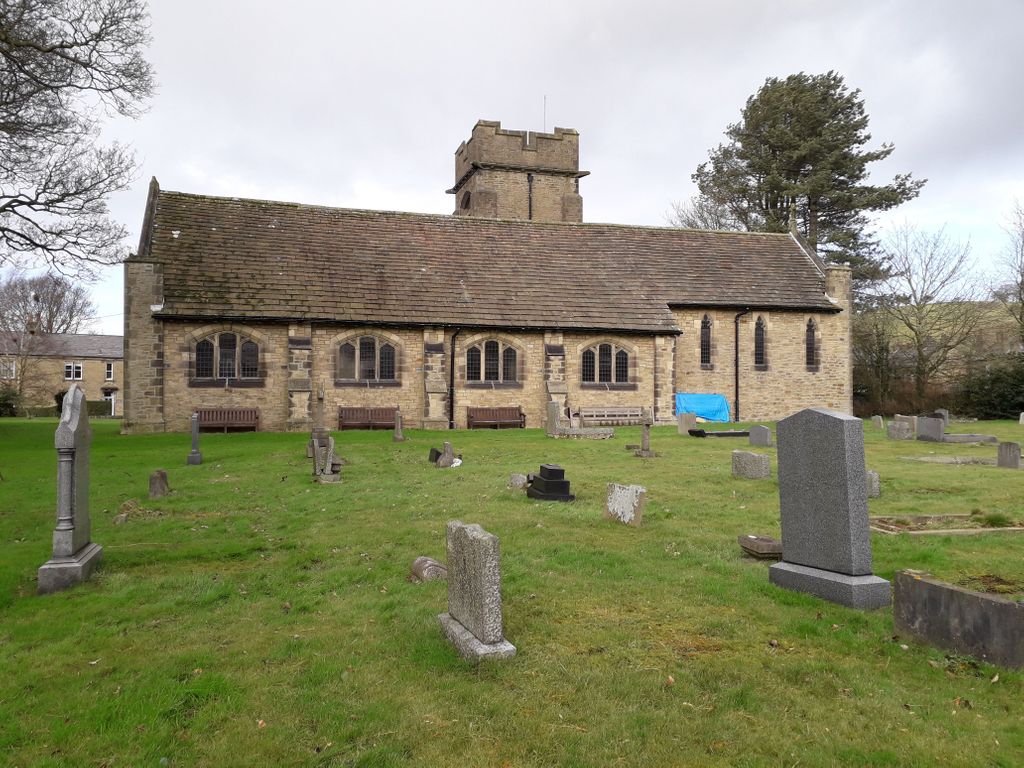
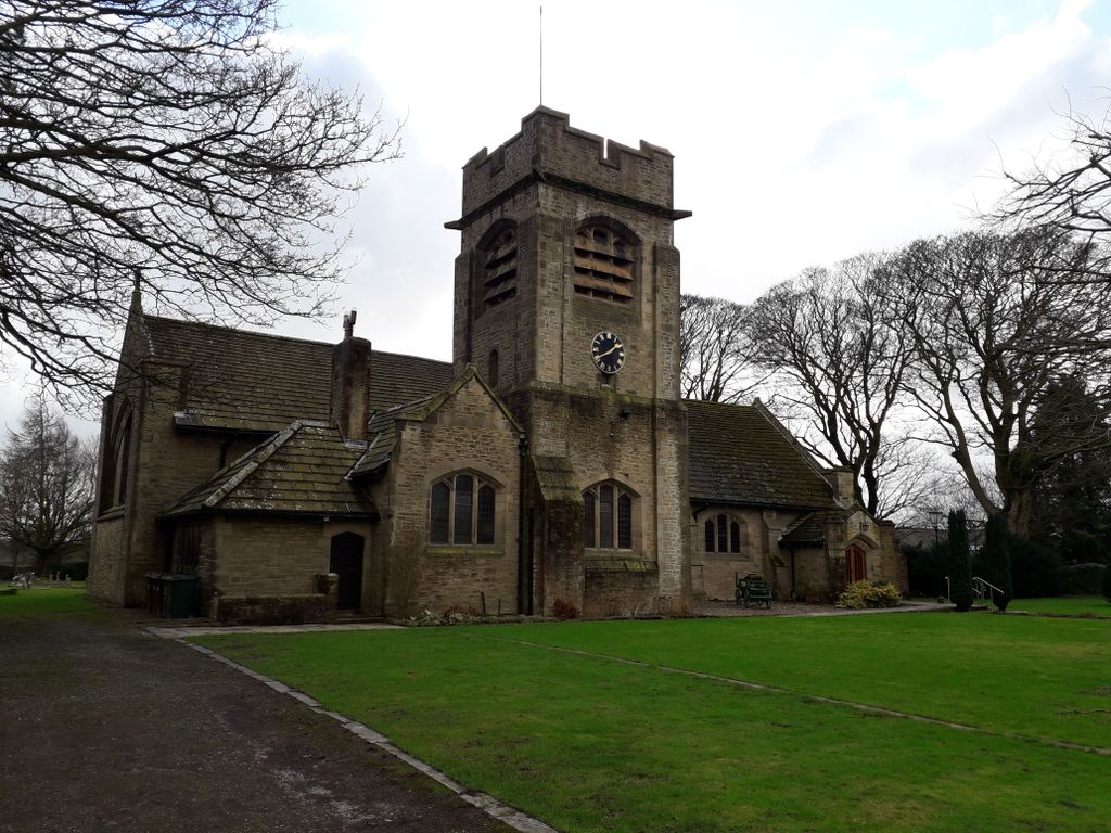
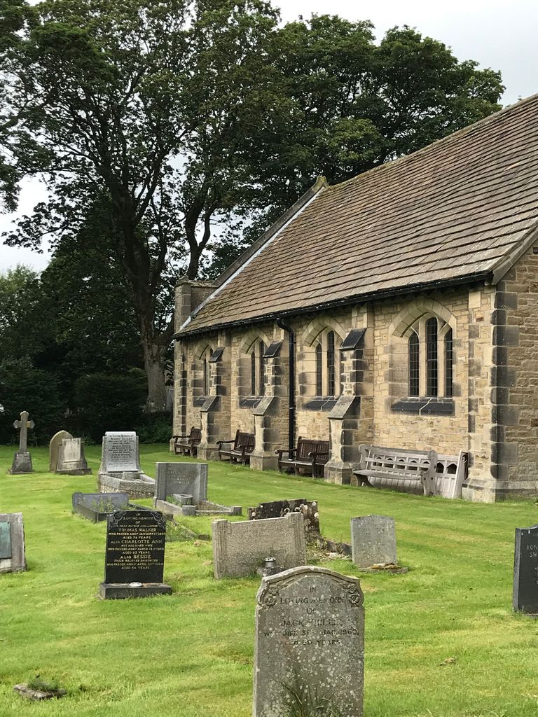
St. Aidan's Churchyard is located at Hellifield, Craven District ,North Yorkshire ,England.
-
St. Aidan's Churchyard cemetery's updated grave count on graveviews.com?
159 memorials
-
Where are the coordinates of the St. Aidan's Churchyard?
Latitude: 54.0042070
Longitude: -2.2201370
Nearby Cemetories:
1. St Mary the Virgin Churchyard
Long Preston, Craven District, England
Coordinate: 54.0183790, -2.2497690
2. Long Preston Baptist Chapel
Long Preston, Craven District, England
Coordinate: 54.0204249, -2.2560031
3. St. Peter's Churchyard
Coniston Cold, Craven District, England
Coordinate: 53.9944380, -2.1493870
4. Brocklands Woodland Burial Site
Rathmell, Craven District, England
Coordinate: 54.0275720, -2.2998880
5. St Michael the Archangel Churchyard
Kirkby Malham, Craven District, England
Coordinate: 54.0448480, -2.1628540
6. Holy Trinity Churchyard
Rathmell, Craven District, England
Coordinate: 54.0351000, -2.3002300
7. St Peter Church
Martons Both, Craven District, England
Coordinate: 53.9522630, -2.1415720
8. St. Peter's Churchyard
Martons Both, Craven District, England
Coordinate: 53.9522064, -2.1413111
9. Zion Congregational Chapelyard
Settle, Craven District, England
Coordinate: 54.0672490, -2.2747040
10. St Andrew Churchyard
Gargrave, Craven District, England
Coordinate: 53.9811830, -2.1054420
11. Saint Michael's Church
Bracewell, Pendle Borough, England
Coordinate: 53.9322400, -2.2099730
12. St. Mary the Virgin Churchyard
Gisburn, Ribble Valley Borough, England
Coordinate: 53.9356080, -2.2605210
13. Friends Burial Ground
Settle, Craven District, England
Coordinate: 54.0685370, -2.2791100
14. Holy Ascension Churchyard
Settle, Craven District, England
Coordinate: 54.0704320, -2.2775390
15. St Bartholomew Churchyard
Tosside, Ribble Valley Borough, England
Coordinate: 54.0002500, -2.3536700
16. St Alkelda Churchyard
Giggleswick, Craven District, England
Coordinate: 54.0721700, -2.2894600
17. Mount Sion Independent Chapelyard
Tosside, Ribble Valley Borough, England
Coordinate: 53.9982500, -2.3578200
18. St John the Evangelist Churchyard
Langcliffe, Craven District, England
Coordinate: 54.0807400, -2.2721000
19. Saint Mary-le-Ghyll
Barnoldswick, Pendle Borough, England
Coordinate: 53.9279505, -2.1647004
20. St Mary the Virgin Churchyard
Thornton-in-Craven, Craven District, England
Coordinate: 53.9311350, -2.1513350
21. Ghyll Cemetery
Barnoldswick, Pendle Borough, England
Coordinate: 53.9271100, -2.1646700
22. All Saints Churchyard
Broughton, Craven District, England
Coordinate: 53.9492880, -2.1019580
23. St Peter and St Paul Churchyard
Bolton-by-Bowland, Ribble Valley Borough, England
Coordinate: 53.9399800, -2.3270300
24. Salterforth Cemetery
Salterforth, Pendle Borough, England
Coordinate: 53.9123170, -2.1654010