James Moore
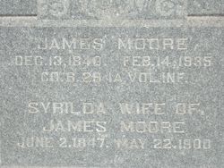
| Birth | : | 13 Dec 1840 Jackson County, Ohio, USA |
| Death | : | 14 Feb 1935 Hastings, Mills County, Iowa, USA |
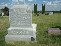
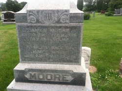
| Burial | : | Wesley Chapel Cemetery, Henderson, Mills County, USA |
| Coordinate | : | 41.1019249, -95.4987793 |
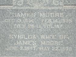
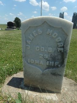
| Inscription | : | CO B 29 IA VOL INF From Civil War military records: Moore, James. Age 21. Residence Council Bluffs,Iowa nativity Ohio. Enlisted Nov. 15, 1862 into Co B 29th Iowa Infantry. Mustered Nov. 15, 1862 Council Bluff |
| Description | : | Malvern Leader February 21, 1935 James Moore, 94, Answered Last Roll Call on Thursday. Veteran of Civil War Dies in Hastings. Funeral Saturday. James Moore, aged veteran of the Civil war and one of the last members of the G.A.R. in Mills county, answered his last roll call last Thursday when Death sent the final summons. He died at the home of W.E. Purcell in Hastings where he was making his home. His last illness was brief, although he had been gradually failing for some months past. Funeral services were held in Henderson Saturday afternoon in the home of Mr. and Mrs.... Read More |
frequently asked questions (FAQ):
-
Where is James Moore's memorial?
James Moore's memorial is located at: Wesley Chapel Cemetery, Henderson, Mills County, USA.
-
When did James Moore death?
James Moore death on 14 Feb 1935 in Hastings, Mills County, Iowa, USA
-
Where are the coordinates of the James Moore's memorial?
Latitude: 41.1019249
Longitude: -95.4987793
Family Members:
Spouse
Children
Flowers:
Nearby Cemetories:
1. Wesley Chapel Cemetery
Henderson, Mills County, USA
Coordinate: 41.1019249, -95.4987793
2. Saylers Farm Cemetery
Henderson, Mills County, USA
Coordinate: 41.1083300, -95.4919440
3. Cotten Cemetery
Mills County, USA
Coordinate: 41.0845000, -95.5167000
4. Wearin Cemetery
Malvern, Mills County, USA
Coordinate: 41.0395000, -95.5313000
5. Farm Creek Cemetery
Henderson, Mills County, USA
Coordinate: 41.1319008, -95.4186020
6. East Liberty Cemetery
Malvern, Mills County, USA
Coordinate: 41.0592346, -95.6005020
7. North Grove Cemetery
Hastings, Mills County, USA
Coordinate: 41.0161018, -95.4618988
8. Hastings Cemetery
Hastings, Mills County, USA
Coordinate: 41.0097008, -95.4993973
9. Emerson Cemetery
Emerson, Mills County, USA
Coordinate: 41.0325012, -95.4021988
10. Lowens Cemetery
Garfield Township, Montgomery County, USA
Coordinate: 41.0527728, -95.3758292
11. Silver City Cemetery
Silver City, Mills County, USA
Coordinate: 41.1042442, -95.6380005
12. Macedonia Cemetery
Macedonia, Pottawattamie County, USA
Coordinate: 41.1921997, -95.4167023
13. Old Town Cemetery
Macedonia, Pottawattamie County, USA
Coordinate: 41.2030983, -95.4421997
14. South Grove Cemetery
Mills County, USA
Coordinate: 40.9775009, -95.4931030
15. Malvern Cemetery
Malvern, Mills County, USA
Coordinate: 40.9886017, -95.5785980
16. Parker Cemetery
White Cloud, Mills County, USA
Coordinate: 40.9737649, -95.5184363
17. Buckner Cemetery
Wales, Montgomery County, USA
Coordinate: 41.1595600, -95.3440700
18. Mormon Cemetery
Macedonia, Pottawattamie County, USA
Coordinate: 41.1885986, -95.3557663
19. Hillsdale Cemetery
Glenwood, Mills County, USA
Coordinate: 41.0097008, -95.6427994
20. Gomer Cemetery
Wales, Montgomery County, USA
Coordinate: 41.1171989, -95.3082962
21. Mills County Farm Cemetery
Glenwood, Mills County, USA
Coordinate: 41.0417930, -95.6756530
22. Mineola Cemetery
Mineola, Mills County, USA
Coordinate: 41.1391130, -95.6941800
23. Zion Congregational Cemetery
Treynor, Pottawattamie County, USA
Coordinate: 41.2325090, -95.6079200
24. Carson Cemetery
Carson, Pottawattamie County, USA
Coordinate: 41.2392006, -95.4044037

