
| Birth | : | 29 Dec 1946 Hoven, Potter County, South Dakota, USA |
| Death | : | 17 Jun 1977 Sully County, South Dakota, USA |
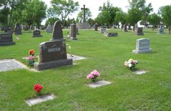
| Burial | : | Mount Calvary Cemetery, Pierre, Hughes County, USA |
| Coordinate | : | 44.4197006, -100.3557968 |
| Plot | : | CALVY 1 4 44 |
| Description | : | James W. Timp PIERRE – James W. Timp, Pierre, died Friday night in a single engine plane crash south of Onida at the age of 30. Funeral mass will be celebrated Monday at 10 a.m. in St. Peter and Paul Catholic church with the Rev. John Lantsberger officiating. Burial will be in Calvary Cemetery. Prayer service will be held Sunday at 7:30 p.m. in the Hall Chapel. James William Timp was born Dec. 29, 1946, at Hoven to Edmund and Catherine Timp. He was a Vietnam veteran. He was an engineer for Trident... Read More |
frequently asked questions (FAQ):
-
Where is James William “Jay” Timp's memorial?
James William “Jay” Timp's memorial is located at: Mount Calvary Cemetery, Pierre, Hughes County, USA.
-
When did James William “Jay” Timp death?
James William “Jay” Timp death on 17 Jun 1977 in Sully County, South Dakota, USA
-
Where are the coordinates of the James William “Jay” Timp's memorial?
Latitude: 44.4197006
Longitude: -100.3557968
Family Members:
Parent
Siblings
Flowers:


Nearby Cemetories:
1. Mount Calvary Cemetery
Pierre, Hughes County, USA
Coordinate: 44.4197006, -100.3557968
2. Fort Pierre Chouteau Cemetery
Fort Pierre, Stanley County, USA
Coordinate: 44.3908700, -100.3878300
3. Scotty Philip Cemetery
Fort Pierre, Stanley County, USA
Coordinate: 44.4019012, -100.4036026
4. South Dakota State Capitol Grounds
Pierre, Hughes County, USA
Coordinate: 44.3660100, -100.3448000
5. Riverside Cemetery
Pierre, Hughes County, USA
Coordinate: 44.3608017, -100.3071976
6. Cedar Hill Cemetery
Fort Pierre, Stanley County, USA
Coordinate: 44.3356018, -100.3964005
7. Byron Township Cemetery
Blunt, Hughes County, USA
Coordinate: 44.4979200, -100.1904700
8. Canning Cemetery
Hughes County, USA
Coordinate: 44.3986890, -100.0278460
9. Okobojo Cemetery
Sully County, USA
Coordinate: 44.6568985, -100.3647003
10. Fort Sully Post Cemetery
Sully County, USA
Coordinate: 44.5866480, -100.6087530
11. Pleasant Hill Cemetery
Blunt, Hughes County, USA
Coordinate: 44.5135994, -100.0156021
12. Meers Cemetery
Stanley County, USA
Coordinate: 44.4116970, -100.7360760
13. Holy Name Episcopal Cemetery
Fort Pierre, Stanley County, USA
Coordinate: 44.2694960, -100.0357300
14. Holy Name Chapel Cemetery
Fort Pierre, Stanley County, USA
Coordinate: 44.2694292, -100.0356989
15. Mathews Family Cemetery
Stanley County, USA
Coordinate: 44.1816040, -100.5581080
16. Fort Bennett Post Cemetery
Stanley County, USA
Coordinate: 44.6716500, -100.6404200
17. Onida Cemetery
Onida, Sully County, USA
Coordinate: 44.7147000, -100.0650000
18. Chapelle Cemetery
Hughes County, USA
Coordinate: 44.3025017, -99.8653030
19. Blair Cemetery
Sully County, USA
Coordinate: 44.8027992, -100.4199982
20. Holy Faith Cemetery
Lyman County, USA
Coordinate: 44.1356010, -99.9878006
21. Mission Ridge Cemetery
Mission Ridge, Stanley County, USA
Coordinate: 44.6960983, -100.7716980
22. Immanuel Lutheran Cemetery
Van Metre, Jones County, USA
Coordinate: 44.0958800, -100.7263300
23. Medicine Hill Cemetery
Harrold, Hughes County, USA
Coordinate: 44.5116997, -99.7453003
24. Saint John Catholic Cemetery
Harrold, Hughes County, USA
Coordinate: 44.5127983, -99.7335968