
| Birth | : | 1 Mar 1872 Lamoni, Decatur County, Iowa, USA |
| Death | : | 3 Jun 1953 Davenport, Scott County, Iowa, USA |
| Burial | : | Saint Michael and All Angels Churchyard, Felton, Northumberland Unitary Authority, England |
| Coordinate | : | 52.8203010, -2.9792430 |
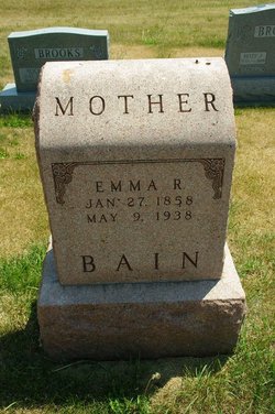
| Description | : | June 3, 1953 Ft. Madison Evening Democrat. In part it said Born March 1, 1872, at Lamoni, Iowa, she had lived here for 31 years. She was married to the late John Blanchard on Dec. 10 1899. She belonged to the Latter Day Saints church. The deceased is survived by two sons, Frank, Creston; and Harry, local; two daughters, Mrs. Frank Powell, local; and Mrs. Nelson Cox, Bettendorf; 11 grandchildren, 12 great grandchildren and five great great grandchildren. Burial was in Hillcrest Memorial Park. |
frequently asked questions (FAQ):
-
Where is Jessie Annabell Wilcox Blanchard's memorial?
Jessie Annabell Wilcox Blanchard's memorial is located at: Saint Michael and All Angels Churchyard, Felton, Northumberland Unitary Authority, England.
-
When did Jessie Annabell Wilcox Blanchard death?
Jessie Annabell Wilcox Blanchard death on 3 Jun 1953 in Davenport, Scott County, Iowa, USA
-
Where are the coordinates of the Jessie Annabell Wilcox Blanchard's memorial?
Latitude: 52.8203010
Longitude: -2.9792430
Family Members:
Parent
Children
Flowers:


Nearby Cemetories:
1. Saint Michael and All Angels Churchyard
Felton, Northumberland Unitary Authority, England
Coordinate: 52.8203010, -2.9792430
2. St Mary the Virgin Parish Church
Hordley, Shropshire Unitary Authority, England
Coordinate: 52.8713670, -2.9208050
3. All Saints Churchyard
Baschurch, Shropshire Unitary Authority, England
Coordinate: 52.7913710, -2.8586210
4. St. Barnabas Churchyard
Hengoed, Shropshire Unitary Authority, England
Coordinate: 52.8883855, -3.0562708
5. Preeshenlle United Reformed Churchyard
Gobowen, Shropshire Unitary Authority, England
Coordinate: 52.8991040, -3.0356200
6. St. Simon and St. Jude Churchyard
Cockshutt, Shropshire Unitary Authority, England
Coordinate: 52.8577297, -2.8412706
7. Alberbury Priory
Alberbury, Shropshire Unitary Authority, England
Coordinate: 52.7311000, -2.9267000
8. St. Michael and All Angels Churchyard
Alberbury, Shropshire Unitary Authority, England
Coordinate: 52.7236380, -2.9509280
9. Saint Mary's Churchyard
Ellesmere, Shropshire Unitary Authority, England
Coordinate: 52.9075740, -2.8894550
10. Ellesmere Cemetery
Ellesmere, Shropshire Unitary Authority, England
Coordinate: 52.9111900, -2.8906500
11. St. Matthew's Churchyard
Ellesmere Rural, Shropshire Unitary Authority, England
Coordinate: 52.9240135, -2.9467180
12. St Peter and St Paul Churchyard
Fitz, Shropshire Unitary Authority, England
Coordinate: 52.7553657, -2.8182247
13. All Saints Churchyard
Alberbury, Shropshire Unitary Authority, England
Coordinate: 52.7062510, -3.0333570
14. St Mary's Churchyard Dudleston
Ellesmere, Shropshire Unitary Authority, England
Coordinate: 52.9392780, -2.9745280
15. St. Michael Churchyard
Ford, Shropshire Unitary Authority, England
Coordinate: 52.7184248, -2.8715080
16. St. Michael’s Churchyard
Cardeston, Shropshire Unitary Authority, England
Coordinate: 52.7050600, -2.8960090
17. Bomere Heath Methodist Church Burial Ground
Bomere Heath, Shropshire Unitary Authority, England
Coordinate: 52.7734260, -2.7833720
18. Bicton Cemetery
Bicton, Shropshire Unitary Authority, England
Coordinate: 52.7284870, -2.8183830
19. St John the Baptist Churchyard
Albrighton, Shropshire Unitary Authority, England
Coordinate: 52.7572400, -2.7462600
20. All Saints Church
Clive, Shropshire Unitary Authority, England
Coordinate: 52.8116250, -2.7212930
21. St Thomas Churchyard
Great Hanwood, Shropshire Unitary Authority, England
Coordinate: 52.6812150, -2.8242660
22. St. Mary Magdalene Church
Hadnall, Shropshire Unitary Authority, England
Coordinate: 52.7759670, -2.7100180
23. St. Mary's Churchyard
Edstaston, Shropshire Unitary Authority, England
Coordinate: 52.8830727, -2.7182040
24. Coton Primitive Methodist Chapel
Cotonwood, Shropshire Unitary Authority, England
Coordinate: 52.9191890, -2.6926830