
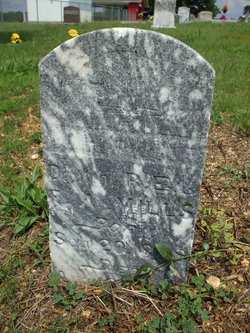
Jocyphine Mills
| Birth | : | 20 Sep 1888 |
| Death | : | 16 Aug 1893 |
| Burial | : | Saxilby Cemetery, Saxilby, West Lindsey District, England |
| Coordinate | : | 53.2755800, -0.6590400 |
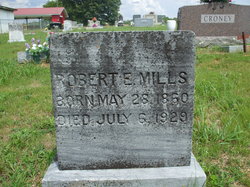
| Description | : | Daughter of Robert Ellis Mills and Francis Ann (Norman) Mills. |
frequently asked questions (FAQ):
-
Where is Jocyphine Mills's memorial?
Jocyphine Mills's memorial is located at: Saxilby Cemetery, Saxilby, West Lindsey District, England.
-
When did Jocyphine Mills death?
Jocyphine Mills death on 16 Aug 1893 in
-
Where are the coordinates of the Jocyphine Mills's memorial?
Latitude: 53.2755800
Longitude: -0.6590400
Family Members:
Parent

Siblings
Flowers:


Nearby Cemetories:
1. Saxilby Cemetery
Saxilby, West Lindsey District, England
Coordinate: 53.2755800, -0.6590400
2. St. Botolph Churchyard
Saxilby, West Lindsey District, England
Coordinate: 53.2747300, -0.6591000
3. All Saints Churchyard
Broxholme, West Lindsey District, England
Coordinate: 53.2922400, -0.6349600
4. Sturton by Stow Quaker Cemetery
Sturton-by-Stow, West Lindsey District, England
Coordinate: 53.3173590, -0.6644260
5. Saint Peter And Saint Paul Churchyard
Kettlethorpe, West Lindsey District, England
Coordinate: 53.2714805, -0.7298717
6. Woodbank Cemetery
Skellingthorpe, North Kesteven District, England
Coordinate: 53.2375380, -0.6229660
7. Sturton by Stow
Sturton-by-Stow, West Lindsey District, England
Coordinate: 53.3192800, -0.6677000
8. St. Luke's Churchyard
North Carlton, West Lindsey District, England
Coordinate: 53.2873000, -0.5831200
9. St. John the Baptist Churchyard
South Carlton, West Lindsey District, England
Coordinate: 53.2785000, -0.5754000
10. Stow Cemetery
Stow, West Lindsey District, England
Coordinate: 53.3252100, -0.6811100
11. All Saints Churchyard
Harby, Newark and Sherwood District, England
Coordinate: 53.2242190, -0.6860660
12. St. John the Baptist Churchyard
Scampton, West Lindsey District, England
Coordinate: 53.3037680, -0.5787140
13. St Peter's Churchyard
Aisthorpe, West Lindsey District, England
Coordinate: 53.3102400, -0.5815300
14. St. Peter's Churchyard
Newton on Trent, West Lindsey District, England
Coordinate: 53.2601290, -0.7528380
15. St. Vincent Churchyard
Burton, West Lindsey District, England
Coordinate: 53.2596400, -0.5598100
16. St Cuthbert's Churchyard
Brattleby, West Lindsey District, England
Coordinate: 53.3156600, -0.5794750
17. St. Edith Churchyard
Coates-by-Stow, West Lindsey District, England
Coordinate: 53.3369700, -0.6377300
18. Dam Busters Dog Memorial
Scampton, West Lindsey District, England
Coordinate: 53.3008200, -0.5495800
19. Saint Margaret of Antioch Churchyard
Marton, West Lindsey District, England
Coordinate: 53.3260600, -0.7406500
20. St. Michael's Churchyard
Cammeringham, West Lindsey District, England
Coordinate: 53.3275480, -0.5781450
21. Marton Cemetery
Marton, West Lindsey District, England
Coordinate: 53.3251500, -0.7468200
22. Holy Trinity Churchyard
Cottam, Bassetlaw District, England
Coordinate: 53.3112500, -0.7732600
23. St. Helen's Churchyard
Gate Burton, West Lindsey District, England
Coordinate: 53.3364060, -0.7420920
24. St. Mary's Churchyard
Riseholme, West Lindsey District, England
Coordinate: 53.2688200, -0.5264900