
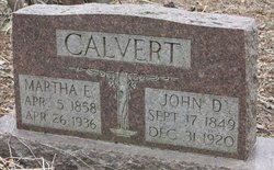
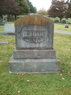
John David Calvert
| Birth | : | 17 Sep 1849 Allen County, Kentucky, USA |
| Death | : | 31 Dec 1920 Allen County, Kentucky, USA |
| Burial | : | Holy Trinity Churchyard, Coleford, Mendip District, England |
| Coordinate | : | 51.2394100, -2.4503100 |
frequently asked questions (FAQ):
-
Where is John David Calvert's memorial?
John David Calvert's memorial is located at: Holy Trinity Churchyard, Coleford, Mendip District, England.
-
When did John David Calvert death?
John David Calvert death on 31 Dec 1920 in Allen County, Kentucky, USA
-
Where are the coordinates of the John David Calvert's memorial?
Latitude: 51.2394100
Longitude: -2.4503100
Family Members:
Spouse

Children
Flowers:


Nearby Cemetories:
1. Holy Trinity Churchyard
Coleford, Mendip District, England
Coordinate: 51.2394100, -2.4503100
2. St Edmund's Church Vobster
Mells, Mendip District, England
Coordinate: 51.2418000, -2.4244930
3. Saint Giles Churchyard
Leigh-on-Mendip, Mendip District, England
Coordinate: 51.2239000, -2.4416000
4. St. Andrew's Churchyard
Holcombe, Mendip District, England
Coordinate: 51.2547850, -2.4760280
5. St. Margaret's Churchyard
Frome, Mendip District, England
Coordinate: 51.2576670, -2.4242260
6. St Michael & All Angels
Stoke St Michael, Mendip District, England
Coordinate: 51.2208300, -2.4819900
7. Saint Vigor Churchyard
Stratton-on-the-Fosse, Mendip District, England
Coordinate: 51.2552000, -2.4896000
8. St. Benedict's Churchyard
Stratton-on-the-Fosse, Mendip District, England
Coordinate: 51.2560684, -2.4913545
9. Downside Abbey
Stratton-on-the-Fosse, Mendip District, England
Coordinate: 51.2544000, -2.4943000
10. St Peter and St Paul Churchyard
Kilmersdon, Mendip District, England
Coordinate: 51.2701480, -2.4372860
11. St Andrew Churchyard
Mells, Mendip District, England
Coordinate: 51.2420710, -2.3912060
12. Christ Church Churchyard
Mendip District, England
Coordinate: 51.2514920, -2.5151540
13. Christ Church, Downside
Chilcompton, Mendip District, England
Coordinate: 51.2515150, -2.5153030
14. Downside Cemetery
Chilcompton, Mendip District, England
Coordinate: 51.2517300, -2.5152400
15. St George's Churchyard
Whatley, Mendip District, England
Coordinate: 51.2270030, -2.3822140
16. St James Churchyard
Ashwick, Mendip District, England
Coordinate: 51.2320800, -2.5229500
17. St John the Baptist Church Cemetery
Chilcompton, Mendip District, England
Coordinate: 51.2693960, -2.5073780
18. St. Nicholas' Churchyard
Radstock, Bath and North East Somerset Unitary Authority, England
Coordinate: 51.2900740, -2.4488510
19. Blessed St Mary the Virgin Churchyard
Hemington, Mendip District, England
Coordinate: 51.2758698, -2.3925455
20. St. John the Baptist Churchyard
Midsomer Norton, Bath and North East Somerset Unitary Authority, England
Coordinate: 51.2870310, -2.4842190
21. Saint Bartholomew Chapel Churchyard
Cranmore, Mendip District, England
Coordinate: 51.1882990, -2.4759150
22. St Bartholomew Churchyard
Cranmore, Mendip District, England
Coordinate: 51.1882670, -2.4760330
23. Saint Mary Magdalene Churchyard
Great Elm, Mendip District, England
Coordinate: 51.2426040, -2.3647230
24. All Saints Churchyard
Nunney, Mendip District, England
Coordinate: 51.2098694, -2.3772340