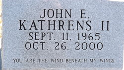
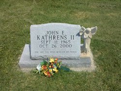
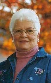
John E. Kathrens II
| Birth | : | 11 Sep 1965 Holton, Jackson County, Kansas, USA |
| Death | : | 26 Oct 2000 Holton, Jackson County, Kansas, USA |
| Burial | : | Holly Memorial Gardens, Pleasant Grove, Belmont County, USA |
| Coordinate | : | 40.1479460, -80.8419940 |
| Plot | : | Section JJ |
| Inscription | : | You are the wind beneath my wings |
| Description | : | HOLTON -- John E. Kathrens II, 35, Holton, was killed Thursday, Oct. 26, 2000, in a two-vehicle accident north of Holton. Mr. Kathrens was a farmer and stockman, and past chairman of the board of directors of the Jackson Farmers Cooperative Inc. He was born Sept. 11, 1965, in Holton, the son of John E. and Janice Fraser Kathrens. He was a lifelong Holton area resident, and graduated from Holton High School in 1984. Mr. Kathrens attended First United Methodist Church in Holton, and he was a member of the Jackson County Livestock Association. He married Denise Hart on Sept. 10, 1988, in Greeley,... Read More |
frequently asked questions (FAQ):
-
Where is John E. Kathrens II's memorial?
John E. Kathrens II's memorial is located at: Holly Memorial Gardens, Pleasant Grove, Belmont County, USA.
-
When did John E. Kathrens II death?
John E. Kathrens II death on 26 Oct 2000 in Holton, Jackson County, Kansas, USA
-
Where are the coordinates of the John E. Kathrens II's memorial?
Latitude: 40.1479460
Longitude: -80.8419940
Family Members:
Parent
Flowers:
Nearby Cemetories:
1. Holly Memorial Gardens
Pleasant Grove, Belmont County, USA
Coordinate: 40.1479460, -80.8419940
2. Pleasant Grove Cemetery
Pleasant Grove, Belmont County, USA
Coordinate: 40.1507988, -80.8463974
3. Hicksite Cemetery
Emerson, Jefferson County, USA
Coordinate: 40.1761017, -80.8289032
4. Joshua Maule Family Burying Ground
Colerain, Belmont County, USA
Coordinate: 40.1350000, -80.8058330
5. Grange Friends Cemetery
Colerain Township, Belmont County, USA
Coordinate: 40.1270140, -80.8062420
6. Barton Cemetery
Barton, Belmont County, USA
Coordinate: 40.1136017, -80.8296967
7. Milhouse Farm Cemetery
Colerain Township, Belmont County, USA
Coordinate: 40.1283330, -80.8008330
8. Short Creek Cemetery
Mount Pleasant, Jefferson County, USA
Coordinate: 40.1802000, -80.8124400
9. Short Creek Cemetery
Bergholz, Jefferson County, USA
Coordinate: 40.1817017, -80.8116989
10. Concord Quaker Cemetery
Colerain Township, Belmont County, USA
Coordinate: 40.1244011, -80.7947006
11. Farmington Cemetery
Barton, Belmont County, USA
Coordinate: 40.1074982, -80.8210983
12. New Barton Cemetery
Barton, Belmont County, USA
Coordinate: 40.1032982, -80.8475037
13. Wilson Cemetery
Mount Pleasant Township, Jefferson County, USA
Coordinate: 40.1824989, -80.8807983
14. Seceder Cemetery
Mount Pleasant, Jefferson County, USA
Coordinate: 40.1749992, -80.7936020
15. Wheeling Valley Cemetery
Fairpoint, Belmont County, USA
Coordinate: 40.1455570, -80.9022550
16. Highland Cemetery
Mount Pleasant, Jefferson County, USA
Coordinate: 40.1785580, -80.7966240
17. First Concord Cemetery
Colerain, Belmont County, USA
Coordinate: 40.1238880, -80.7888880
18. Alley Cemetery
Harrisville, Harrison County, USA
Coordinate: 40.1828003, -80.8861008
19. Coleman Cemetery
Wheeling Township, Belmont County, USA
Coordinate: 40.1244011, -80.8992004
20. Friends Meeting House Cemetery
Adena, Jefferson County, USA
Coordinate: 40.1903970, -80.8805160
21. Olive Branch Cemetery
Harrisville, Harrison County, USA
Coordinate: 40.1810989, -80.8953018
22. Hardesty Cemetery
Blaine, Belmont County, USA
Coordinate: 40.0931015, -80.8416977
23. Scotch Ridge Cemetery
Martins Ferry, Belmont County, USA
Coordinate: 40.1303490, -80.7606390
24. Oak Grove Cemetery
Mount Pleasant, Jefferson County, USA
Coordinate: 40.1769060, -80.7655010


