
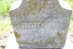
John Henrich Wichmer
| Birth | : | Aug 1813 Münster, Stadtkreis Münster, Nordrhein-Westfalen, Germany |
| Death | : | 22 Mar 1893 Roselle, Carroll County, Iowa, USA |
| Burial | : | Christ Church Churchyard, Colne, Pendle Borough, England |
| Coordinate | : | 53.8602110, -2.1415670 |
| Plot | : | Block 1, Grave 5 |
| Description | : | John and Maria Anna immigrated to the United States and settling in St. Marys, PA and then in 1871 moving to Roselle, IA. They had three sons, Joseph Bernard, Frank Henry, and John (Jr.). On March 9, 1893 while helping his son, Frank Henry pack to move to Breda, he injuried his hand and developed blood poisoning and passed away. He is buried in Sts. Peter and Paul Cemetery in Carroll, IA. Sts. Peter and Paul Cemetery was renamed Mt Olivet Cemetery. |
frequently asked questions (FAQ):
-
Where is John Henrich Wichmer's memorial?
John Henrich Wichmer's memorial is located at: Christ Church Churchyard, Colne, Pendle Borough, England.
-
When did John Henrich Wichmer death?
John Henrich Wichmer death on 22 Mar 1893 in Roselle, Carroll County, Iowa, USA
-
Where are the coordinates of the John Henrich Wichmer's memorial?
Latitude: 53.8602110
Longitude: -2.1415670
Family Members:
Spouse
Children

Flowers:


Nearby Cemetories:
1. Christ Church Churchyard
Colne, Pendle Borough, England
Coordinate: 53.8602110, -2.1415670
2. New Lane Inghamite Cemetery
Winewall, Pendle Borough, England
Coordinate: 53.8548000, -2.1367150
3. Colne Cemetery
Colne, Pendle Borough, England
Coordinate: 53.8577420, -2.1585350
4. Trawden Wesley Chapel Graveyard
Trawden Forest, Pendle Borough, England
Coordinate: 53.8459885, -2.1355791
5. West Street Inghamite Chapel Chapelyard
Colne, Pendle Borough, England
Coordinate: 53.8555930, -2.1672140
6. St. Bartholomew Churchyard
Colne, Pendle Borough, England
Coordinate: 53.8570600, -2.1700470
7. St. Mary the Virgin Churchyard
Trawden Forest, Pendle Borough, England
Coordinate: 53.8431010, -2.1366050
8. St. Michael's Churchyard
Foulridge, Pendle Borough, England
Coordinate: 53.8734569, -2.1693508
9. Friends Burial Ground
Foulridge, Pendle Borough, England
Coordinate: 53.8769360, -2.1669040
10. Nelson Cemetery
Nelson, Pendle Borough, England
Coordinate: 53.8420330, -2.1972230
11. St Mary's Churchyard
Kelbrook, Pendle Borough, England
Coordinate: 53.8991000, -2.1494100
12. St. John the Evangelist Churchyard
Nelson, Pendle Borough, England
Coordinate: 53.8367000, -2.1977200
13. Barrowford Cemetery
Nelson, Pendle Borough, England
Coordinate: 53.8521100, -2.2130300
14. John Ecroyd's Orchard
Lancaster, City of Lancaster, England
Coordinate: 53.8201990, -2.1697920
15. St. Thomas Churchyard
Barrowford, Pendle Borough, England
Coordinate: 53.8513900, -2.2196600
16. Hill Lane Baptist Church Churchyard
Briercliffe, Burnley Borough, England
Coordinate: 53.8161467, -2.1875368
17. St. Paul's Churchyard
Nelson, Pendle Borough, England
Coordinate: 53.8289250, -2.2157520
18. Salterforth Cemetery
Salterforth, Pendle Borough, England
Coordinate: 53.9123170, -2.1654010
19. Haggate Baptist Church Burial Ground
Burnley Borough, England
Coordinate: 53.8145048, -2.1960725
20. All Souls Cemetery
Barrowford, Pendle Borough, England
Coordinate: 53.8462900, -2.2355600
21. Marsden Friends Burial Ground
Marsden, Metropolitan Borough of Kirklees, England
Coordinate: 53.8241910, -2.2197410
22. Holy Trinity Churchyard
Cowling, Craven District, England
Coordinate: 53.8837150, -2.0503150
23. Holy Trinity Churchyard
Cowling, Craven District, England
Coordinate: 53.8836930, -2.0502720
24. Earby Cemetery
Earby, Pendle Borough, England
Coordinate: 53.9189987, -2.1370001