
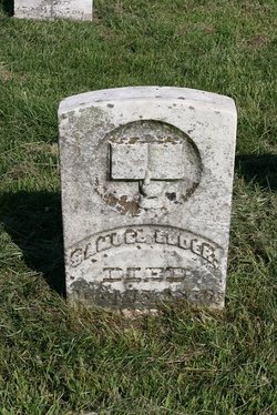
| Birth | : | 19 Mar 1837 |
| Death | : | 4 May 1911 |
| Burial | : | Half-Day Cemetery, Elmont, Shawnee County, USA |
| Coordinate | : | 39.1584702, -95.7143402 |
| Description | : | The funeral services of John M. Elder, the old soldier who was struck by a street car Wednesday morning at Fifth and Jackson streets, will be held from the Church of the Latter Day Saints Monday morning at 10 o'clock. The services will be in charge of Topeka Post No. 71, G.A.R. G.A.R. members will take Oakland car to the corner of Seward avenue and Logan streets, boarding cars at Sixth and Kansas avenue free of fare at 9:30 o'clock. John M. Elder enlisted in Company K, 29th regiment Indiana infantry, October 22, 1861, and was honorably... Read More |
frequently asked questions (FAQ):
-
Where is John Martin Elder's memorial?
John Martin Elder's memorial is located at: Half-Day Cemetery, Elmont, Shawnee County, USA.
-
When did John Martin Elder death?
John Martin Elder death on 4 May 1911 in
-
Where are the coordinates of the John Martin Elder's memorial?
Latitude: 39.1584702
Longitude: -95.7143402
Family Members:
Parent
Spouse

Siblings
Children
Flowers:


Nearby Cemetories:
1. Half-Day Cemetery
Elmont, Shawnee County, USA
Coordinate: 39.1584702, -95.7143402
2. Prairie Home Cemetery
Topeka, Shawnee County, USA
Coordinate: 39.1077118, -95.7482910
3. Rochester Cemetery
Topeka, Shawnee County, USA
Coordinate: 39.1044006, -95.6800003
4. Bennie Lee Graham Memorial Cemetery
Shawnee County, USA
Coordinate: 39.1020584, -95.6836472
5. Curtis Family Cemetery
North Topeka, Shawnee County, USA
Coordinate: 39.0792870, -95.6702270
6. Hoyt Cemetery
Hoyt, Jackson County, USA
Coordinate: 39.2435989, -95.7375031
7. Topeka State Hospital Cemetery
Topeka, Shawnee County, USA
Coordinate: 39.0671005, -95.7080994
8. Steward Cemetery
Jackson County, USA
Coordinate: 39.2310982, -95.6363983
9. Memorial Park Cemetery
Topeka, Shawnee County, USA
Coordinate: 39.0619011, -95.7221985
10. Saint Joseph's Catholic Cemetery
Hoyt, Jackson County, USA
Coordinate: 39.2601204, -95.7099762
11. Security Benefit Association Cemetery
Topeka, Shawnee County, USA
Coordinate: 39.0630989, -95.7606583
12. Horn-Hainline Family Cemetery
Hoyt, Jackson County, USA
Coordinate: 39.2584000, -95.6744000
13. Mount Calvary Cemetery
Topeka, Shawnee County, USA
Coordinate: 39.0532990, -95.7360992
14. Saint Aloysius Cemetery
Meriden, Jefferson County, USA
Coordinate: 39.1872482, -95.5795593
15. Grace Episcopal Cathedral Columbarium
Topeka, Shawnee County, USA
Coordinate: 39.0511284, -95.6843719
16. Grace Episcopal Cathedral Sanctuary
Topeka, Shawnee County, USA
Coordinate: 39.0506925, -95.6839273
17. Walnut Hill Cemetery
Silver Lake, Shawnee County, USA
Coordinate: 39.1940498, -95.8500671
18. Westminster Presbyterian Church Memorial Garden
Topeka, Shawnee County, USA
Coordinate: 39.0430400, -95.7021700
19. Silver Lake Cemetery
Silver Lake, Shawnee County, USA
Coordinate: 39.1189003, -95.8617020
20. Saint Davids Episcopal Church Columbarium
Topeka, Shawnee County, USA
Coordinate: 39.0369860, -95.7259480
21. Mount Hope Cemetery
Topeka, Shawnee County, USA
Coordinate: 39.0367393, -95.7386703
22. Carnegie Hall
Topeka, Shawnee County, USA
Coordinate: 39.0350600, -95.6999100
23. Old Grantville Cemetery
Grantville, Jefferson County, USA
Coordinate: 39.0949500, -95.5771300
24. Meriden Cemetery
Meriden, Jefferson County, USA
Coordinate: 39.1946793, -95.5606079