
| Birth | : | 18 Aug 1843 New Hampshire, USA |
| Death | : | 27 Sep 1921 |
| Burial | : | St Michael Churchyard, Burrowbridge, Taunton Deane Borough, England |
| Coordinate | : | 51.0698090, -2.9174960 |
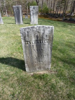
| Inscription | : | 12 NH Infantry 1 Lt. Co. G 1 REGT U S INF VOL |
frequently asked questions (FAQ):
-
Where is John P Eaton's memorial?
John P Eaton's memorial is located at: St Michael Churchyard, Burrowbridge, Taunton Deane Borough, England.
-
When did John P Eaton death?
John P Eaton death on 27 Sep 1921 in
-
Where are the coordinates of the John P Eaton's memorial?
Latitude: 51.0698090
Longitude: -2.9174960
Family Members:
Parent

Spouse
Siblings
Flowers:


Nearby Cemetories:
1. St Michael Churchyard
Burrowbridge, Taunton Deane Borough, England
Coordinate: 51.0698090, -2.9174960
2. Ebenezer Chapelyard
Burrowbridge, Taunton Deane Borough, England
Coordinate: 51.0727744, -2.9222989
3. Athelney Abbey (Defunct)
Athelney, Sedgemoor District, England
Coordinate: 51.0593000, -2.9345800
4. Othery Cemetery
Othery, Sedgemoor District, England
Coordinate: 51.0771222, -2.8906189
5. Northmoor Green St. Peter & St. John Churchyard
North Petherton, Sedgemoor District, England
Coordinate: 51.0841694, -2.9486911
6. East Lyng St Bartholomew
Lyng, Sedgemoor District, England
Coordinate: 51.0553000, -2.9534000
7. Holy Cross Churchyard
Middlezoy, Sedgemoor District, England
Coordinate: 51.0937200, -2.8941260
8. The Baptist Chapel
Stoke St Gregory, Taunton Deane Borough, England
Coordinate: 51.0430441, -2.9375476
9. Stoke St Gregory
Stoke St Gregory, Taunton Deane Borough, England
Coordinate: 51.0398130, -2.9310570
10. Saint Andrew's Churchyard
Aller, South Somerset District, England
Coordinate: 51.0554000, -2.8627000
11. Westonzoyland Cemetery
Westonzoyland, Sedgemoor District, England
Coordinate: 51.1078900, -2.9264440
12. The Old Chapel
Westonzoyland, Sedgemoor District, England
Coordinate: 51.1077425, -2.9285237
13. St. Mary's Churchyard
Westonzoyland, Sedgemoor District, England
Coordinate: 51.1087000, -2.9273800
14. Westonzoyland Cemetery New
Westonzoyland, Sedgemoor District, England
Coordinate: 51.1096271, -2.9349336
15. St. Michael's Churchyard
North Newton, Sedgemoor District, England
Coordinate: 51.0650279, -2.9974435
16. St. Peter's Churchyard
North Newton, Sedgemoor District, England
Coordinate: 51.0751380, -2.9990730
17. Curry Rivel Cemetery
Curry Rivel, South Somerset District, England
Coordinate: 51.0257667, -2.8676226
18. St. Andrew's Churchyard
Curry Rivel, South Somerset District, England
Coordinate: 51.0246570, -2.8687410
19. St. Peter & St. Paul's Churchyard
North Curry, Taunton Deane Borough, England
Coordinate: 51.0258710, -2.9716440
20. Buckland Priory
Durston, Taunton Deane Borough, England
Coordinate: 51.0476530, -2.9988180
21. Methodist Churchyard
North Curry, Taunton Deane Borough, England
Coordinate: 51.0213358, -2.9731175
22. Sutton Mallet Churchyard
Sutton Mallet, Sedgemoor District, England
Coordinate: 51.1282540, -2.8974536
23. High Ham Cemetery
High Ham, South Somerset District, England
Coordinate: 51.0739931, -2.8216351
24. St. Andrew's Churchyard
High Ham, South Somerset District, England
Coordinate: 51.0760320, -2.8218400