
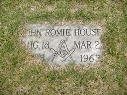

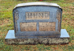
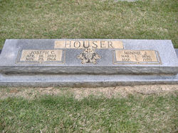
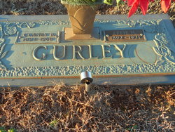
John Romie Houser
| Birth | : | 18 Aug 1888 Rutherford County, North Carolina, USA |
| Death | : | 22 Mar 1963 Morganton, Burke County, North Carolina, USA |
| Burial | : | Whitby Cemetery, Whitby, Scarborough Borough, England |
| Coordinate | : | 54.4755000, -0.6106500 |
| Description | : | Name:John Romey Houser Gender:Male Race:White Age:74 Birth Date:18 Aug 1888 Birth Place:Rutherford, North Carolina, United States Residence Place:Ellenboro, Rutherford, North Carolina Death Date:22 Mar 1963 Death Place:Morganton, Burke, North Carolina, USA Father:William Houser Mother:Amanda Jones Spouse:Estridge Bridges |
frequently asked questions (FAQ):
-
Where is John Romie Houser's memorial?
John Romie Houser's memorial is located at: Whitby Cemetery, Whitby, Scarborough Borough, England.
-
When did John Romie Houser death?
John Romie Houser death on 22 Mar 1963 in Morganton, Burke County, North Carolina, USA
-
Where are the coordinates of the John Romie Houser's memorial?
Latitude: 54.4755000
Longitude: -0.6106500
Family Members:
Parent

Siblings
Flowers:


Nearby Cemetories:
1. Whitby Cemetery
Whitby, Scarborough Borough, England
Coordinate: 54.4755000, -0.6106500
2. Quaker Burial Ground
Whitby, Scarborough Borough, England
Coordinate: 54.4847790, -0.6194700
3. Whitby Abbey
Whitby, Scarborough Borough, England
Coordinate: 54.4883230, -0.6073850
4. St. Mary the Virgin Churchyard
Whitby, Scarborough Borough, England
Coordinate: 54.4888400, -0.6093420
5. St. Hilda's Churchyard
Sneaton, Scarborough Borough, England
Coordinate: 54.4579490, -0.6226930
6. St Hilda Priory Cemetery
Whitby, Scarborough Borough, England
Coordinate: 54.4823300, -0.6431400
7. All Saints Churchyard
High Hawsker, Scarborough Borough, England
Coordinate: 54.4624580, -0.5785000
8. All Saints Churchyard
Ugglebarnby, Scarborough Borough, England
Coordinate: 54.4522340, -0.6446610
9. St John the Evangelist Churchyard
Sleights, Scarborough Borough, England
Coordinate: 54.4503500, -0.6651200
10. St. Margaret's Churchyard
Aislaby, Scarborough Borough, England
Coordinate: 54.4653900, -0.6792400
11. St. Stephen Old Churchyard
Fylingdales, Scarborough Borough, England
Coordinate: 54.4400890, -0.5496350
12. St Oswald Churchyard
Lythe, Scarborough Borough, England
Coordinate: 54.5065120, -0.6885870
13. St. Stephen's New Churchyard
Robin Hoods Bay, Scarborough Borough, England
Coordinate: 54.4341460, -0.5394280
14. St Matthew Churchyard
Grosmont, Scarborough Borough, England
Coordinate: 54.4348410, -0.7243950
15. St Hilda Churchyard
Egton, Scarborough Borough, England
Coordinate: 54.4414240, -0.7535720
16. Christ Church Churchyard
Ugthorpe, Scarborough Borough, England
Coordinate: 54.4892300, -0.7672700
17. Egton Cemetery
Egton, Scarborough Borough, England
Coordinate: 54.4482300, -0.7690700
18. St Hilda Churchyard
Ravenscar, Scarborough Borough, England
Coordinate: 54.3973500, -0.4925300
19. Ebenezers Baptist Church
Scarborough Borough, England
Coordinate: 54.3744655, -0.6557164
20. St Mary Churchyard
Goathland, Scarborough Borough, England
Coordinate: 54.3950300, -0.7266400
21. St. Hilda Churchyard
Hinderwell, Scarborough Borough, England
Coordinate: 54.5422400, -0.7784600
22. Hinderwell Cemetery
Hinderwell, Scarborough Borough, England
Coordinate: 54.5430090, -0.7781630
23. St Thomas Churchyard
Glaisdale, Scarborough Borough, England
Coordinate: 54.4373700, -0.8083400
24. Our Lady of Sacred Heart Roman Catholic Churchyard
Lealholm, Scarborough Borough, England
Coordinate: 54.4592200, -0.8234600