
| Birth | : | 27 Apr 1797 Rutherford County, North Carolina, USA |
| Death | : | 24 Jul 1864 Mitchell County, North Carolina, USA |
| Burial | : | Penrhys Cemetery, Wales |
| Coordinate | : | 51.6420500, -3.4425800 |
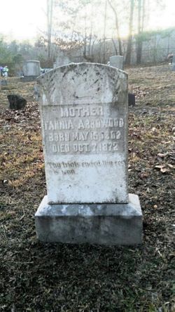
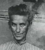
| Description | : | John married Frances "Fanny" Fannia Barnett and together they had at least 13 children. ********************************************************** Toward the end of the War of 1812, John enlisted at Jonesboro , in Washington County, Tennessee, as a substitute for Jesse Arrowood, who had been drafted. He travelled 100 miles to Knoxville, where on September 20, 1814, he was mustered into service as a Private in Capt. Abner Pearce's Company of the 3rd Tennessee Militia. The following spring, he was discharged at Fort Williams, in central Alabama, on April 10, 1815. After selling his final pay voucher to a man in Western Tennessee, he returned... Read More |
frequently asked questions (FAQ):
-
Where is John “The Indian Fighter” Arrowood's memorial?
John “The Indian Fighter” Arrowood's memorial is located at: Penrhys Cemetery, Wales.
-
When did John “The Indian Fighter” Arrowood death?
John “The Indian Fighter” Arrowood death on 24 Jul 1864 in Mitchell County, North Carolina, USA
-
Where are the coordinates of the John “The Indian Fighter” Arrowood's memorial?
Latitude: 51.6420500
Longitude: -3.4425800
Family Members:
Spouse
Children

Flowers:


Nearby Cemetories:
1. Penrhys Cemetery
Wales
Coordinate: 51.6420500, -3.4425800
2. Holy Trinity Churchyard
Ilfracombe, North Devon District, England
Coordinate: 51.5571712, -3.5946496
3. Newcastle St. Illtyd Churchyard
Wales
Coordinate: 51.5080900, -3.5829600
4. St George's Churchyard
Wales
Coordinate: 51.4819300, -3.2911700
5. St Nicholas Church
Wales
Coordinate: 51.4605000, -3.3098000
6. Twyn yr Odyn Baptist Chapel Burial Ground
Wales
Coordinate: 51.4563708, -3.2739268
7. Saint David's Churchyard
Wales
Coordinate: 51.8017440, -3.6967650
8. St. Peter's Churchyard
Wales
Coordinate: 51.6133800, -3.0590490
9. St David Church Burial Ground
Wales
Coordinate: 51.7703100, -3.7884600
10. Godre'r Graig Independent Chapel Cemetery
Wales
Coordinate: 51.7474400, -3.8089300
11. Alltwen Welsh Congregational Chapelyard
Wales
Coordinate: 51.7139600, -3.8444700
12. St Elli’s Churchyard
Wales
Coordinate: 51.8264420, -3.1154820
13. Rhyd-Y-Fro Saron Congregational Old Chapelyard
Wales
Coordinate: 51.7379400, -3.8662700
14. St. Peter's Churchyard
Wales
Coordinate: 51.7364689, -2.9735286
15. St. Cadoc
Wales
Coordinate: 51.7818400, -2.9716800
16. Three Crosses Churchyard, Capel y Crwys
Wales
Coordinate: 51.6278387, -4.0653017
17. St. John the Baptist Churchyard
Weston-super-Mare, North Somerset Unitary Authority, England
Coordinate: 51.3523010, -2.9813260
18. Saint Pauls Churchyard
Kewstoke, North Somerset Unitary Authority, England
Coordinate: 51.3655500, -2.9568900
19. St Paul's Churchyard
Kewstoke, North Somerset Unitary Authority, England
Coordinate: 51.3655390, -2.9566120
20. Clevedon Cemetery
Clevedon, North Somerset Unitary Authority, England
Coordinate: 51.4322600, -2.8747270
21. St Andrew Churchyard
Clevedon, North Somerset Unitary Authority, England
Coordinate: 51.4331670, -2.8735760
22. Weston-Super-Mare Cemetery
Weston-super-Mare, North Somerset Unitary Authority, England
Coordinate: 51.3541300, -2.9676900
23. Llandingat Parish Church
Wales
Coordinate: 51.9914392, -3.8022458
24. Weston-super-Mare Emmanuel Churchyard
Weston-super-Mare, North Somerset Unitary Authority, England
Coordinate: 51.3458940, -2.9773860