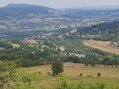
| Memorials | : | 7 |
| Location | : | Wales |
| Coordinate | : | 51.8264420, -3.1154820 |
| Description | : | St Ellyn Church known locally as Llanely Church Has two building periods the South Aisle and Tower dating back as far as 1175-1250. The North aisle was added in 1626. In the Tower there are Six bells, one dated 1908, two 1715, and two 1620, and the oldest from about 1440 and is the oldest in Wales. Information taken from official guide to the Church. |
frequently asked questions (FAQ):
-
Where is St Elli’s Churchyard?
St Elli’s Churchyard is located at llanelly Monmouthshire ,Wales.
-
St Elli’s Churchyard cemetery's updated grave count on graveviews.com?
7 memorials
-
Where are the coordinates of the St Elli’s Churchyard?
Latitude: 51.8264420
Longitude: -3.1154820
Nearby Cemetories:
1. St. Cadoc
Wales
Coordinate: 51.7818400, -2.9716800
2. St. Peter's Churchyard
Wales
Coordinate: 51.7364689, -2.9735286
3. Ewyas Harold Priory (Defunct)
Ewyas Harold, Herefordshire Unitary Authority, England
Coordinate: 51.9539100, -2.8969800
4. St. Michael and All Angels Churchyard
Ewyas Harold, Herefordshire Unitary Authority, England
Coordinate: 51.9539100, -2.8926070
5. St Mary's Churchyard
Kentchurch, Herefordshire Unitary Authority, England
Coordinate: 51.9263169, -2.8456161
6. Holy Trinity and St Mary Churchyard
Abbey Dore, Herefordshire Unitary Authority, England
Coordinate: 51.9686570, -2.8936760
7. St Michael churchyard
Garway, Herefordshire Unitary Authority, England
Coordinate: 51.8982110, -2.7934460
8. St. Peter's Churchyard
Wales
Coordinate: 51.6133800, -3.0590490
9. St. Mary & David Churchyard
Kilpeck, Herefordshire Unitary Authority, England
Coordinate: 51.9692310, -2.8076150
10. Church of St. Mary
Cusop, Herefordshire Unitary Authority, England
Coordinate: 52.0670000, -3.1100000
11. St. Leonard's Churchyard
Blakemere, Herefordshire Unitary Authority, England
Coordinate: 52.0646460, -2.9322980
12. St. Swithin's Churchyard
Ganarew, Herefordshire Unitary Authority, England
Coordinate: 51.8433258, -2.6850994
13. Christ Church Cemetery
Llangarron, Herefordshire Unitary Authority, England
Coordinate: 51.8699460, -2.6889130
14. St. John the Baptist Churchyard
Llanwarne, Herefordshire Unitary Authority, England
Coordinate: 51.9501676, -2.7203512
15. Penrhys Cemetery
Wales
Coordinate: 51.6420500, -3.4425800
16. St Andrew Churchyard
Bredwardine, Herefordshire Unitary Authority, England
Coordinate: 52.0948000, -2.9725000
17. All Saints Churchyard
Staunton (Coleford), Forest of Dean District, England
Coordinate: 51.8101900, -2.6533900
18. Little Birch Churchyard
Little Birch, Herefordshire Unitary Authority, England
Coordinate: 51.9770250, -2.7126530
19. All Saints Churchyard
Newland, Forest of Dean District, England
Coordinate: 51.7825990, -2.6499310
20. Aconbury Hill
Aconbury, Herefordshire Unitary Authority, England
Coordinate: 51.9932540, -2.7212790
21. All Saints Church
Clehonger, Herefordshire Unitary Authority, England
Coordinate: 52.0373470, -2.7806970
22. St. Dubricius Churchyard
Hentland, Herefordshire Unitary Authority, England
Coordinate: 51.9342080, -2.6660250
23. Christchurch Churchyard
Coleford, Forest of Dean District, England
Coordinate: 51.8135470, -2.6229980
24. Coleford Cemetery
Coleford, Forest of Dean District, England
Coordinate: 51.7933080, -2.6245110

