
| Memorials | : | 2 |
| Location | : | Wales |
| Coordinate | : | 51.7364689, -2.9735286 |
frequently asked questions (FAQ):
-
Where is St. Peter's Churchyard?
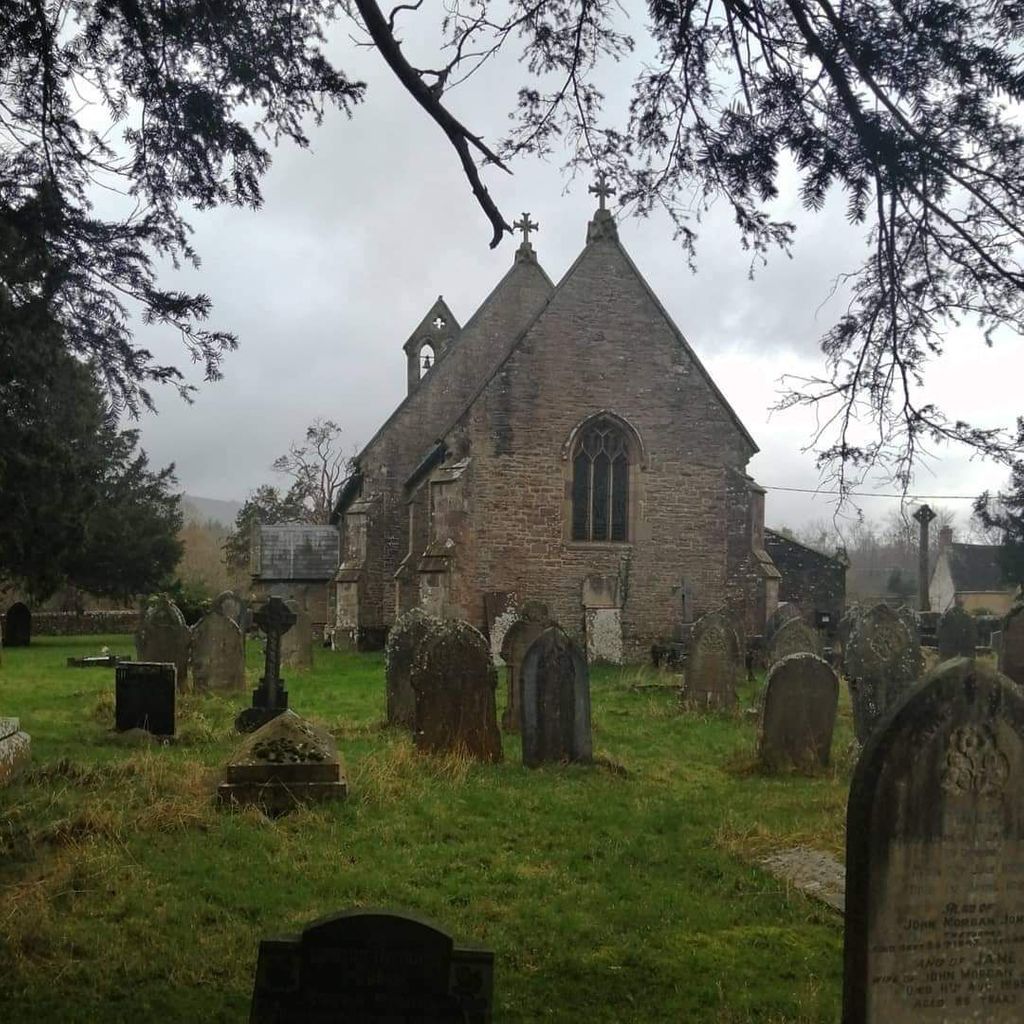
St. Peter's Churchyard is located at Monmouthshire , NP7 9DWWales.
-
St. Peter's Churchyard cemetery's updated grave count on graveviews.com?
2 memorials
-
Where are the coordinates of the St. Peter's Churchyard?
Latitude: 51.7364689
Longitude: -2.9735286
Nearby Cemetories:
1. St. Cadoc
Wales
Coordinate: 51.7818400, -2.9716800
2. St Elli’s Churchyard
Wales
Coordinate: 51.8264420, -3.1154820
3. St. Peter's Churchyard
Wales
Coordinate: 51.6133800, -3.0590490
4. St Michael churchyard
Garway, Herefordshire Unitary Authority, England
Coordinate: 51.8982110, -2.7934460
5. All Saints Churchyard
Newland, Forest of Dean District, England
Coordinate: 51.7825990, -2.6499310
6. St Mary's Churchyard
Kentchurch, Herefordshire Unitary Authority, England
Coordinate: 51.9263169, -2.8456161
7. St. Mary the Virgin Churchyard
St Briavels, Forest of Dean District, England
Coordinate: 51.7388290, -2.6405550
8. St. Luke's Churchyard
Tutshill, Forest of Dean District, England
Coordinate: 51.6544740, -2.6660020
9. St. Swithin's Churchyard
Ganarew, Herefordshire Unitary Authority, England
Coordinate: 51.8433258, -2.6850994
10. St Michael & All Angels Churchyard
Tidenham Chase, Forest of Dean District, England
Coordinate: 51.6862323, -2.6432188
11. All Saints Churchyard
Staunton (Coleford), Forest of Dean District, England
Coordinate: 51.8101900, -2.6533900
12. St. Mary and St. Peter Churchyard
Tidenham Chase, Forest of Dean District, England
Coordinate: 51.6601690, -2.6434850
13. Christ Church Cemetery
Llangarron, Herefordshire Unitary Authority, England
Coordinate: 51.8699460, -2.6889130
14. Ewyas Harold Priory (Defunct)
Ewyas Harold, Herefordshire Unitary Authority, England
Coordinate: 51.9539100, -2.8969800
15. St. Michael and All Angels Churchyard
Ewyas Harold, Herefordshire Unitary Authority, England
Coordinate: 51.9539100, -2.8926070
16. Clearwell Cemetery Chapel
Clearwell, Forest of Dean District, England
Coordinate: 51.7685400, -2.6167800
17. Coleford Cemetery
Coleford, Forest of Dean District, England
Coordinate: 51.7933080, -2.6245110
18. Christchurch Churchyard
Coleford, Forest of Dean District, England
Coordinate: 51.8135470, -2.6229980
19. Beachley Barracks Military Cemetery
Beachley, Forest of Dean District, England
Coordinate: 51.6185000, -2.6512000
20. St. John the Evangelist Churchyard
Beachley, Forest of Dean District, England
Coordinate: 51.6184750, -2.6505640
21. St. Andrew's Churchyard
Woolaston, Forest of Dean District, England
Coordinate: 51.6912000, -2.5982900
22. Holy Trinity and St Mary Churchyard
Abbey Dore, Herefordshire Unitary Authority, England
Coordinate: 51.9686570, -2.8936760
23. St. James' Churchyard
Bream, Forest of Dean District, England
Coordinate: 51.7468630, -2.5795910
24. St Mary Churchyard
English Bicknor, Forest of Dean District, England
Coordinate: 51.8390300, -2.6082000