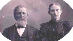
John Washington Reed
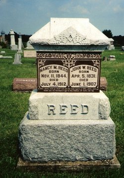
| Birth | : | 5 Apr 1831 Breckinridge County, Kentucky, USA |
| Death | : | 1 Jun 1907 Scotland County, Missouri, USA |
| Burial | : | Taita Lawn Cemetery, Naenae, Lower Hutt City, New Zealand |
| Coordinate | : | -41.1968900, 174.9634900 |
| Inscription | : | A little while, and ye shall not see me; and again, a little while and ye shall see me because I go to the Father. John 16:16 |
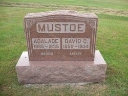
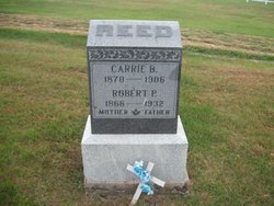
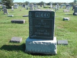
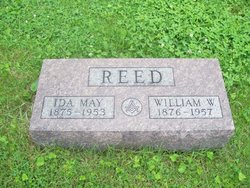
| Description | : | Married Nancy Melvina Cox April 27, 1862 in Scotland County, Missouri. Children: Florentine, Adalaide, Robert Porter, Peter, Nancy Madaline, William Wesley, Ina Myrtle, Grace. John was a successful farmer and a dedicated Mason. On each June 24th he brought his family together for a reunion to celebrate a day set aside for the Mason to honor the day the Grand Lodge was organized. * * * * John W. Reed, farmer and stock raiser, was born in Breckinridge County, Ky., near Louisville, April 5, 1831, and is a son of Peter and Nancy (Gray) Reed. This family of... Read More |
frequently asked questions (FAQ):
-
Where is John Washington Reed's memorial?
John Washington Reed's memorial is located at: Taita Lawn Cemetery, Naenae, Lower Hutt City, New Zealand.
-
When did John Washington Reed death?
John Washington Reed death on 1 Jun 1907 in Scotland County, Missouri, USA
-
Where are the coordinates of the John Washington Reed's memorial?
Latitude: -41.1968900
Longitude: 174.9634900
Family Members:
Parent
Spouse
Siblings
Children
Flowers:
Nearby Cemetories:
1. Taita Lawn Cemetery
Naenae, Lower Hutt City, New Zealand
Coordinate: -41.1968900, 174.9634900
2. Knox Presbyterian Church Cemetery
Lower Hutt, Lower Hutt City, New Zealand
Coordinate: -41.1965430, 174.9579920
3. Taita Old Cemetery
Naenae, Lower Hutt City, New Zealand
Coordinate: -41.1945700, 174.9564000
4. Christ Church Anglican Cemetery
Taita, Lower Hutt City, New Zealand
Coordinate: -41.1820960, 174.9600920
5. Boulcott Farm Cemetery
Lower Hutt, Lower Hutt City, New Zealand
Coordinate: -41.2030590, 174.9272750
6. St. James Churchyard
Lower Hutt, Lower Hutt City, New Zealand
Coordinate: -41.2128840, 174.9003910
7. Bridge Street Cemetery
Lower Hutt, Lower Hutt City, New Zealand
Coordinate: -41.2117740, 174.8969660
8. Owhiti Urupā
Seaview, Lower Hutt City, New Zealand
Coordinate: -41.2358800, 174.9044500
9. Woodlands Farm Cemetery
Wainuiomata, Lower Hutt City, New Zealand
Coordinate: -41.2587540, 174.9549250
10. Korokoro Catholic Cemetery
Lower Hutt, Lower Hutt City, New Zealand
Coordinate: -41.2210110, 174.8702590
11. Te Puni Urupā
Petone, Lower Hutt City, New Zealand
Coordinate: -41.2254898, 174.8686975
12. Wainuiomata Remembrance Garden
Wainuiomata, Lower Hutt City, New Zealand
Coordinate: -41.2762300, 174.9696800
13. Sinclair Cemetery
Wainuiomata, Lower Hutt City, New Zealand
Coordinate: -41.2770470, 174.9697580
14. Homedale Methodist Cemetery
Wainuiomata, Lower Hutt City, New Zealand
Coordinate: -41.2780500, 174.9527000
15. St Josephs Catholic Cemetery
Pauatahanui, Porirua City, New Zealand
Coordinate: -41.1135060, 174.9196220
16. St. John's Anglican Churchyard Cemetery
Trentham, Upper Hutt City, New Zealand
Coordinate: -41.1303100, 175.0443500
17. Bradey Grave
Whitby, Porirua City, New Zealand
Coordinate: -41.1173161, 174.9056161
18. Somes Island
Wellington, Wellington City, New Zealand
Coordinate: -41.2548630, 174.8650830
19. Saint Albans Burial Ground
Pauatahanui, Porirua City, New Zealand
Coordinate: -41.1067240, 174.9179340
20. Pauatahanui Burial Ground
Pauatahanui, Porirua City, New Zealand
Coordinate: -41.1068190, 174.9173310
21. Wallaceville Cemetery
Wallaceville, Upper Hutt City, New Zealand
Coordinate: -41.1359900, 175.0743300
22. Porirua Cemetery
Porirua, Porirua City, New Zealand
Coordinate: -41.1453640, 174.8420300
23. Grasslees Reserve
Tawa, Wellington City, New Zealand
Coordinate: -41.1647415, 174.8284302
24. St. Joseph's Church Cemetery
Upper Hutt, Upper Hutt City, New Zealand
Coordinate: -41.1243380, 175.0686570

