
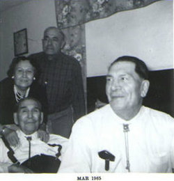
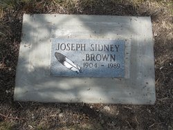

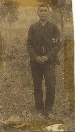
Joseph Sidney Brown
| Birth | : | 3 Jan 1904 Browning, Glacier County, Montana, USA |
| Death | : | 9 Jul 1989 Browning, Glacier County, Montana, USA |
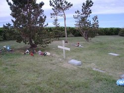
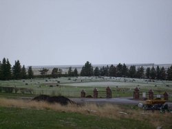
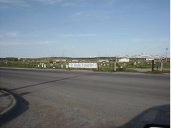
| Burial | : | St. Mary the Virgin Churchyard, Redgrave, Mid Suffolk District, England |
| Coordinate | : | 52.3632900, 1.0196800 |
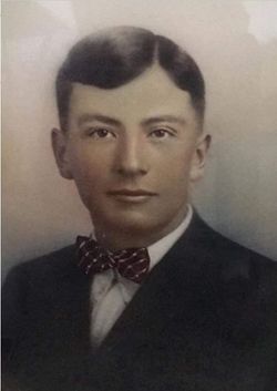
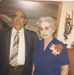
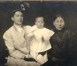
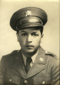
| Description | : | Exerpt from J.H. Sherburne (Teacher) on his pupils June 15, 1914: I shall take each pupil as they appear on my year register: Sidney Brown (2nd grade) Slow worker, should enter the second grade for 2 or 3 months. Excitable nature and should not be scolded too horribly." Sidney owned his own trucking company, was a carpenter. He lived in Browning all of his life. Was married to Jane Elizabeth McKelvy with two children from that marriage. He later remarried to Dorothy Ann Kipling Devereaux with six children from that marriage. |
frequently asked questions (FAQ):
-
Where is Joseph Sidney Brown's memorial?
Joseph Sidney Brown's memorial is located at: St. Mary the Virgin Churchyard, Redgrave, Mid Suffolk District, England.
-
When did Joseph Sidney Brown death?
Joseph Sidney Brown death on 9 Jul 1989 in Browning, Glacier County, Montana, USA
-
Where are the coordinates of the Joseph Sidney Brown's memorial?
Latitude: 52.3632900
Longitude: 1.0196800
Family Members:
Parent
Spouse
Siblings


Flowers:


Nearby Cemetories:
1. St. Mary the Virgin Churchyard
Redgrave, Mid Suffolk District, England
Coordinate: 52.3632900, 1.0196800
2. St. Botolph's Church Burial Ground
Botesdale, Mid Suffolk District, England
Coordinate: 52.3428830, 1.0061950
3. Botesdale Methodist Church Churchyard
Botesdale, Mid Suffolk District, England
Coordinate: 52.3430420, 1.0028410
4. Bressingham Cemetery
Bressingham, South Norfolk District, England
Coordinate: 52.3854520, 1.0486290
5. St. John the Baptist Churchyard
Bressingham, South Norfolk District, England
Coordinate: 52.3853850, 1.0489290
6. St. Mary's Churchyard
Hinderclay, Mid Suffolk District, England
Coordinate: 52.3521190, 0.9749790
7. St. Mary's Churchyard (Inferior)
Rickinghall, Mid Suffolk District, England
Coordinate: 52.3363130, 0.9912010
8. St Mary Churchyard
Rickinghall, Mid Suffolk District, England
Coordinate: 52.3363130, 0.9910550
9. St. Mary of Pity Churchyard
Burgate, Mid Suffolk District, England
Coordinate: 52.3389250, 1.0551270
10. St Nicholas Church
Thelnetham, St Edmundsbury Borough, England
Coordinate: 52.3656000, 0.9635000
11. St Andrew Churchyard
South Lopham, Breckland Borough, England
Coordinate: 52.3957830, 0.9969650
12. St. Remigius Churchyard
Roydon, South Norfolk District, England
Coordinate: 52.3815610, 1.0784680
13. St Andrew Churchyard
Fersfield, South Norfolk District, England
Coordinate: 52.4043450, 1.0351310
14. St Andrew's Churchyard
Blo' Norton, Breckland Borough, England
Coordinate: 52.3784830, 0.9549700
15. St Nicholas Churchyard
North Lopham, Breckland Borough, England
Coordinate: 52.4029430, 0.9920510
16. Methodist Churchyard
North Lopham, Breckland Borough, England
Coordinate: 52.4053630, 0.9920680
17. St Mary the Virgin Churchyard
Mellis, Mid Suffolk District, England
Coordinate: 52.3268950, 1.0725720
18. Croft Lane Baptist Church Burial Ground
Diss, South Norfolk District, England
Coordinate: 52.3771070, 1.1025490
19. St Peter Churchyard
Palgrave, Mid Suffolk District, England
Coordinate: 52.3634190, 1.1059170
20. Unitarian Chapel Cemetery
Palgrave, Mid Suffolk District, England
Coordinate: 52.3693130, 1.1086820
21. Diss War Memorial
Diss, South Norfolk District, England
Coordinate: 52.3773380, 1.1088530
22. St. John The Baptist Churchyard
Garboldisham, Breckland Borough, England
Coordinate: 52.3961130, 0.9444950
23. Saint Mary Churchyard
Diss, South Norfolk District, England
Coordinate: 52.3772370, 1.1097880
24. All Saints Churchyard
Hopton, St Edmundsbury Borough, England
Coordinate: 52.3730420, 0.9275760