
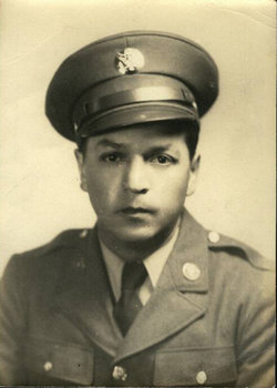

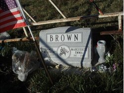
James Woodrow “Woods” Brown
| Birth | : | 6 Nov 1912 Browning, Glacier County, Montana, USA |
| Death | : | 22 May 2002 Browning, Glacier County, Montana, USA |
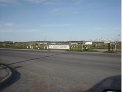
| Burial | : | Coloma Cemetery, Coloma, Berrien County, USA |
| Coordinate | : | 42.1860008, -86.3119965 |
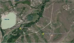
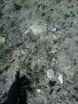
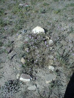
| Plot | : | South Fork of the Milk River |
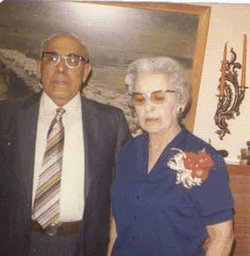
| Description | : | Not much is known about Uncle Woodrow. He was always a favorite of generations of family children. The kids always wanted to go with Uncle Woodrow out to the ranch. He was patient with children, easy going, treated you as a person,and there was always fishing, swimming, horses, cattle. Woodrow ranched on his father's spread out on the South Fork of the Milk River. He and Margeurite lived in the log house built in 1900. Early days on the ranch (mid-a950's), we still brought up water from the river for cooking, bathing, and washing. Still used an... Read More |
frequently asked questions (FAQ):
-
Where is James Woodrow “Woods” Brown's memorial?
James Woodrow “Woods” Brown's memorial is located at: Coloma Cemetery, Coloma, Berrien County, USA.
-
When did James Woodrow “Woods” Brown death?
James Woodrow “Woods” Brown death on 22 May 2002 in Browning, Glacier County, Montana, USA
-
Where are the coordinates of the James Woodrow “Woods” Brown's memorial?
Latitude: 42.1860008
Longitude: -86.3119965
Family Members:
Parent
Spouse
Siblings


Children
Flowers:


Nearby Cemetories:
1. Coloma Cemetery
Coloma, Berrien County, USA
Coordinate: 42.1860008, -86.3119965
2. Saint Josephs Catholic Cemetery
Watervliet, Berrien County, USA
Coordinate: 42.1852989, -86.2722015
3. Curtis Cemetery
Hagar Township, Berrien County, USA
Coordinate: 42.1856003, -86.3544006
4. Boyer Cemetery
Bainbridge Center, Berrien County, USA
Coordinate: 42.1572222, -86.3305556
5. Kniebes Cemetery
Coloma, Berrien County, USA
Coordinate: 42.1511002, -86.3071976
6. Harris Cemetery
Lake Michigan Beach, Berrien County, USA
Coordinate: 42.2144012, -86.3482971
7. Baptist Cemetery
Bainbridge Center, Berrien County, USA
Coordinate: 42.1455600, -86.2947300
8. Watervliet Cemetery
Watervliet, Berrien County, USA
Coordinate: 42.1886110, -86.2536110
9. Saint Marys Catholic Church Cemetery
Watervliet, Berrien County, USA
Coordinate: 42.1450000, -86.2916670
10. Saint Pauls United Church of Christ Cemetery
Watervliet, Berrien County, USA
Coordinate: 42.1447222, -86.2819444
11. New Hope United Methodist Church Cemetery
Bainbridge Center, Berrien County, USA
Coordinate: 42.1380530, -86.2812620
12. North Shore Memory Gardens
Coloma, Berrien County, USA
Coordinate: 42.2024994, -86.3908005
13. Millburg Cemetery
Millburg, Berrien County, USA
Coordinate: 42.1264000, -86.3486023
14. Fairview Memorial Cemetery
Watervliet, Berrien County, USA
Coordinate: 42.1969440, -86.2236110
15. Emmanuel Home Cemetery
Covert, Van Buren County, USA
Coordinate: 42.2508253, -86.2624946
16. Bainbridge Cemetery
Bainbridge Center, Berrien County, USA
Coordinate: 42.1156006, -86.2694016
17. Byers Cemetery
Bainbridge Center, Berrien County, USA
Coordinate: 42.1156700, -86.2680820
18. Fish Cemetery
Covert, Van Buren County, USA
Coordinate: 42.2655983, -86.2981033
19. Lake Shore Cemetery
Riverside, Berrien County, USA
Coordinate: 42.1669388, -86.4177780
20. Rush Lake Indian Cemetery
Hartford, Van Buren County, USA
Coordinate: 42.2357340, -86.2058600
21. Brant Cemetery
Bainbridge Township, Berrien County, USA
Coordinate: 42.0866000, -86.3197000
22. Penn Yan Cemetery
Bainbridge Center, Berrien County, USA
Coordinate: 42.0868988, -86.2817001
23. Pioneer Cemetery
Hartford, Van Buren County, USA
Coordinate: 42.2052200, -86.1769400
24. Pearl Cemetery
Benton Township, Berrien County, USA
Coordinate: 42.0905991, -86.3641968