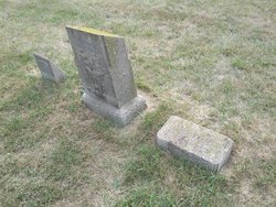
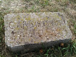
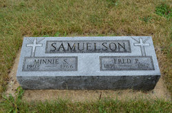
Karin “Carrie” Nilsdotter Samuelson
| Birth | : | 17 Jul 1850 Ovanaker, Ovanåkers kommun, Gävleborgs län, Sweden |
| Death | : | 6 Mar 1927 Stratford, Hamilton County, Iowa, USA |
| Burial | : | Hardin Township Cemetery, Hardin Township, Webster County, USA |
| Coordinate | : | 42.2411003, -93.9708023 |
| Description | : | Stratford Courier March 10, 1927 MRS. CARRIE SAMUELSON Mrs. Carrie Samuelson passed away at her home here Sunday morning after an illness of about three weeks. She was born in Ovannaker, Helsingland, Sweden, July 17, 1850 and died March 6, 1927, at the age of 76 years, 8 months, 19 days. She spent her childhood days in her native land, coming to America in 1880 and locating in Boone County. On Jan. 1, 1884, she was married to Peter M. Samuelson, who preceded her in death twelve years ago, on January 7, 1915. Nine children came to bless... Read More |
frequently asked questions (FAQ):
-
Where is Karin “Carrie” Nilsdotter Samuelson's memorial?
Karin “Carrie” Nilsdotter Samuelson's memorial is located at: Hardin Township Cemetery, Hardin Township, Webster County, USA.
-
When did Karin “Carrie” Nilsdotter Samuelson death?
Karin “Carrie” Nilsdotter Samuelson death on 6 Mar 1927 in Stratford, Hamilton County, Iowa, USA
-
Where are the coordinates of the Karin “Carrie” Nilsdotter Samuelson's memorial?
Latitude: 42.2411003
Longitude: -93.9708023
Family Members:
Parent
Spouse
Siblings
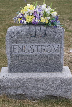
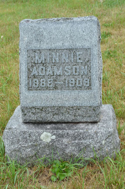
Children
Flowers:
Nearby Cemetories:
1. Hardin Township Cemetery
Hardin Township, Webster County, USA
Coordinate: 42.2411003, -93.9708023
2. Linn Cemetery
Pilot Mound, Boone County, USA
Coordinate: 42.2045330, -93.9970230
3. White Cemetery
Boone County, USA
Coordinate: 42.1777992, -93.9636002
4. Bass Cemetery
Dayton, Webster County, USA
Coordinate: 42.2966995, -94.0149994
5. Hooks Point Cemetery
Hamilton County, USA
Coordinate: 42.2944530, -93.9199090
6. Oakwood Cemetery
Stratford, Hamilton County, USA
Coordinate: 42.2942009, -93.9182968
7. Runyan Cemetery
Pilot Mound, Boone County, USA
Coordinate: 42.1749992, -94.0015030
8. South Marion Cemetery
Stratford, Hamilton County, USA
Coordinate: 42.2327995, -93.8735962
9. Mineral Ridge Cemetery
Ridgeport, Boone County, USA
Coordinate: 42.1749992, -93.9266968
10. Christ the King Catholic Cemetery
Dayton, Webster County, USA
Coordinate: 42.2601929, -94.0727539
11. Vegors Cemetery
Webster County, USA
Coordinate: 42.3177986, -93.9421997
12. Dayton Cemetery
Dayton, Webster County, USA
Coordinate: 42.2675000, -94.0755000
13. Pilot Mound Cemetery
Pilot Mound, Boone County, USA
Coordinate: 42.1636200, -94.0282600
14. Boone County Poor Farm Cemetery
Boone County, USA
Coordinate: 42.1591100, -93.9159000
15. Schlicht Cemetery
Fraser, Boone County, USA
Coordinate: 42.1444200, -93.9780100
16. McGuire Bend Cemetery
Dayton, Webster County, USA
Coordinate: 42.3410000, -93.9880000
17. Neese Cemetery
Homer, Hamilton County, USA
Coordinate: 42.3250000, -93.8935000
18. Nesse Cemetery
Hamilton County, USA
Coordinate: 42.3250008, -93.8933029
19. Swedish Lutheran Church Cemetery
Dayton, Webster County, USA
Coordinate: 42.2175000, -94.1065000
20. Lawn Cemetery
Boone County, USA
Coordinate: 42.1771011, -94.0867996
21. Oak Grove Cemetery
Lehigh, Webster County, USA
Coordinate: 42.3438988, -94.0475006
22. Hartman Cemetery
Lehigh, Webster County, USA
Coordinate: 42.3666397, -93.9835627
23. Union Cemetery
Boxholm, Boone County, USA
Coordinate: 42.1369019, -94.0852966
24. Hickory Grove Cemetery
Boone County, USA
Coordinate: 42.1074982, -93.9507980

