
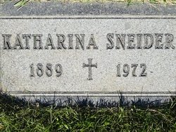
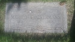
Katharina W. Koch Sneider
| Birth | : | 10 Apr 1889 Dixon County, Nebraska, USA |
| Death | : | 30 Jul 1972 Chester, Liberty County, Montana, USA |
| Burial | : | Highland Cemetery, Havre, Hill County, USA |
| Coordinate | : | 48.5463982, -109.6900024 |
| Plot | : | Space A Lot 48 Block 23 |
| Description | : | Liberty County Times, Chester, MT, 10 Aug 1972 Katharina W. Sneider Mrs, Katharina W. Sneider, 83, of Rudyard, died in Chester July 30, following several years of ill health. Born in Dixon County, Nebraska, April 10, 1889, she was raised and schooled in Concord, Neb. She came to the Rudyard area in 1916, and returned to Concord to marry William F. Sneider in February of 1917. The couple moved to Rudyard and homesteaded south of town. Her husband preceded her in death in 1952. Survivors include children, Minna Sneider of Concord, Neb., Norman Sneider of Rudyard, and Mrs.... Read More |
frequently asked questions (FAQ):
-
Where is Katharina W. Koch Sneider's memorial?
Katharina W. Koch Sneider's memorial is located at: Highland Cemetery, Havre, Hill County, USA.
-
When did Katharina W. Koch Sneider death?
Katharina W. Koch Sneider death on 30 Jul 1972 in Chester, Liberty County, Montana, USA
-
Where are the coordinates of the Katharina W. Koch Sneider's memorial?
Latitude: 48.5463982
Longitude: -109.6900024
Family Members:
Parent
Spouse
Siblings

Children

Flowers:


Nearby Cemetories:
1. Highland Cemetery
Havre, Hill County, USA
Coordinate: 48.5463982, -109.6900024
2. Calvary Cemetery
Havre, Hill County, USA
Coordinate: 48.5457000, -109.6883000
3. Mount Hope Cemetery
Havre, Hill County, USA
Coordinate: 48.5540000, -109.7050000
4. Sunset Garden Park
Havre, Hill County, USA
Coordinate: 48.5531006, -109.8019028
5. North Havre Lutheran Church Graveyard (Defunct)
Havre, Hill County, USA
Coordinate: 48.6538903, -109.6815870
6. Grainbelt Cemetery
Hill County, USA
Coordinate: 48.6828003, -109.8657990
7. Andrew S. Lohman Grave Site
Lohman, Blaine County, USA
Coordinate: 48.5903520, -109.4073350
8. East End Colony Cemetery
East End Colony, Hill County, USA
Coordinate: 48.7485000, -109.5474000
9. Hilldale Hutterite Colony Cemetery
Hilldale Colony, Hill County, USA
Coordinate: 48.7997000, -109.7872000
10. Saint Johns Catholic Cemetery
Havre, Hill County, USA
Coordinate: 48.7625008, -109.9638977
11. Saint Gabriel Cemetery
Chinook, Blaine County, USA
Coordinate: 48.6065200, -109.2531200
12. Kuper Memorial Cemetery
Chinook, Blaine County, USA
Coordinate: 48.6083100, -109.2531200
13. Rocky Boy Cemetery
Rocky Boy, Hill County, USA
Coordinate: 48.2572410, -109.7923690
14. Box Elder Cemetery
Box Elder, Hill County, USA
Coordinate: 48.3274000, -110.0095000
15. Rocky Boy Gravel Cemetery
Rocky Boy, Hill County, USA
Coordinate: 48.2427720, -109.7596500
16. Cottonwood Lutheran Church Cemetery
Havre, Hill County, USA
Coordinate: 48.4545000, -110.1748000
17. Bear Paw Battlefield
Chinook, Blaine County, USA
Coordinate: 48.3780070, -109.2121290
18. Hungry Hollow Cemetery
Blaine County, USA
Coordinate: 48.2103004, -109.4677963
19. Milk River Valley Church Graveyard
Hill County, USA
Coordinate: 48.6787180, -110.2261080
20. Hollandville Cemetery
Chinook, Blaine County, USA
Coordinate: 48.6960310, -109.1557200
21. Gildford Hill County Cemetery
Gildford, Hill County, USA
Coordinate: 48.5778008, -110.2957993
22. Prairie Chapel United Brethren Cemetery
Chinook, Blaine County, USA
Coordinate: 48.8860000, -109.3414000
23. Mennonite Brethren Cemetery
Chinook, Blaine County, USA
Coordinate: 48.8012560, -109.1980620
24. Bethel Bruderthaler Mennonite Church Cemetery
Chinook, Blaine County, USA
Coordinate: 48.7552000, -109.1345000