
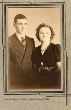

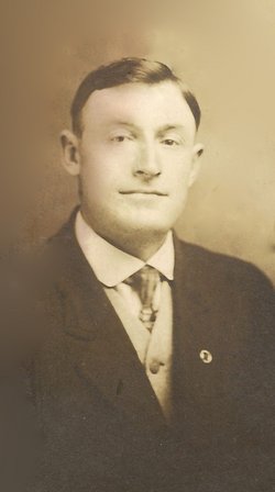
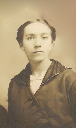
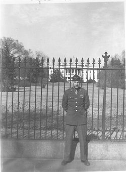
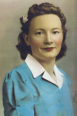
Katherine Van Dyke Stoner
| Birth | : | 18 Feb 1922 |
| Death | : | 1 Apr 2002 |
| Burial | : | St Thomas and the Holy Rood Churchyard, Melling, Metropolitan Borough of Sefton, England |
| Coordinate | : | 53.4954510, -2.9227850 |
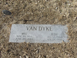
| Description | : | STONER -- Katherine, 80, Unadilla, died Monday (4/1/02) in Lincoln. Memorial service: 2 p.m. Friday, Unadilla Christian Church. David Pearson, officiating. Graveside service: 1 p.m. Friday, rural Unadilla Cemetery. Visitation: 9 a.m.-9 p.m. today; 9 a.m.-noon Friday, Fusselman-Wymore-Marshall Funeral Home, Syracuse. Casket closed at the graveside. |
frequently asked questions (FAQ):
-
Where is Katherine Van Dyke Stoner's memorial?
Katherine Van Dyke Stoner's memorial is located at: St Thomas and the Holy Rood Churchyard, Melling, Metropolitan Borough of Sefton, England.
-
When did Katherine Van Dyke Stoner death?
Katherine Van Dyke Stoner death on 1 Apr 2002 in
-
Where are the coordinates of the Katherine Van Dyke Stoner's memorial?
Latitude: 53.4954510
Longitude: -2.9227850
Family Members:
Parent
Spouse
Siblings

Children
Flowers:


Nearby Cemetories:
1. St Thomas and the Holy Rood Churchyard
Melling, Metropolitan Borough of Sefton, England
Coordinate: 53.4954510, -2.9227850
2. Melling Churchyard
Melling, Metropolitan Borough of Sefton, England
Coordinate: 53.4953370, -2.9228780
3. St. Andrew Churchyard
Maghull, Metropolitan Borough of Sefton, England
Coordinate: 53.5104770, -2.9428820
4. St. Chad Churchyard
Kirkby, Metropolitan Borough of Knowsley, England
Coordinate: 53.4842890, -2.8930700
5. Aintree Racecourse Grounds
Aintree Village, Metropolitan Borough of Sefton, England
Coordinate: 53.4733880, -2.9549700
6. Sefton Parish Churchyard
Sefton, Metropolitan Borough of Sefton, England
Coordinate: 53.5044060, -2.9712190
7. Kirkdale Cemetery
Liverpool, Metropolitan Borough of Liverpool, England
Coordinate: 53.4672530, -2.9479800
8. St Swithins Churchyard
Liverpool, Metropolitan Borough of Liverpool, England
Coordinate: 53.4585631, -2.9012280
9. Everton Cemetery
Everton, Metropolitan Borough of Liverpool, England
Coordinate: 53.4555430, -2.9442480
10. Long Lane Jewish Cemetery
Liverpool, Metropolitan Borough of Liverpool, England
Coordinate: 53.4550140, -2.9420480
11. Thornton Garden of Rest and Crematorium
Thornton, Metropolitan Borough of Sefton, England
Coordinate: 53.5001850, -2.9951960
12. Ford Cemetery
Ford, Metropolitan Borough of Sefton, England
Coordinate: 53.4824040, -2.9925980
13. West Derby Cemetery
West Derby, Metropolitan Borough of Liverpool, England
Coordinate: 53.4513790, -2.9154630
14. West Derby Jewish Cemetery
Liverpool, Metropolitan Borough of Liverpool, England
Coordinate: 53.4504986, -2.9137393
15. Saint Michael's Churchyard
Aughton, West Lancashire District, England
Coordinate: 53.5419170, -2.9197240
16. Bootle Cemetery
Bootle, Metropolitan Borough of Sefton, England
Coordinate: 53.4627680, -2.9787450
17. St Catherine Churchyard
Lydiate, Metropolitan Borough of Sefton, England
Coordinate: 53.5368000, -2.9612660
18. Walton Park Cemetery
Walton, Metropolitan Borough of Liverpool, England
Coordinate: 53.4564370, -2.9695960
19. Rice Lane Jewish Cemetery
Walton, Metropolitan Borough of Liverpool, England
Coordinate: 53.4521700, -2.9590600
20. Friends Burial Ground
Bickerstaffe, West Lancashire District, England
Coordinate: 53.5347720, -2.8748780
21. Our Lady's Roman Catholic Churchyard
Lydiate, Metropolitan Borough of Sefton, England
Coordinate: 53.5396850, -2.9599940
22. St Thomas Churchyard
Lydiate, Metropolitan Borough of Sefton, England
Coordinate: 53.5443480, -2.9621640
23. St Mary the Virgin Churchyard
Walton, Metropolitan Borough of Liverpool, England
Coordinate: 53.4464930, -2.9673330
24. St. Mary's Churchyard
Knowsley, Metropolitan Borough of Knowsley, England
Coordinate: 53.4561960, -2.8528580