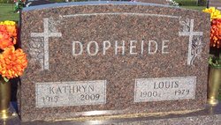
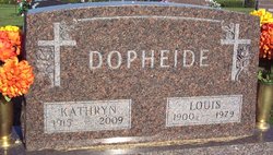
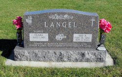
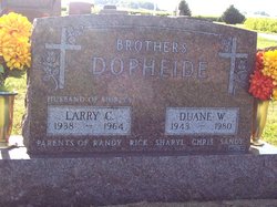
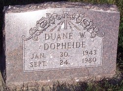
Kathryn Beata Langel Dopheide
| Birth | : | 17 Nov 1915 Carroll County, Iowa, USA |
| Death | : | 21 Jul 2009 Carroll, Carroll County, Iowa, USA |
| Burial | : | Frankeberger Cemetery, Ellsworth, McLean County, USA |
| Coordinate | : | 40.4239006, -88.7328033 |
| Description | : | July 23 2009 - Kathryn Beata Dopheide, 93, of Carroll died Tuesday, July 21, 2009, at Carroll Health Center. Mass of the Christian burial for Mrs. Dopheide, formerly of Templeton, will be at 10:30 a.m. Saturday, July 25, at Sacred Heart Catholic Church in Templeton with the Rev. Dale Reiff presiding. Lector will be Allen Weber. Gift bearers will be Sandy Umbarger, Deb Anthofer and Roxanne Wittrock. Eucharistic minister will be Randy Dopheide. Servers will be Daniel Umbarger and Cody Williams. Music will be by organist Jeanne Kerkhoff and the Sacred Heart Men's Choir. Casket bearers will be Tyler Dopheide,... Read More |
frequently asked questions (FAQ):
-
Where is Kathryn Beata Langel Dopheide's memorial?
Kathryn Beata Langel Dopheide's memorial is located at: Frankeberger Cemetery, Ellsworth, McLean County, USA.
-
When did Kathryn Beata Langel Dopheide death?
Kathryn Beata Langel Dopheide death on 21 Jul 2009 in Carroll, Carroll County, Iowa, USA
-
Where are the coordinates of the Kathryn Beata Langel Dopheide's memorial?
Latitude: 40.4239006
Longitude: -88.7328033
Family Members:
Parent
Spouse
Siblings
Children
Flowers:
Nearby Cemetories:
1. Frankeberger Cemetery
Ellsworth, McLean County, USA
Coordinate: 40.4239006, -88.7328033
2. Dawson Cemetery
Ellsworth, McLean County, USA
Coordinate: 40.4197006, -88.7117004
3. Barnes Cemetery
Ellsworth, McLean County, USA
Coordinate: 40.4081001, -88.6931000
4. Arrowsmith Township Cemetery
Arrowsmith, McLean County, USA
Coordinate: 40.4282990, -88.6658020
5. United Brethren Cemetery
Ellsworth, McLean County, USA
Coordinate: 40.4710780, -88.6884640
6. Lebo Cemetery
Downs, McLean County, USA
Coordinate: 40.4075012, -88.8091660
7. Hoover Cemetery
McLean County, USA
Coordinate: 40.4485470, -88.8090560
8. Love Cemetery
Sabina, McLean County, USA
Coordinate: 40.3918000, -88.6563200
9. Creel Cemetery
McLean County, USA
Coordinate: 40.4223180, -88.8213300
10. Friends Cemetery
Bentown, McLean County, USA
Coordinate: 40.4761086, -88.8050003
11. Payne Cemetery
Arrowsmith, McLean County, USA
Coordinate: 40.4418983, -88.6306000
12. Garr Cemetery
Downs, McLean County, USA
Coordinate: 40.4008500, -88.8344190
13. Blue Mound Cemetery
Cooksville, McLean County, USA
Coordinate: 40.5046997, -88.7288971
14. Oak Grove Cemetery
Le Roy, McLean County, USA
Coordinate: 40.3391991, -88.7358017
15. Howard Cemetery
Le Roy, McLean County, USA
Coordinate: 40.3384514, -88.7318115
16. Pleasant Grove Cemetery
Downs, McLean County, USA
Coordinate: 40.4285202, -88.8456802
17. Gilmore Cemetery
Le Roy, McLean County, USA
Coordinate: 40.3403460, -88.7923840
18. Holy Cross Cemetery
Merna, McLean County, USA
Coordinate: 40.5163002, -88.8058014
19. Hopewell Cemetery
Downs, McLean County, USA
Coordinate: 40.3996240, -88.8712190
20. Rutledge Cemetery
Le Roy, McLean County, USA
Coordinate: 40.3414993, -88.8386002
21. Barnett Farm Cemetery
McLean County, USA
Coordinate: 40.3995100, -88.8926120
22. Greenwood Cemetery
Arrowsmith, McLean County, USA
Coordinate: 40.4561005, -88.5753021
23. Deffenbaugh Family Cemetery
Le Roy, McLean County, USA
Coordinate: 40.3017502, -88.7753067
24. Plymouth Cemetery
Arrowsmith, McLean County, USA
Coordinate: 40.5003014, -88.5988998

