
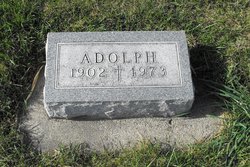

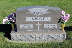
Adolph Langel
| Birth | : | 5 Apr 1902 |
| Death | : | 23 Sep 1973 |
| Burial | : | Fortune-Kuykendall Cemetery, Zirconia, Henderson County, USA |
| Coordinate | : | 35.2424000, -82.4032000 |
| Description | : | Adolph Langel Templeton - Adolph Langel, 71, lifelong resident of Templeton, died unexpectedly Saturday afternoon, Sept. 29, at Nebraska Methodist Hospital in Omaha. He had been in ill health for several years. Requiem mass will be celebrated at 11 a.m. Tuesday at Sacred Heart Church here by the Rev. Eugene T. Schumacher. Burial will be in the parish cemetery. Friends may call at the Ohde Funeral Home in Manning, where there will be a scripture service at 8 p.m. Monday, followed by a Knights of Columbus rosary recitation at 8:45. Mr. Langel was a retired farmer.... Read More |
frequently asked questions (FAQ):
-
Where is Adolph Langel's memorial?
Adolph Langel's memorial is located at: Fortune-Kuykendall Cemetery, Zirconia, Henderson County, USA.
-
When did Adolph Langel death?
Adolph Langel death on 23 Sep 1973 in
-
Where are the coordinates of the Adolph Langel's memorial?
Latitude: 35.2424000
Longitude: -82.4032000
Family Members:
Parent

Spouse
Siblings

Children
Flowers:


Nearby Cemetories:
1. Fortune-Kuykendall Cemetery
Zirconia, Henderson County, USA
Coordinate: 35.2424000, -82.4032000
2. Ward Family Cemetery
Henderson County, USA
Coordinate: 35.2308780, -82.4049850
3. Crossroads Baptist Church Cemetery
Zirconia, Henderson County, USA
Coordinate: 35.2287090, -82.4154320
4. Mountain View Baptist Church Cemetery
Tuxedo, Henderson County, USA
Coordinate: 35.2325000, -82.4285000
5. Anders Cemetery
East Flat Rock, Henderson County, USA
Coordinate: 35.2654700, -82.4064300
6. Tuxedo First Baptist Church Cemetery
Zirconia, Henderson County, USA
Coordinate: 35.2299000, -82.4285000
7. Oak Grove Baptist Church Cemetery
East Flat Rock, Henderson County, USA
Coordinate: 35.2729000, -82.4031580
8. Bell Family Cemetery
Tuxedo, Henderson County, USA
Coordinate: 35.2158970, -82.4247920
9. Grace Missionary Baptist Church Cemetery
Mountain Page, Henderson County, USA
Coordinate: 35.2176960, -82.3746780
10. Freeman-Murray Cemetery
Tuxedo, Henderson County, USA
Coordinate: 35.2185860, -82.4416270
11. Old Mountain Page Baptist Cemetery
Mountain Page, Henderson County, USA
Coordinate: 35.2190300, -82.3607200
12. Saluda City Cemetery
Saluda, Polk County, USA
Coordinate: 35.2438600, -82.3505400
13. Mountain Page Baptist Church Cemetery
Mountain Page, Henderson County, USA
Coordinate: 35.2097000, -82.3683400
14. Gilbert-Justus Family Cemetery
Upward, Henderson County, USA
Coordinate: 35.2861000, -82.3894380
15. Oakland Cemetery
East Flat Rock, Henderson County, USA
Coordinate: 35.2835999, -82.4302979
16. Hill Mausoleum
Flat Rock, Henderson County, USA
Coordinate: 35.2630638, -82.4577080
17. Pinecrest Presbyterian Church Memorial Garden
Flat Rock, Henderson County, USA
Coordinate: 35.2822100, -82.4426360
18. Andrews Cemetery
Henderson County, USA
Coordinate: 35.2089005, -82.4507980
19. Saint John In the Wilderness Cemetery
Flat Rock, Henderson County, USA
Coordinate: 35.2821170, -82.4435670
20. Davis Family Cemetery
Henderson County, USA
Coordinate: 35.1979750, -82.4363250
21. Pace Cemetery
Henderson County, USA
Coordinate: 35.2131004, -82.4625015
22. Mount Olivet Baptist Church Cemetery
Zirconia, Henderson County, USA
Coordinate: 35.2366900, -82.4749000
23. Jones Family Cemetery at Upward
Upward, Henderson County, USA
Coordinate: 35.3022003, -82.3855972
24. Double Springs Cemetery
Zirconia, Henderson County, USA
Coordinate: 35.1838989, -82.4289017