
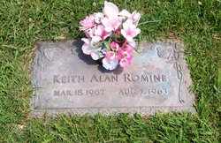
Keith Alan Romine
| Birth | : | 18 Mar 1962 Chanute, Neosho County, Kansas, USA |
| Death | : | 7 Aug 1963 Saint Joseph, Buchanan County, Missouri, USA |
| Burial | : | Saint Matthews Episcopal Church Cemetery, New Guilford, Coshocton County, USA |
| Coordinate | : | 40.2964170, -82.1820690 |
| Plot | : | 37.66092 -95.47492 |
frequently asked questions (FAQ):
-
Where is Keith Alan Romine's memorial?
Keith Alan Romine's memorial is located at: Saint Matthews Episcopal Church Cemetery, New Guilford, Coshocton County, USA.
-
When did Keith Alan Romine death?
Keith Alan Romine death on 7 Aug 1963 in Saint Joseph, Buchanan County, Missouri, USA
-
Where are the coordinates of the Keith Alan Romine's memorial?
Latitude: 40.2964170
Longitude: -82.1820690
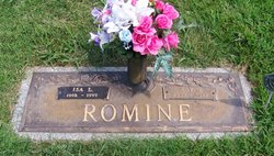
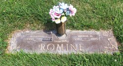
Family Members:
Parent
Flowers:


Nearby Cemetories:
1. Saint Matthews Episcopal Church Cemetery
New Guilford, Coshocton County, USA
Coordinate: 40.2964170, -82.1820690
2. Scott Cemetery
Walhonding, Coshocton County, USA
Coordinate: 40.2964569, -82.1829250
3. New Guilford Cemetery
Coshocton County, USA
Coordinate: 40.2896996, -82.1699982
4. Mount Airy Cemetery
Coshocton County, USA
Coordinate: 40.3107310, -82.1854160
5. Stricker Cemetery
Bladensburg, Knox County, USA
Coordinate: 40.2978800, -82.2227900
6. Giffen Cemetery
Coshocton County, USA
Coordinate: 40.3339005, -82.1769028
7. Newcastle Cemetery
Newcastle, Coshocton County, USA
Coordinate: 40.3333015, -82.1707993
8. Rine Family Cemetery
Jackson Township, Knox County, USA
Coordinate: 40.2728050, -82.2224780
9. Dennis Cemetery
Knox County, USA
Coordinate: 40.3055200, -82.2334200
10. Winding Fork Evangelical Lutheran Church Cemetery
Coshocton County, USA
Coordinate: 40.2589240, -82.1589090
11. Butler Baptist Cemetery
Knox County, USA
Coordinate: 40.3334800, -82.2106200
12. Wilson Chapel Cemetery
Nellie, Coshocton County, USA
Coordinate: 40.3017690, -82.1207660
13. Perry Chapel Baptist Cemetery
West Carlisle, Coshocton County, USA
Coordinate: 40.2470200, -82.1899500
14. Christian Church Cemetery
Warsaw, Coshocton County, USA
Coordinate: 40.3250000, -82.1230000
15. Goshen Cemetery
Warsaw, Coshocton County, USA
Coordinate: 40.2728004, -82.1193008
16. Mohawk Baptist Church Cemetery
Nellie, Coshocton County, USA
Coordinate: 40.2941380, -82.1107120
17. Eli Nichols Family Cemetery
Walhonding, Coshocton County, USA
Coordinate: 40.3549160, -82.1847690
18. VanWinkle Cemetery
Licking County, USA
Coordinate: 40.2329140, -82.1921640
19. Kemmerer Cemetery
Knox County, USA
Coordinate: 40.3232994, -82.2596970
20. Mount Zion Cemetery
Bladensburg, Knox County, USA
Coordinate: 40.2543800, -82.2475300
21. Mikesell Cemetery
West Bedford, Coshocton County, USA
Coordinate: 40.2882500, -82.0963240
22. Wilson Cemetery
Frampton, Licking County, USA
Coordinate: 40.2262390, -82.2059550
23. Walhonding Cemetery
Walhonding, Coshocton County, USA
Coordinate: 40.3627800, -82.1411700
24. Bladensburg Cemetery
Bladensburg, Knox County, USA
Coordinate: 40.2848500, -82.2774600