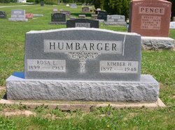
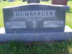
Kimber Herman Humbarger
| Birth | : | 23 Feb 1897 Whitley County, Indiana, USA |
| Death | : | 15 Dec 1948 Van Buren, Grant County, Indiana, USA |
| Burial | : | St. Mary's Churchyard, Mellor, Ribble Valley Borough, England |
| Coordinate | : | 53.7728600, -2.5312400 |
| Description | : | OBITUARY in the Columbia City Post dated 12/16/1948 (Note the misspelling of Kimber's first name but this is the correct obituary.) DEATH OF T. HUMBARGER IS SUDDEN DEATH OCCURS AT SANITORIUM AT VEN BUREN WHERE HE HAD DELIVERED A VAULT Timber (sic) Humbarger, 52 years old, a resident of Thorncreek township until nine years ago when he became owner of the Valut Works at Marion, died at 3:30 p.m. Wednesday. Mr. Humbarger had been ill with a heart condition for some time but was still in charge of his business and had made the delivery of a vault to the sanitorium at... Read More |
frequently asked questions (FAQ):
-
Where is Kimber Herman Humbarger's memorial?
Kimber Herman Humbarger's memorial is located at: St. Mary's Churchyard, Mellor, Ribble Valley Borough, England.
-
When did Kimber Herman Humbarger death?
Kimber Herman Humbarger death on 15 Dec 1948 in Van Buren, Grant County, Indiana, USA
-
Where are the coordinates of the Kimber Herman Humbarger's memorial?
Latitude: 53.7728600
Longitude: -2.5312400
Family Members:
Parent
Spouse
Flowers:
Nearby Cemetories:
1. St. Mary's Churchyard
Mellor, Ribble Valley Borough, England
Coordinate: 53.7728600, -2.5312400
2. Mellor Methodist Churchyard
Blackburn, Blackburn with Darwen Unitary Authority, England
Coordinate: 53.7742950, -2.5255060
3. St Mary's R.C. Church Cemetery
Osbaldeston, Ribble Valley Borough, England
Coordinate: 53.7816970, -2.5350240
4. St Leonard Churchyard
Balderstone, Ribble Valley Borough, England
Coordinate: 53.7860070, -2.5609380
5. St Peter Churchyard
Salesbury, Ribble Valley Borough, England
Coordinate: 53.7915000, -2.4859100
6. Pleasington Cemetery and Crematorium
Blackburn, Blackburn with Darwen Unitary Authority, England
Coordinate: 53.7388880, -2.5368710
7. St Paul's
Blackburn, Blackburn with Darwen Unitary Authority, England
Coordinate: 53.7491222, -2.4891266
8. Blackburn Cemetery
Blackburn, Blackburn with Darwen Unitary Authority, England
Coordinate: 53.7662430, -2.4726050
9. St Wilfrid Churchyard
Ribchester, Ribble Valley Borough, England
Coordinate: 53.8102780, -2.5332650
10. Wesleyan Methodist Chapel Chapelyard
Blackburn, Blackburn with Darwen Unitary Authority, England
Coordinate: 53.7464910, -2.4848380
11. Independent Chapel Churchyard
Blackburn, Blackburn with Darwen Unitary Authority, England
Coordinate: 53.7454960, -2.4864460
12. St. Peter's Churchyard
Blackburn, Blackburn with Darwen Unitary Authority, England
Coordinate: 53.7448110, -2.4865070
13. Pleasington Priory
Pleasington, Blackburn with Darwen Unitary Authority, England
Coordinate: 53.7348590, -2.5433060
14. Blackburn Cathedral
Blackburn, Blackburn with Darwen Unitary Authority, England
Coordinate: 53.7472960, -2.4820020
15. St Alban's Churchyard
Blackburn, Blackburn with Darwen Unitary Authority, England
Coordinate: 53.7530090, -2.4748540
16. Holy Trinity Church
Blackburn with Darwen Unitary Authority, England
Coordinate: 53.7511727, -2.4747178
17. Mount St Presbyterian Chapelyard
Blackburn, Blackburn with Darwen Unitary Authority, England
Coordinate: 53.7478000, -2.4775000
18. The Church of St. Saviour The Holy House of Stydd
Ribchester, Ribble Valley Borough, England
Coordinate: 53.8188690, -2.5272770
19. St. Josephs Roman Catholic Churchyard
Brindle, Chorley Borough, England
Coordinate: 53.7350780, -2.5880640
20. St. Mary's and St. John RC Churchyard, Southworth
Samlesbury, South Ribble Borough, England
Coordinate: 53.7676690, -2.6183400
21. New Row Methodist Church
Blackburn with Darwen Unitary Authority, England
Coordinate: 53.7208950, -2.5023720
22. St. Leonard the Less Churchyard
Samlesbury, South Ribble Borough, England
Coordinate: 53.7680000, -2.6237000
23. Holy Trinity Churchyard
Hoghton, Chorley Borough, England
Coordinate: 53.7279300, -2.5848550
24. Our Lady and St. Michael Roman Catholic Churchyard
Longridge, Ribble Valley Borough, England
Coordinate: 53.8088040, -2.6133470


