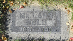
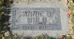
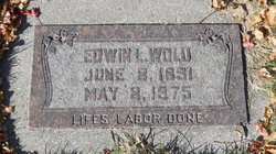
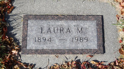
Lars Wold
| Birth | : | 16 Feb 1853 |
| Death | : | 29 Nov 1936 Richland County, North Dakota, USA |
| Burial | : | St Audry's Hospital Chapel Burial Grounds, Melton, Suffolk Coastal District, England |
| Coordinate | : | 52.1169050, 1.3321920 |
frequently asked questions (FAQ):
-
Where is Lars Wold's memorial?
Lars Wold's memorial is located at: St Audry's Hospital Chapel Burial Grounds, Melton, Suffolk Coastal District, England.
-
When did Lars Wold death?
Lars Wold death on 29 Nov 1936 in Richland County, North Dakota, USA
-
Where are the coordinates of the Lars Wold's memorial?
Latitude: 52.1169050
Longitude: 1.3321920
Family Members:
Spouse
Children
Flowers:
Nearby Cemetories:
1. St Audry's Hospital Chapel Burial Grounds
Melton, Suffolk Coastal District, England
Coordinate: 52.1169050, 1.3321920
2. St Andrew the Apostle Churchyard
Melton, Suffolk Coastal District, England
Coordinate: 52.1065910, 1.3336210
3. Melton Old Churchyard
Melton, Suffolk Coastal District, England
Coordinate: 52.1125150, 1.3505240
4. St Andrew's Churchyard
Bredfield, Suffolk Coastal District, England
Coordinate: 52.1288710, 1.3129440
5. St Edmund's Churchyard
Bromeswell, Suffolk Coastal District, England
Coordinate: 52.1064300, 1.3617740
6. St Michael Churchyard
Boulge, Suffolk Coastal District, England
Coordinate: 52.1280920, 1.2918290
7. St. Peter and St. Paul Churchyard
Pettistree, Suffolk Coastal District, England
Coordinate: 52.1410880, 1.3525270
8. St Andrew Churchyard
Hasketon, Suffolk Coastal District, England
Coordinate: 52.1063910, 1.2845520
9. All Saints Church Burial Ground
Eyke, Suffolk Coastal District, England
Coordinate: 52.1156810, 1.3832240
10. Saint Mary Churchyard
Dallinghoo, Suffolk Coastal District, England
Coordinate: 52.1465220, 1.3109100
11. St Gregory the Great Churchyard
Rendlesham, Suffolk Coastal District, England
Coordinate: 52.1247080, 1.3952270
12. Campsey Priory
Campsey Ash, Suffolk Coastal District, England
Coordinate: 52.1396150, 1.3866000
13. All Saints Church Cemetery
Debach, Suffolk Coastal District, England
Coordinate: 52.1421030, 1.2760230
14. Charsfield Baptist Church
Charsfield, Suffolk Coastal District, England
Coordinate: 52.1590750, 1.3005590
15. St. Mary's Churchyard
Martlesham, Suffolk Coastal District, England
Coordinate: 52.0742350, 1.3000490
16. St Peter Churchyard
Charsfield, Suffolk Coastal District, England
Coordinate: 52.1614360, 1.2945540
17. Baptist Chapelyard
Grundisburgh, Suffolk Coastal District, England
Coordinate: 52.1058380, 1.2499810
18. All Saints Churchyard
Sutton, Suffolk Coastal District, England
Coordinate: 52.0682690, 1.3636990
19. St Botolph Churchyard
Burgh, Suffolk Coastal District, England
Coordinate: 52.1239800, 1.2470740
20. St. Mary's Churchyard
Great Bealings, Suffolk Coastal District, England
Coordinate: 52.0930240, 1.2554220
21. St Mary the Virgin
Grundisburgh, Suffolk Coastal District, England
Coordinate: 52.1130840, 1.2460330
22. St Mary Churchyard
Clopton, Suffolk Coastal District, England
Coordinate: 52.1269860, 1.2431221
23. St John the Baptist Churchyard
Campsey Ash, Suffolk Coastal District, England
Coordinate: 52.1520000, 1.4040000
24. All Saints Churchyard
Little Bealings, Suffolk Coastal District, England
Coordinate: 52.0854520, 1.2525230

