

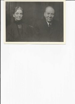
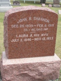
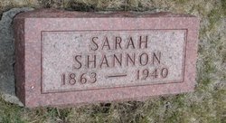
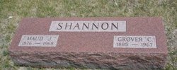
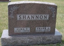
Laura Amanda Rafter Shannon
| Birth | : | 2 Jul 1846 |
| Death | : | 12 Nov 1923 |
| Burial | : | St Cecilia Churchyard, Little Hadham, East Hertfordshire District, England |
| Coordinate | : | 51.8847860, 0.0997890 |
| Inscription | : | wife of John B |
frequently asked questions (FAQ):
-
Where is Laura Amanda Rafter Shannon's memorial?
Laura Amanda Rafter Shannon's memorial is located at: St Cecilia Churchyard, Little Hadham, East Hertfordshire District, England.
-
When did Laura Amanda Rafter Shannon death?
Laura Amanda Rafter Shannon death on 12 Nov 1923 in
-
Where are the coordinates of the Laura Amanda Rafter Shannon's memorial?
Latitude: 51.8847860
Longitude: 0.0997890
Family Members:
Parent

Spouse
Siblings
Children


Nearby Cemetories:
1. St Cecilia Churchyard
Little Hadham, East Hertfordshire District, England
Coordinate: 51.8847860, 0.0997890
2. St Mary's Churchyard
Albury, East Hertfordshire District, England
Coordinate: 51.9026500, 0.0852920
3. St Andrew & Holy Cross Churchyard
Much Hadham, East Hertfordshire District, England
Coordinate: 51.8573180, 0.0754260
4. St. Mary the Virgin Churchyard
Farnham, Uttlesford District, England
Coordinate: 51.9020340, 0.1517660
5. St Michael Churchyard
Bishops Stortford, East Hertfordshire District, England
Coordinate: 51.8707970, 0.1574420
6. Bishop's Stortford New Cemetery
Bishops Stortford, East Hertfordshire District, England
Coordinate: 51.8640900, 0.1545490
7. St. Thomas' Churchyard
Perry Green, East Hertfordshire District, England
Coordinate: 51.8419070, 0.0835140
8. St James The Great Churchyard
Thorley, East Hertfordshire District, England
Coordinate: 51.8486900, 0.1411600
9. St. Mary's Churchyard
Standon, East Hertfordshire District, England
Coordinate: 51.8813515, 0.0273820
10. St Mary the Virgin Churchyard
Furneux Pelham, East Hertfordshire District, England
Coordinate: 51.9316710, 0.0808950
11. St Mary the Virgin Churchyard
Braughing, East Hertfordshire District, England
Coordinate: 51.9078420, 0.0282310
12. St Mary the Virgin Churchyard
Birchanger, Uttlesford District, England
Coordinate: 51.8831930, 0.1885850
13. Puckeridge Chapel
Northchurch, Dacorum Borough, England
Coordinate: 51.8890720, 0.0106480
14. St Giles Churchyard
Great Hallingbury, Uttlesford District, England
Coordinate: 51.8546820, 0.1932020
15. St. Mary the Virgin Churchyard
Stansted Mountfitchet, Uttlesford District, England
Coordinate: 51.8953440, 0.2091880
16. St Edmund of Canterbury and the English Martyrs
Old Hall Green, East Hertfordshire District, England
Coordinate: 51.8799220, -0.0110510
17. St. John the Baptist Churchyard
Widford, East Hertfordshire District, England
Coordinate: 51.8228370, 0.0491000
18. St Mary Churchyard
Little Hallingbury, Uttlesford District, England
Coordinate: 51.8354480, 0.1801370
19. Little Hormead St Mary Churchyard
Hormead, East Hertfordshire District, England
Coordinate: 51.9428430, 0.0331630
20. Great Hormead St Nicholas Churchyard
Hormead, East Hertfordshire District, England
Coordinate: 51.9469500, 0.0353300
21. Saint James the Great Churchyard
Sawbridgeworth, East Hertfordshire District, England
Coordinate: 51.8066600, 0.1213100
22. St. Mary the Virgin-Westmill
St Albans, St Albans District, England
Coordinate: 51.9262000, -0.0098000
23. Great St. Mary Churchyard
Sawbridgeworth, East Hertfordshire District, England
Coordinate: 51.8123290, 0.1527570
24. Holy Trinity Churchyard
Wareside, East Hertfordshire District, England
Coordinate: 51.8212430, 0.0221440