
| Memorials | : | 22 |
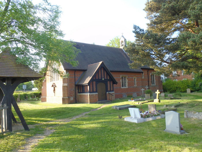
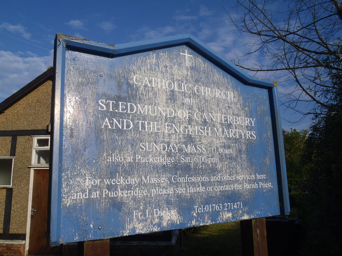
| Location | : | Old Hall Green, East Hertfordshire District, England |
| Coordinate | : | 51.8799220, -0.0110510 |
frequently asked questions (FAQ):
-
Where is St Edmund of Canterbury and the English Martyrs?
St Edmund of Canterbury and the English Martyrs is located at Farm Lane Old Hall Green, East Hertfordshire District ,Hertfordshire ,England.
-
St Edmund of Canterbury and the English Martyrs cemetery's updated grave count on graveviews.com?
1 memorials
-
Where are the coordinates of the St Edmund of Canterbury and the English Martyrs?
Latitude: 51.8799220
Longitude: -0.0110510
Nearby Cemetories:
1. Puckeridge Chapel
Northchurch, Dacorum Borough, England
Coordinate: 51.8890720, 0.0106480
2. St. Nicholas' Churchyard
Great Munden, East Hertfordshire District, England
Coordinate: 51.8996010, -0.0316180
3. St. Mary's Churchyard
Standon, East Hertfordshire District, England
Coordinate: 51.8813515, 0.0273820
4. St John the Evangelist Churchyard
High Cross, East Hertfordshire District, England
Coordinate: 51.8500010, -0.0213550
5. All Saints Churchyard
Little Munden, East Hertfordshire District, England
Coordinate: 51.8795770, -0.0625920
6. St Mary the Virgin Churchyard
Braughing, East Hertfordshire District, England
Coordinate: 51.9078420, 0.0282310
7. Thundridge Old Churchyard
Thundridge, East Hertfordshire District, England
Coordinate: 51.8378330, -0.0156530
8. St. Mary Parish Churchyard
Thundridge, East Hertfordshire District, England
Coordinate: 51.8366590, -0.0291820
9. St. Mary the Virgin-Westmill
St Albans, St Albans District, England
Coordinate: 51.9262000, -0.0098000
10. St Andrew & Holy Cross Churchyard
Much Hadham, East Hertfordshire District, England
Coordinate: 51.8573180, 0.0754260
11. Holy Trinity Churchyard
Wareside, East Hertfordshire District, England
Coordinate: 51.8212430, 0.0221440
12. St Mary's Churchyard
Albury, East Hertfordshire District, England
Coordinate: 51.9026500, 0.0852920
13. Ware Cemetery New
Ware, East Hertfordshire District, England
Coordinate: 51.8181400, -0.0438590
14. Ware Cemetery Old
Ware, East Hertfordshire District, England
Coordinate: 51.8170650, -0.0433230
15. Ss Mary and Andrew Churchyard
Watton-at-Stone, East Hertfordshire District, England
Coordinate: 51.8533290, -0.1102500
16. St Peter Churchyard
Benington, East Hertfordshire District, England
Coordinate: 51.8956030, -0.1167310
17. St. John the Baptist Churchyard
Widford, East Hertfordshire District, England
Coordinate: 51.8228370, 0.0491000
18. Little Hormead St Mary Churchyard
Hormead, East Hertfordshire District, England
Coordinate: 51.9428430, 0.0331630
19. St Cecilia Churchyard
Little Hadham, East Hertfordshire District, England
Coordinate: 51.8847860, 0.0997890
20. Saint Mary's Churchyard
Ware, East Hertfordshire District, England
Coordinate: 51.8120500, -0.0331800
21. St. Thomas' Churchyard
Perry Green, East Hertfordshire District, England
Coordinate: 51.8419070, 0.0835140
22. St Mary the Virgin Churchyard
Stapleford, East Hertfordshire District, England
Coordinate: 51.8349710, -0.0973140
23. St Lawrence Churchyard
Ardeley, East Hertfordshire District, England
Coordinate: 51.9274000, -0.0989000
24. Hare Street Benson Grounds
Buntingford, East Hertfordshire District, England
Coordinate: 51.9492640, 0.0221120