
| Memorials | : | 1 |
| Location | : | Braughing, East Hertfordshire District, England |
| Coordinate | : | 51.9078420, 0.0282310 |
| Description | : | Braughing is a village and civil parish, between the rivers Quin and Rib, in the non-metropolitan district of East Hertfordshire, part of the English county of Hertfordshire, England. |
frequently asked questions (FAQ):
-
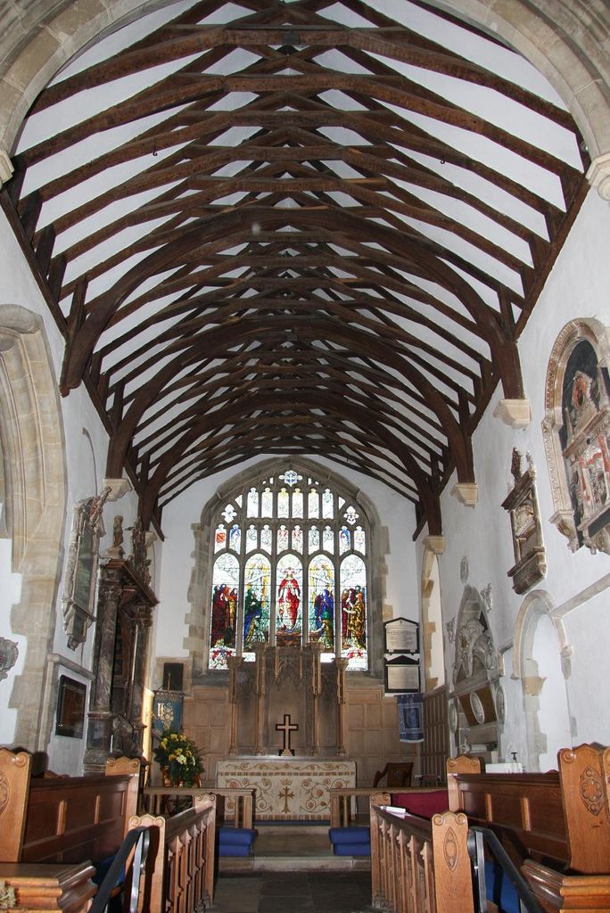
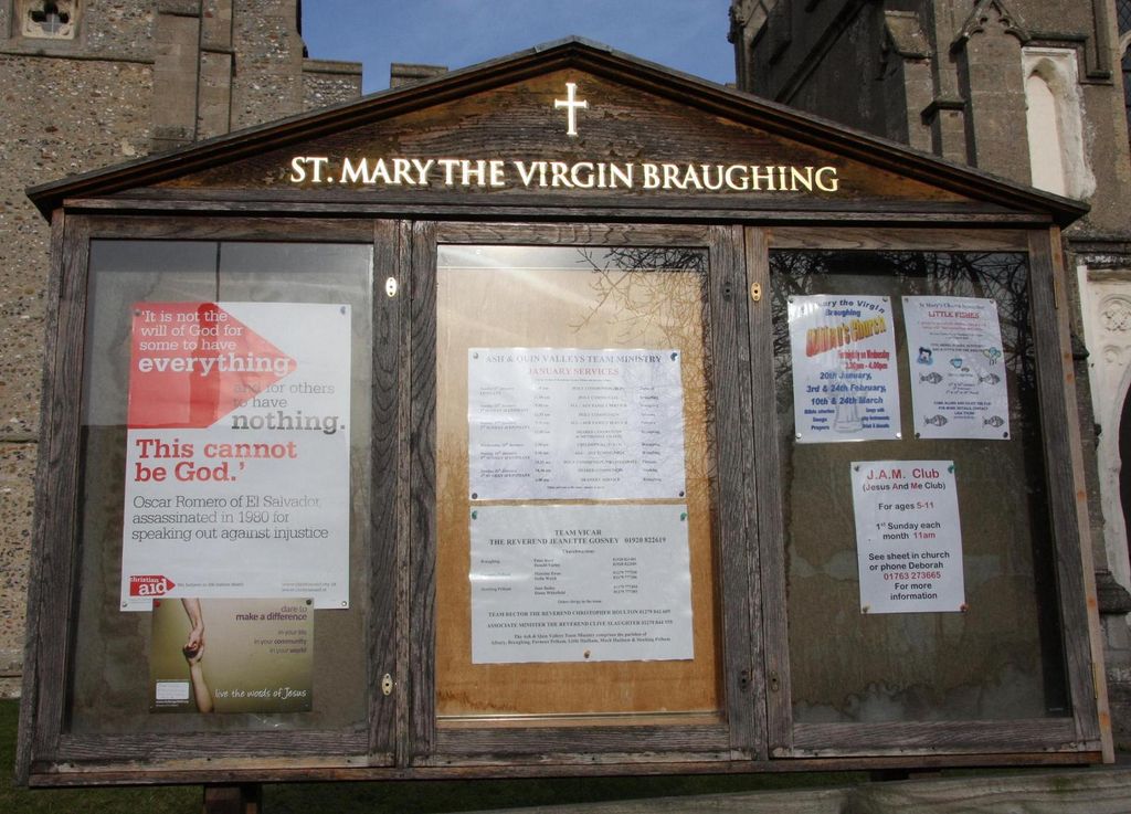
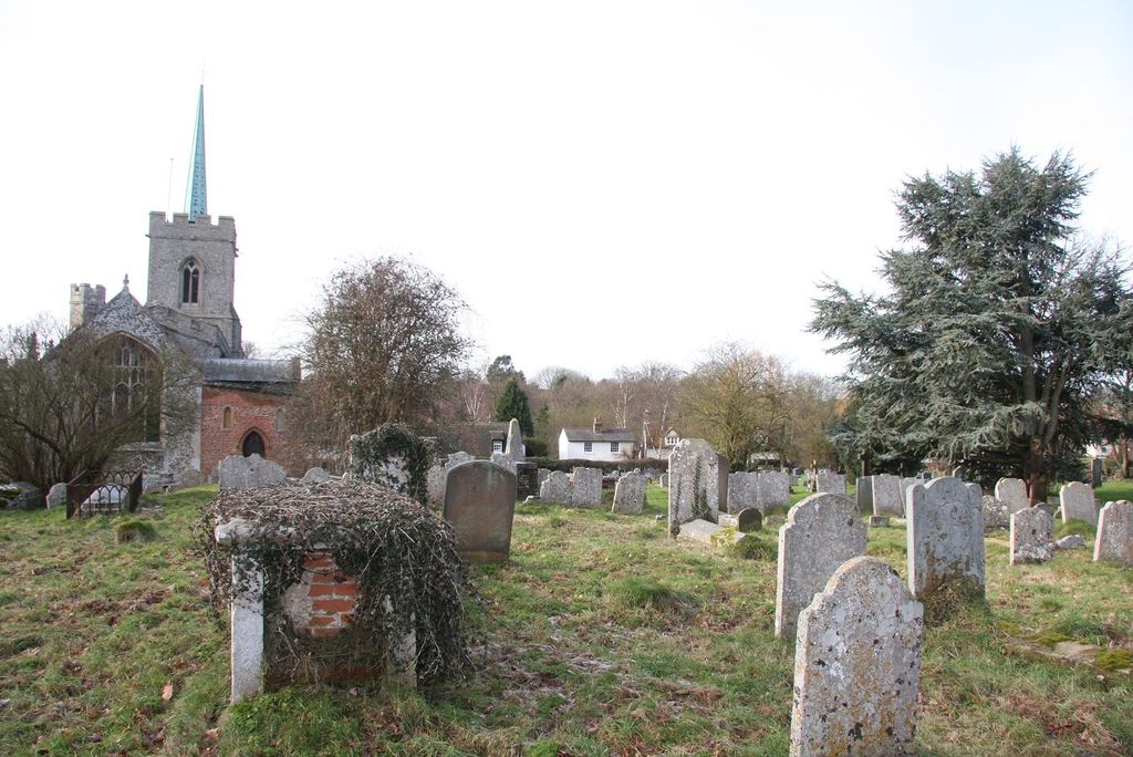
Where is St Mary the Virgin Churchyard?
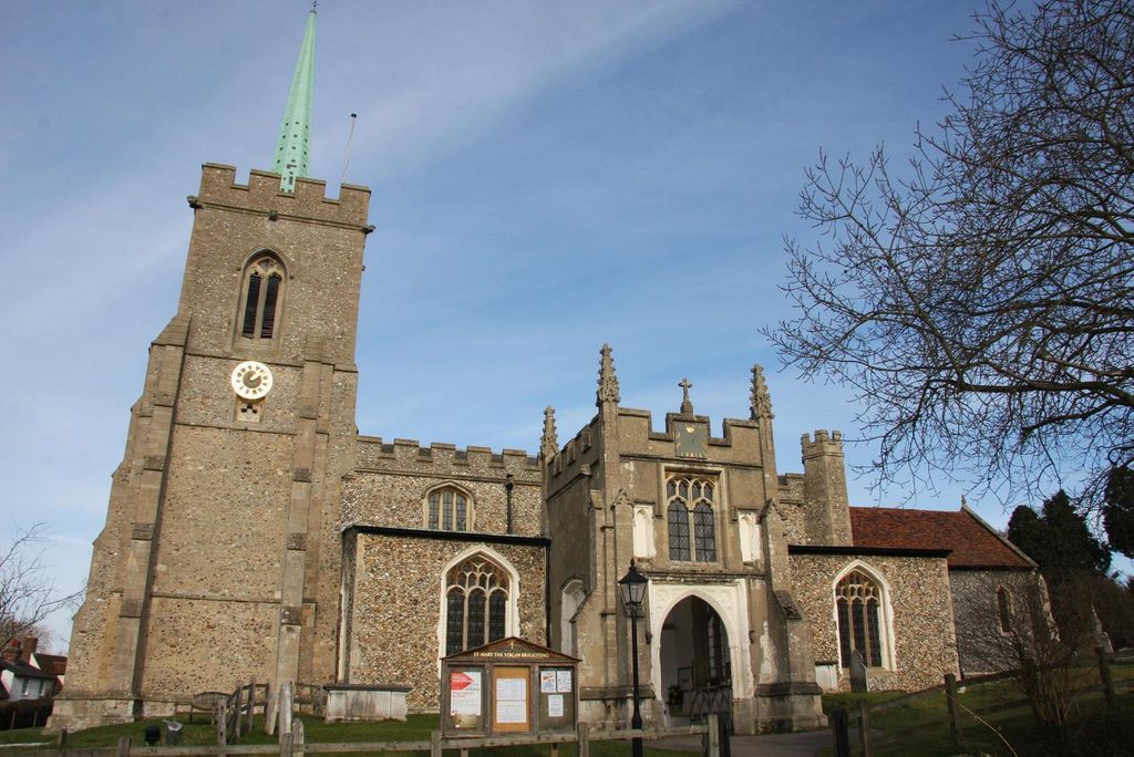
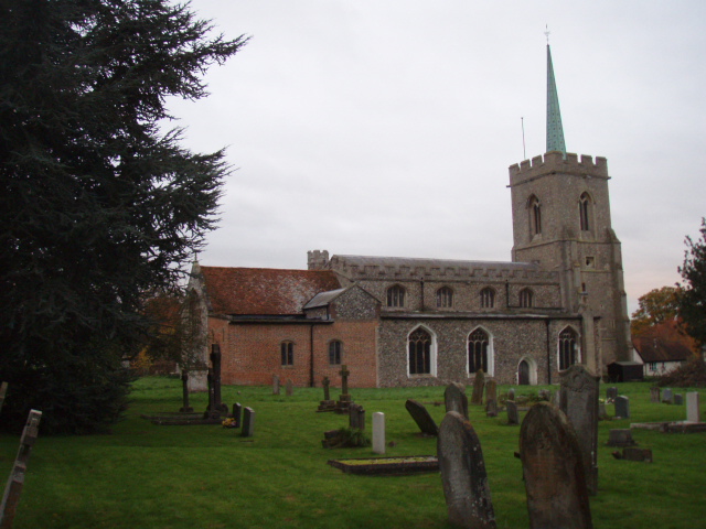
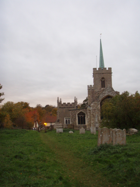
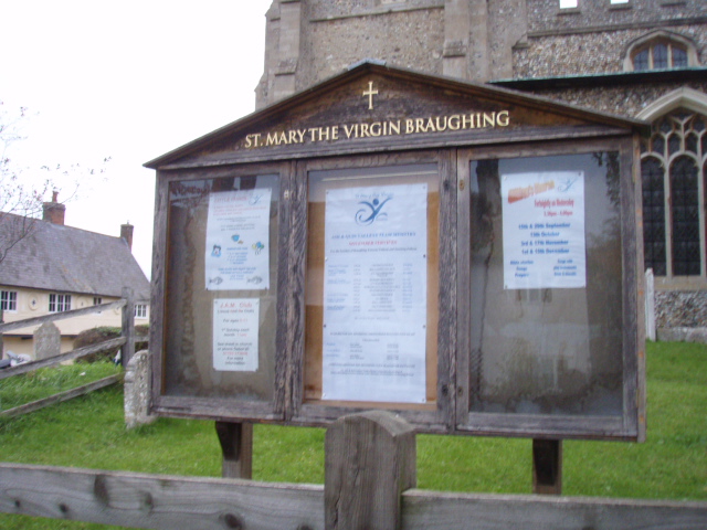
St Mary the Virgin Churchyard is located at Church End Braughing, East Hertfordshire District ,Hertfordshire , SG11 2QAEngland.
-
St Mary the Virgin Churchyard cemetery's updated grave count on graveviews.com?
1 memorials
-
Where are the coordinates of the St Mary the Virgin Churchyard?
Latitude: 51.9078420
Longitude: 0.0282310
Nearby Cemetories:
1. Puckeridge Chapel
Northchurch, Dacorum Borough, England
Coordinate: 51.8890720, 0.0106480
2. St. Mary's Churchyard
Standon, East Hertfordshire District, England
Coordinate: 51.8813515, 0.0273820
3. St. Mary the Virgin-Westmill
St Albans, St Albans District, England
Coordinate: 51.9262000, -0.0098000
4. Little Hormead St Mary Churchyard
Hormead, East Hertfordshire District, England
Coordinate: 51.9428430, 0.0331630
5. St Mary's Churchyard
Albury, East Hertfordshire District, England
Coordinate: 51.9026500, 0.0852920
6. St Edmund of Canterbury and the English Martyrs
Old Hall Green, East Hertfordshire District, England
Coordinate: 51.8799220, -0.0110510
7. St. Nicholas' Churchyard
Great Munden, East Hertfordshire District, England
Coordinate: 51.8996010, -0.0316180
8. Great Hormead St Nicholas Churchyard
Hormead, East Hertfordshire District, England
Coordinate: 51.9469500, 0.0353300
9. St Mary the Virgin Churchyard
Furneux Pelham, East Hertfordshire District, England
Coordinate: 51.9316710, 0.0808950
10. Hare Street Benson Grounds
Buntingford, East Hertfordshire District, England
Coordinate: 51.9492640, 0.0221120
11. St Cecilia Churchyard
Little Hadham, East Hertfordshire District, England
Coordinate: 51.8847860, 0.0997890
12. St Bartholomew's Church Churchyard
Buntingford, East Hertfordshire District, England
Coordinate: 51.9525530, -0.0089720
13. St Andrew & Holy Cross Churchyard
Much Hadham, East Hertfordshire District, England
Coordinate: 51.8573180, 0.0754260
14. St Giles Churchyard
Wyddial, East Hertfordshire District, England
Coordinate: 51.9673270, -0.0010730
15. All Saints Churchyard
Little Munden, East Hertfordshire District, England
Coordinate: 51.8795770, -0.0625920
16. St John the Evangelist Churchyard
High Cross, East Hertfordshire District, England
Coordinate: 51.8500010, -0.0213550
17. Holy Trinity Churchyard
Buntingford, East Hertfordshire District, England
Coordinate: 51.9540854, -0.0541753
18. St George Churchyard
Anstey, East Hertfordshire District, England
Coordinate: 51.9766990, 0.0431300
19. St. Thomas' Churchyard
Perry Green, East Hertfordshire District, England
Coordinate: 51.8419070, 0.0835140
20. Thundridge Old Churchyard
Thundridge, East Hertfordshire District, England
Coordinate: 51.8378330, -0.0156530
21. Saint Mary Churchyard
Meesden, East Hertfordshire District, England
Coordinate: 51.9728000, 0.0934270
22. St. Mary the Virgin Churchyard
Farnham, Uttlesford District, England
Coordinate: 51.9020340, 0.1517660
23. St John the Baptist Churchyard
Cottered, East Hertfordshire District, England
Coordinate: 51.9458000, -0.0846000
24. St. Mary Parish Churchyard
Thundridge, East Hertfordshire District, England
Coordinate: 51.8366590, -0.0291820