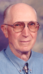
| Birth | : | 2 Dec 1881 Nebraska, USA |
| Death | : | 7 Dec 1958 Fremont, Dodge County, Nebraska, USA |
| Burial | : | Allentown Presbyterian Church Cemetery, Allentown, Monmouth County, USA |
| Coordinate | : | 40.1737518, -74.5862503 |
| Plot | : | Section 3, Lot 258, Grave 4 |
| Description | : | The Hooper Sentinel December 11, 1958 Rites Are Held Here For Mr. A. G. Uehling Mrs. Lenora A. Uehling, 77, of 807 West 6th St., died on Sunday after a brief illness. Services were held at Redeemer Lutheran East Church in Hooper with the Rev. G. Van Boening officiating. Interment was in the Hooper Cemetery. Mrs. Uehling had lived in Fremont the past three years, moving there from the Hooper area. She was baptized and confirmed in Zion Lutheran Church in Hooper. On Jan. 15, 1902 she married August C. Uehling in Hooper. He died in April, 1924, at Scribner.... Read More |
frequently asked questions (FAQ):
-
Where is Lenora Weigle Uehling's memorial?
Lenora Weigle Uehling's memorial is located at: Allentown Presbyterian Church Cemetery, Allentown, Monmouth County, USA.
-
When did Lenora Weigle Uehling death?
Lenora Weigle Uehling death on 7 Dec 1958 in Fremont, Dodge County, Nebraska, USA
-
Where are the coordinates of the Lenora Weigle Uehling's memorial?
Latitude: 40.1737518
Longitude: -74.5862503
Family Members:
Parent
Spouse
Siblings
Children
Flowers:
Nearby Cemetories:
1. Allentown Presbyterian Church Cemetery
Allentown, Monmouth County, USA
Coordinate: 40.1737518, -74.5862503
2. Old Christ Episcopal Burial Ground
Allentown, Monmouth County, USA
Coordinate: 40.1765300, -74.5844000
3. Saint Johns Cemetery
Allentown, Monmouth County, USA
Coordinate: 40.1742363, -74.5923615
4. Hamilton Street Cemetery
Allentown, Monmouth County, USA
Coordinate: 40.1801200, -74.5846800
5. Allentown Methodist Cemetery
Allentown, Monmouth County, USA
Coordinate: 40.1809578, -74.5833359
6. Princeton Memorial Park and Mausoleum
Robbinsville, Mercer County, USA
Coordinate: 40.2107900, -74.5800700
7. Sharon Methodist Episcopal Cemetery
Robbinsville, Mercer County, USA
Coordinate: 40.2046180, -74.5526530
8. Old Ellisdale Cemetery
Ellisdale, Burlington County, USA
Coordinate: 40.1300125, -74.5839996
9. Crosswicks Community Cemetery
North Crosswicks, Mercer County, USA
Coordinate: 40.1627007, -74.6472015
10. Crosswicks Methodist Cemetery
Crosswicks, Burlington County, USA
Coordinate: 40.1506195, -74.6428375
11. Crosswicks Friends Meetinghouse Cemetery
Crosswicks, Burlington County, USA
Coordinate: 40.1518580, -74.6471970
12. Chesterfield Friends Burial Ground
Crosswicks, Burlington County, USA
Coordinate: 40.1519320, -74.6477880
13. Arneytown Cemetery
Wrightstown, Burlington County, USA
Coordinate: 40.1202000, -74.5769800
14. Cream Ridge Cemetery
Cream Ridge, Monmouth County, USA
Coordinate: 40.1349068, -74.5234375
15. Groveville Cemetery
Groveville, Mercer County, USA
Coordinate: 40.1714900, -74.6717800
16. Windsor United Methodist Church Cemetery
Windsor, Mercer County, USA
Coordinate: 40.2431297, -74.5825348
17. Upper Freehold Friends Burying Ground
Arneytown, Monmouth County, USA
Coordinate: 40.1014709, -74.5658340
18. Hamilton Square Baptist Church Cemetery
Hamilton Square, Mercer County, USA
Coordinate: 40.2273600, -74.6531700
19. East Windsor Cemetery
Hightstown, Mercer County, USA
Coordinate: 40.2336121, -74.5236130
20. First Presbyterian Churchyard
Hamilton Square, Mercer County, USA
Coordinate: 40.2297600, -74.6602700
21. Ye Olde Robbins Burial Place
Imlaystown, Monmouth County, USA
Coordinate: 40.1892300, -74.4810200
22. Brigadier General William C. Doyle Memorial Cemetery
Arneytown, Burlington County, USA
Coordinate: 40.0940018, -74.5619583
23. Hamilton Square Methodist Episcopal Churchyard
Hamilton Square, Mercer County, USA
Coordinate: 40.2312400, -74.6629600
24. Emleys Hill Methodist Episcopal Churchyard
Cream Ridge, Monmouth County, USA
Coordinate: 40.1433334, -74.4830551


