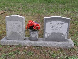
Leo Sprouse
| Birth | : | 22 Jun 1936 Gilmer County, West Virginia, USA |
| Death | : | 18 Sep 2013 Bridgeport, Harrison County, West Virginia, USA |
| Burial | : | Boilon Cemetery, Gilmer County, USA |
| Coordinate | : | 38.9519005, -80.6718979 |
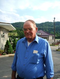
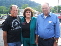
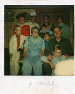
| Description | : | s/o Wilbur Sprouse and Mae (Frashure) h/o 1st wife Liza (Radcliff) Children include 7 Leo D. Sprouse, age 77, of Ellis Road, Linn, West Virginia, departed this life at 11:50 a.m. Wednesday, September 18, 2013 in the United Hospital Center, Bridgeport, West Virginia, following an extended illness. Born June 22, 1936 in Gilmer County, WV; son of the late Wilbur and Mae Frashure Sprouse. Leo enjoyed playing bingo, wood working, gardening, fishing in his younger years, he also enjoyed visiting friends and family. He retired as a maintenance man at the United Bank of Glenville and Louie Glass in Weston. He was a member of... Read More |
frequently asked questions (FAQ):
-
Where is Leo Sprouse's memorial?
Leo Sprouse's memorial is located at: Boilon Cemetery, Gilmer County, USA.
-
When did Leo Sprouse death?
Leo Sprouse death on 18 Sep 2013 in Bridgeport, Harrison County, West Virginia, USA
-
Where are the coordinates of the Leo Sprouse's memorial?
Latitude: 38.9519005
Longitude: -80.6718979
Family Members:
Parent
Spouse
Siblings
Children
Flowers:
Nearby Cemetories:
1. Boilon Cemetery
Gilmer County, USA
Coordinate: 38.9519005, -80.6718979
2. Schoonover-Dawson Cemetery
Donlan, Gilmer County, USA
Coordinate: 38.9461770, -80.6854790
3. Rogers Cemetery
Gilmer County, USA
Coordinate: 38.9406013, -80.6936035
4. Keith Cemetery
Gilmer County, USA
Coordinate: 38.9561005, -80.6986008
5. Blackburn Cemetery
Blackburn, Gilmer County, USA
Coordinate: 38.9235700, -80.6743200
6. Old Field Fork Cemetery
Lewis County, USA
Coordinate: 38.9827995, -80.6710968
7. Dyer Cemetery
Gilmer County, USA
Coordinate: 38.9319000, -80.7110977
8. McHenry Cemetery
Gilmer County, USA
Coordinate: 38.9341870, -80.7130200
9. McHenry Cemetery #1
Sand Fork, Gilmer County, USA
Coordinate: 38.9353310, -80.7162630
10. Tumbling Cemetery
Gilmer County, USA
Coordinate: 38.9085999, -80.6594009
11. Tomblin Cemetery
Blackburn, Gilmer County, USA
Coordinate: 38.9076650, -80.6597330
12. Queen Family Cemetery
Copley, Lewis County, USA
Coordinate: 38.9499000, -80.6130000
13. Pumphrey Cemetery
Orlando, Lewis County, USA
Coordinate: 38.9275880, -80.6216500
14. Varner Cemetery
Sand Fork, Gilmer County, USA
Coordinate: 38.9254709, -80.7212012
15. Canfield Cemetery
Gilmer, Gilmer County, USA
Coordinate: 38.9071999, -80.6900024
16. Conrad Cemetery
Sand Fork, Gilmer County, USA
Coordinate: 38.9364014, -80.7296982
17. Mick Cemetery
Gilmer County, USA
Coordinate: 38.9157200, -80.6316400
18. Killingsworth Cemetery
Sand Fork, Gilmer County, USA
Coordinate: 38.9169640, -80.7249834
19. Locust Knob Cemetery
Stouts Mills, Gilmer County, USA
Coordinate: 38.8990000, -80.6880000
20. Montgomery Cemetery
Bealls Mills, Lewis County, USA
Coordinate: 38.9648890, -80.6035400
21. Snyder Cemetery
Gilmer County, USA
Coordinate: 38.9006004, -80.6964035
22. Hiney Hill Cemetery
Linn, Gilmer County, USA
Coordinate: 38.9676950, -80.7405600
23. Pickerel Cemetery
Baldwin, Gilmer County, USA
Coordinate: 38.9891200, -80.7289800
24. Finster Chapel Cemetery
Peterson, Lewis County, USA
Coordinate: 38.9300003, -80.5999985

