
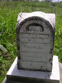
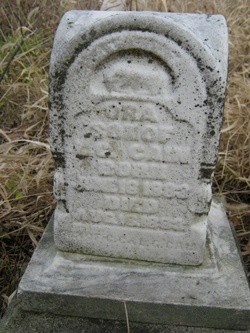
Leslie B. Cain
| Birth | : | 15 Jun 1880 Nodaway County, Missouri, USA |
| Death | : | 9 Sep 1880 Maryville, Nodaway County, Missouri, USA |
| Burial | : | Arvin Cemetery, Arvin, Kern County, USA |
| Coordinate | : | 35.2132300, -118.8952700 |
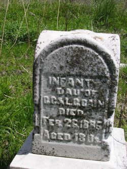
| Inscription | : | s/o C.C. & L.C. |
| Description | : | Fourth child of Columbus and Lucinda Cain. Shares stone with his brother Ora and an unnamed sister. This stone sits in the south eastern section of the cemetery and is next to their mother, Lucinda. |
frequently asked questions (FAQ):
-
Where is Leslie B. Cain's memorial?
Leslie B. Cain's memorial is located at: Arvin Cemetery, Arvin, Kern County, USA.
-
When did Leslie B. Cain death?
Leslie B. Cain death on 9 Sep 1880 in Maryville, Nodaway County, Missouri, USA
-
Where are the coordinates of the Leslie B. Cain's memorial?
Latitude: 35.2132300
Longitude: -118.8952700
Family Members:
Parent
Siblings

Flowers:


Nearby Cemetories:
1. Arvin Cemetery
Arvin, Kern County, USA
Coordinate: 35.2132300, -118.8952700
2. Greenlawn Southwest Mortuary and Cemetery
Bakersfield, Kern County, USA
Coordinate: 35.2948990, -119.0330810
3. Hillcrest Memorial Park
Bakersfield, Kern County, USA
Coordinate: 35.3814316, -118.9012527
4. Union Cemetery
Bakersfield, Kern County, USA
Coordinate: 35.3646500, -118.9948700
5. Home of Peace Jewish Cemetery
Bakersfield, Kern County, USA
Coordinate: 35.3631500, -118.9987400
6. Chinese Cemetery
Bakersfield, Kern County, USA
Coordinate: 35.3510550, -119.0273380
7. Bakersfield National Cemetery
Arvin, Kern County, USA
Coordinate: 35.2559600, -118.6693480
8. Saint Pauls Episcopal Church Columbarium
Bakersfield, Kern County, USA
Coordinate: 35.3746120, -119.0277940
9. Greenlawn Cemetery and Mortuary
Bakersfield, Kern County, USA
Coordinate: 35.4067001, -118.9856033
10. Fickert Family Cemetery
Bear Valley Springs, Kern County, USA
Coordinate: 35.1697260, -118.6443350
11. Kuntz Ranch Cemetery
Bakersfield, Kern County, USA
Coordinate: 35.4373560, -118.9390180
12. Tejon Indian Settlement Cemetery
Kern County, USA
Coordinate: 35.0422000, -118.6553900
13. Cesar E. Chavez National Monument
Keene, Kern County, USA
Coordinate: 35.2236000, -118.5592400
14. Tehachapi Cove Cemetery
Tehachapi, Kern County, USA
Coordinate: 35.1190000, -118.5724600
15. Brite Family Cemetery
Tehachapi, Kern County, USA
Coordinate: 35.1085350, -118.5473470
16. Rankin Cemetery
Walker Basin, Kern County, USA
Coordinate: 35.3844560, -118.5388890
17. Peter Lebeck Gravesite
Lebec, Kern County, USA
Coordinate: 34.8743040, -118.8926210
18. Long Tom Mine Cemetery
Woody, Kern County, USA
Coordinate: 35.5495600, -118.8308700
19. Fort Tejon Military Cemetery
Lebec, Kern County, USA
Coordinate: 34.8720500, -118.8971500
20. Old Tehachapi Cemetery
Tehachapi, Kern County, USA
Coordinate: 35.1400990, -118.4795570
21. Tehachapi Westside Cemetery
Tehachapi, Kern County, USA
Coordinate: 35.1387400, -118.4633600
22. Shafter Memorial Park
Shafter, Kern County, USA
Coordinate: 35.4728012, -119.2341995
23. Buhn Ranch Cemetery
Tehachapi, Kern County, USA
Coordinate: 35.1352210, -118.4319290
24. Paris-Loraine Cemetery
Loraine, Kern County, USA
Coordinate: 35.3059000, -118.4355000