
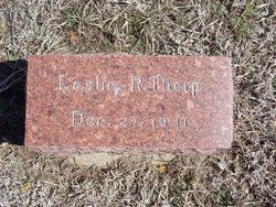
Leslie Ray Thorp
| Birth | : | 27 Dec 1941 |
| Death | : | 27 Dec 1941 |
| Burial | : | Wesleyan Cemetery, Oak Hill, Clay County, USA |
| Coordinate | : | 39.2268982, -97.2572021 |
frequently asked questions (FAQ):
-
Where is Leslie Ray Thorp's memorial?
Leslie Ray Thorp's memorial is located at: Wesleyan Cemetery, Oak Hill, Clay County, USA.
-
When did Leslie Ray Thorp death?
Leslie Ray Thorp death on 27 Dec 1941 in
-
Where are the coordinates of the Leslie Ray Thorp's memorial?
Latitude: 39.2268982
Longitude: -97.2572021
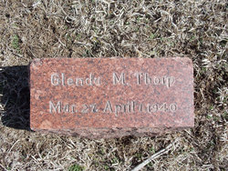
Family Members:
Parent
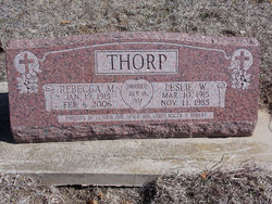

Siblings

Flowers:


Nearby Cemetories:
1. Wesleyan Cemetery
Oak Hill, Clay County, USA
Coordinate: 39.2268982, -97.2572021
2. Pleasant Valley Cemetery
Oak Hill, Clay County, USA
Coordinate: 39.2468987, -97.2889023
3. Rose Meron Cemetery
Oak Hill, Clay County, USA
Coordinate: 39.2194700, -97.3338900
4. Pleasant Ridge Cemetery
Clay County, USA
Coordinate: 39.2789001, -97.1841965
5. Athelstane Cemetery
Athelstane Township, Clay County, USA
Coordinate: 39.1768990, -97.1753006
6. Table Mound Cemetery
Idana, Clay County, USA
Coordinate: 39.3141300, -97.2792300
7. Hebron Cemetery
Clay County, USA
Coordinate: 39.3213800, -97.2601400
8. Zion Lutheran Cemetery
Clay County, USA
Coordinate: 39.2928009, -97.1557999
9. Mizpah Cemetery
Clay County, USA
Coordinate: 39.2057800, -97.1238500
10. Keystone Cemetery
Manchester, Dickinson County, USA
Coordinate: 39.1185989, -97.2917023
11. Swartwood Cemetery
Longford, Clay County, USA
Coordinate: 39.1323200, -97.3431500
12. Shields Cemetery
Clay County, USA
Coordinate: 39.3208008, -97.3507996
13. Uniondale Cemetery
Wakefield, Clay County, USA
Coordinate: 39.2382800, -97.0918400
14. Idana Cemetery
Idana, Clay County, USA
Coordinate: 39.3574500, -97.2693300
15. Republican City Cemetery
Clay Center, Clay County, USA
Coordinate: 39.3431015, -97.1628036
16. Greenridge Cemetery
Dickinson County, USA
Coordinate: 39.1199989, -97.1433029
17. Mount Liberty Church Cemetery
Ottawa County, USA
Coordinate: 39.2489400, -97.4356200
18. Saint John's Episcopal Cemetery
Clay County, USA
Coordinate: 39.2193985, -97.0744019
19. Henry Cemetery
Buckeye, Dickinson County, USA
Coordinate: 39.0828018, -97.1857986
20. Milo Chapman Gravesite
Broughton, Clay County, USA
Coordinate: 39.2888500, -97.0724400
21. Gilbert Cemetery
Clay County, USA
Coordinate: 39.2853012, -97.0625000
22. Wilson Cemetery
Clay County, USA
Coordinate: 39.3800011, -97.1896973
23. Vine Creek Cemetery
Ottawa County, USA
Coordinate: 39.1194000, -97.4180984
24. White Cloud Cemetery
Manchester, Dickinson County, USA
Coordinate: 39.0744019, -97.3525009