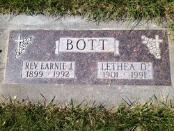
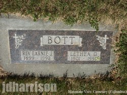
Lethea D. Coyle Bott
| Birth | : | 14 Dec 1901 Saint Joseph, Buchanan County, Missouri, USA |
| Death | : | 7 Jan 1991 Laurel, Yellowstone County, Montana, USA |
| Burial | : | Roth Cemetery, Trenton, Henry County, USA |
| Coordinate | : | 41.0515000, -91.6772000 |
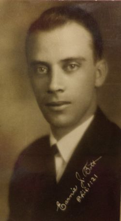
| Description | : | LAUREL OUTLOOK Wednesday, 9 Jan 1991 Lethea D. Bott 14 Dec. 1901 - 7 Jan. 1991 Lethea D. Bott, 89, of Laurel, died Monday, Jan. 7, 1991 at the Laurel Care Center. She was born Dec. 14, 1901, in St. Joseph, MO., daughter of George and Ida Coyle. She met E.J. Bott at the Moody Bible Institute of Chicago. They both graduated from the institute in 1928 and were married July 7, 1929, in Chicago. The couple came to Montana in 1929. Mrs. Bott served in the Evangelical Church as a trained soloist and musician for 37 years. She began her career in Plentywood... Read More |
frequently asked questions (FAQ):
-
Where is Lethea D. Coyle Bott's memorial?
Lethea D. Coyle Bott's memorial is located at: Roth Cemetery, Trenton, Henry County, USA.
-
When did Lethea D. Coyle Bott death?
Lethea D. Coyle Bott death on 7 Jan 1991 in Laurel, Yellowstone County, Montana, USA
-
Where are the coordinates of the Lethea D. Coyle Bott's memorial?
Latitude: 41.0515000
Longitude: -91.6772000
Family Members:
Spouse
Children
Flowers:
Nearby Cemetories:
1. Roth Cemetery
Trenton, Henry County, USA
Coordinate: 41.0515000, -91.6772000
2. Scheffel Family Cemetery
Trenton, Henry County, USA
Coordinate: 41.0539030, -91.6921730
3. Messer Cemetery
Henry County, USA
Coordinate: 41.0419006, -91.6885986
4. Green Mound Cemetery
Henry County, USA
Coordinate: 41.0696983, -91.6652985
5. White Oak Cemetery
Trenton, Henry County, USA
Coordinate: 41.0293999, -91.6793976
6. Alfred Warner Family Burial Ground
Trenton, Henry County, USA
Coordinate: 41.0180520, -91.6909500
7. Vorhies Cemetery
Rome, Henry County, USA
Coordinate: 41.0213230, -91.7134810
8. New Richwoods Cemetery
Trenton, Henry County, USA
Coordinate: 41.0270000, -91.6118000
9. Finley Cemetery
Henry County, USA
Coordinate: 41.0913800, -91.6202800
10. Richwoods South Cemetery
Henry County, USA
Coordinate: 41.0177000, -91.6115000
11. Traxler Cemetery
Mount Pleasant, Henry County, USA
Coordinate: 41.0413500, -91.5922000
12. Grant Cemetery
Rome, Henry County, USA
Coordinate: 40.9880981, -91.6992035
13. Old Baptist Cemetery
Wayland, Henry County, USA
Coordinate: 41.1045000, -91.6209000
14. Four Corners German Lutheran Cemetery
Lockridge, Jefferson County, USA
Coordinate: 41.0247002, -91.7605972
15. Sample Cemetery
Henry County, USA
Coordinate: 40.9812000, -91.6528000
16. Dallner Cemetery
Jefferson County, USA
Coordinate: 41.1047000, -91.7458000
17. Oak Grove Cemetery
Mount Pleasant, Henry County, USA
Coordinate: 41.0323982, -91.5813522
18. Hopkirk Family Cemetery
Lockridge, Jefferson County, USA
Coordinate: 40.9928820, -91.7396530
19. Hope Lutheran Cemetery
Germanville, Jefferson County, USA
Coordinate: 41.0943985, -91.7593994
20. Union Free Cemetery
Germanville, Jefferson County, USA
Coordinate: 41.0971000, -91.7585000
21. Hopkirk Cemetery
Jefferson County, USA
Coordinate: 41.0029000, -91.7566000
22. Smith Family Burial Site
Mount Pleasant, Henry County, USA
Coordinate: 40.9755300, -91.6987500
23. New Sweden United Methodist Church Cemetery
Lockridge, Jefferson County, USA
Coordinate: 41.0247002, -91.7752991
24. Nelson Plot
Jefferson County, USA
Coordinate: 41.1243890, -91.7185420


