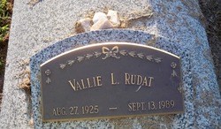
| Birth | : | 3 Feb 1918 Genoa, Nance County, Nebraska, USA |
| Death | : | 19 Nov 2005 Omaha, Douglas County, Nebraska, USA |
| Burial | : | All Saints Churchyard, Snodland, Tonbridge and Malling Borough, England |
| Coordinate | : | 51.3299000, 0.4496900 |
| Description | : | Daughter of Charles Edward & Anna Catherine (Zejlun) Saline. She graduated from Genoa High School in 1935. Lida continued her education at Midland and Kearney State Teachers College where she received her teaching certificate. She taught at rural country schools for 10 years. She was united in marriage to William Louis Liskovec on September 16, 1947 in Osceola. Lida went to work for Dale Electronics from 1955 until 1983. She was a member of St. Isidore Catholic Church in Columbus. Lida was a supporter of the Genoa Indian School Foundation and enjoyed spending time with her children and grandchildren. She is survived... Read More |
frequently asked questions (FAQ):
-
Where is Lida Lucille Saline Liskovec's memorial?
Lida Lucille Saline Liskovec's memorial is located at: All Saints Churchyard, Snodland, Tonbridge and Malling Borough, England.
-
When did Lida Lucille Saline Liskovec death?
Lida Lucille Saline Liskovec death on 19 Nov 2005 in Omaha, Douglas County, Nebraska, USA
-
Where are the coordinates of the Lida Lucille Saline Liskovec's memorial?
Latitude: 51.3299000
Longitude: 0.4496900
Family Members:
Parent
Spouse
Siblings
Children
Flowers:
Nearby Cemetories:
1. All Saints Churchyard
Snodland, Tonbridge and Malling Borough, England
Coordinate: 51.3299000, 0.4496900
2. All Saints with Christchurch Churchyard
Snodland, Tonbridge and Malling Borough, England
Coordinate: 51.3246110, 0.4406010
3. St Mary Old Churchyard
Burham, Tonbridge and Malling Borough, England
Coordinate: 51.3312262, 0.4619326
4. Snodland Cemetery
Snodland, Tonbridge and Malling Borough, England
Coordinate: 51.3336110, 0.4348770
5. Burham War Memorial
Burham, Tonbridge and Malling Borough, England
Coordinate: 51.3327530, 0.4785610
6. St John the Baptist Churchyard
Halling, Medway Unitary Authority, England
Coordinate: 51.3484993, 0.4468510
7. Halling Church Cemetery
Halling, Medway Unitary Authority, England
Coordinate: 51.3499140, 0.4447960
8. St. Benedict Churchyard
Snodland, Tonbridge and Malling Borough, England
Coordinate: 51.3332200, 0.4171600
9. Eccles War Memorial
Aylesford, Tonbridge and Malling Borough, England
Coordinate: 51.3178120, 0.4788630
10. Halling War Memorial
Halling, Medway Unitary Authority, England
Coordinate: 51.3519630, 0.4439060
11. All Saints Churchyard
Wouldham, Tonbridge and Malling Borough, England
Coordinate: 51.3528130, 0.4580580
12. Holy Trinity Churchyard
Larkfield, Tonbridge and Malling Borough, England
Coordinate: 51.3062210, 0.4441090
13. All Saints Churchyard
Birling, Tonbridge and Malling Borough, England
Coordinate: 51.3197010, 0.4097520
14. Aylesford Priory
Aylesford, Tonbridge and Malling Borough, England
Coordinate: 51.3030586, 0.4724390
15. St Peter and St Paul Churchyard
Leybourne, Tonbridge and Malling Borough, England
Coordinate: 51.3042520, 0.4222550
16. St Peter and St Paul Churchyard
Aylesford, Tonbridge and Malling Borough, England
Coordinate: 51.3040630, 0.4793870
17. Aylesford Cemetery
Aylesford, Tonbridge and Malling Borough, England
Coordinate: 51.3001000, 0.4752090
18. St Peter ad vincula Churchyard
Ditton, Tonbridge and Malling Borough, England
Coordinate: 51.2958810, 0.4510820
19. Royal British Legion Village Memorial
Aylesford, Tonbridge and Malling Borough, England
Coordinate: 51.2964380, 0.4744810
20. Medway Crematorium
Chatham, Medway Unitary Authority, England
Coordinate: 51.3331340, 0.5107590
21. St. Michael and All Angels Churchyard
Cuxton, Medway Unitary Authority, England
Coordinate: 51.3714120, 0.4546760
22. St. James the Great Churchyard
East Malling, Tonbridge and Malling Borough, England
Coordinate: 51.2874670, 0.4402040
23. St. Mary the Virgin Churchyard
West Malling, Tonbridge and Malling Borough, England
Coordinate: 51.2921700, 0.4068400
24. St Matthew Churchyard
Borstal, Medway Unitary Authority, England
Coordinate: 51.3736150, 0.4868020


