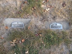
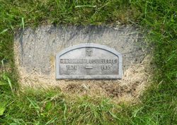
Louis Brouillette
| Birth | : | 11 May 1876 Sioux City, Woodbury County, Iowa, USA |
| Death | : | 30 Jan 1968 Fargo, Cass County, North Dakota, USA |
| Burial | : | St. Giles' Churchyard, Horspath, South Oxfordshire District, England |
| Coordinate | : | 51.7397190, -1.1738770 |
| Description | : | LOUIS BROUILLETTE DIES AT FARGO, N.D.; SET LE MARS RTTES Louis 0. Brouillette, 92, former longtime Le Mars resident, died Tuesday at a Fargo, N.D., hospital where he has been a patient for 10 days. He made his home with his daughter, Mrs. Wallace Thorns, at Fargo in recent years. Mr. Brouillette was born May 11, 1876, near Sioux City, His marriage to Barbara Simeon took place in Le Mars in 1902. She preceded him in death in 1936. At the age of 14 he took an apprenticeship in horseshoeing and blacksmithing and until 1960 he pursued his... Read More |
frequently asked questions (FAQ):
-
Where is Louis Brouillette's memorial?
Louis Brouillette's memorial is located at: St. Giles' Churchyard, Horspath, South Oxfordshire District, England.
-
When did Louis Brouillette death?
Louis Brouillette death on 30 Jan 1968 in Fargo, Cass County, North Dakota, USA
-
Where are the coordinates of the Louis Brouillette's memorial?
Latitude: 51.7397190
Longitude: -1.1738770
Family Members:
Parent
Spouse
Siblings
Children
Flowers:
Nearby Cemetories:
1. St. Giles' Churchyard
Horspath, South Oxfordshire District, England
Coordinate: 51.7397190, -1.1738770
2. Wheatley War Memorial
Wheatley, South Oxfordshire District, England
Coordinate: 51.7468630, -1.1388780
3. Holy Trinity Churchyard
Headington, City of Oxford, England
Coordinate: 51.7577500, -1.1979980
4. St Mary the Virgin Churchyard
Wheatley, South Oxfordshire District, England
Coordinate: 51.7476020, -1.1366080
5. Cornerstone Church Cemetery
Headington, City of Oxford, England
Coordinate: 51.7587275, -1.1995588
6. St. Aldate's Churchyard
Oxford, City of Oxford, England
Coordinate: 51.7497900, -1.2118500
7. St. Nicholas' Church
Forest Hill, South Oxfordshire District, England
Coordinate: 51.7641400, -1.1567200
8. Forest Hill Church Cemetery
Forest Hill, South Oxfordshire District, England
Coordinate: 51.7641700, -1.1567100
9. Saint Mary's Churchyard
Garsington, South Oxfordshire District, England
Coordinate: 51.7140100, -1.1600700
10. St. James Churchyard
Cowley, City of Oxford, England
Coordinate: 51.7305878, -1.2202638
11. All Saints Churchyard
Cuddesdon, South Oxfordshire District, England
Coordinate: 51.7230140, -1.1316130
12. Rose Hill Cemetery
Oxford, City of Oxford, England
Coordinate: 51.7320960, -1.2254070
13. The Priory
Headington, City of Oxford, England
Coordinate: 51.7638260, -1.2108100
14. St Bartholomew Churchyard
Holton, South Oxfordshire District, England
Coordinate: 51.7529490, -1.1246510
15. Oxford Crematorium
Headington, City of Oxford, England
Coordinate: 51.7719240, -1.1904020
16. St Andrew Churchyard
Headington, City of Oxford, England
Coordinate: 51.7647100, -1.2121400
17. St Lawrence Churchyard
Toot Baldon, South Oxfordshire District, England
Coordinate: 51.7051720, -1.1750220
18. St Mary and St Nicholas Churchyard
Littlemore, City of Oxford, England
Coordinate: 51.7210753, -1.2232272
19. St Mary and St John Church
Oxford, City of Oxford, England
Coordinate: 51.7452501, -1.2314021
20. Littlemore Chapel
Littlemore, City of Oxford, England
Coordinate: 51.7208320, -1.2270330
21. Headington Cemetery
Headington, City of Oxford, England
Coordinate: 51.7668050, -1.2179280
22. Saint John the Baptist
Stanton St John, South Oxfordshire District, England
Coordinate: 51.7800350, -1.1642830
23. St. Clements Churchyard
Oxford, City of Oxford, England
Coordinate: 51.7527790, -1.2369920
24. Greyfriars
Oxford, City of Oxford, England
Coordinate: 51.7437920, -1.2401460


