
| Birth | : | 26 Jan 1882 El Dorado County, California, USA |
| Death | : | 16 Jul 1962 Pepperwood, Humboldt County, California, USA |
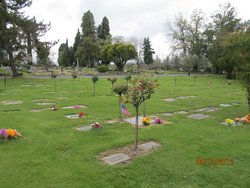
| Burial | : | Oakham Cemetery, Oakham, Rutland Unitary Authority, England |
| Coordinate | : | 52.6768700, -0.7297400 |
| Description | : | Louisa May Smith is the daughter of William Henry Smith and Maria Eloisa Quijada. She was born in Light Canyon, Eldorado County, California. She married first to George Clifford Ragon. They had 4 children. Her second husband is Roy Evans Holmes. **************************************************** Holmes, Louisa May--July 16, Pepperwood, California. Wife of Roy E. Holmes, Pepperwood. Mother of Mrs. Rosalena Fleckstein of Ceres, Calif., Clifford Ragon of Oakland, Mrs. Anna Marie Rhode of Northfield, Ohio, Glen Ragon of Kneeland, Mrs. Ann Hunt, Miss Helen Holmes and George Holmes all of Pepperwood. Sister of John Smith and Mrs. Ousey of Auburn and Mrs. Annie Brooks of... Read More |
frequently asked questions (FAQ):
-
Where is Louisa May Smith Holmes's memorial?
Louisa May Smith Holmes's memorial is located at: Oakham Cemetery, Oakham, Rutland Unitary Authority, England.
-
When did Louisa May Smith Holmes death?
Louisa May Smith Holmes death on 16 Jul 1962 in Pepperwood, Humboldt County, California, USA
-
Where are the coordinates of the Louisa May Smith Holmes's memorial?
Latitude: 52.6768700
Longitude: -0.7297400
Family Members:
Parent

Spouse
Siblings
Flowers:


Nearby Cemetories:
1. Oakham Cemetery
Oakham, Rutland Unitary Authority, England
Coordinate: 52.6768700, -0.7297400
2. SS Peter and Paul Church
Langham, Rutland Unitary Authority, England
Coordinate: 52.6918700, -0.7529300
3. St Mary the Virgin Churchyard
Ashwell, Rutland Unitary Authority, England
Coordinate: 52.7144490, -0.7200580
4. St Andrew Churchyard
Hambleton, Rutland Unitary Authority, England
Coordinate: 52.6585060, -0.6712280
5. St John the Baptist Churchyard
Cold Overton, Melton Borough, England
Coordinate: 52.6829560, -0.8027660
6. St Andrew Churchyard
Whissendine, Rutland Unitary Authority, England
Coordinate: 52.7200520, -0.7682370
7. St. Nicholas Churchyard
Cottesmore, Rutland Unitary Authority, England
Coordinate: 52.7128800, -0.6655820
8. St Peter Churchyard
Knossington, Melton Borough, England
Coordinate: 52.6699000, -0.8168600
9. St Peter and St Paul Churchyard
Exton, Rutland Unitary Authority, England
Coordinate: 52.6905790, -0.6396910
10. Holy Trinity Churchyard
Teigh, Rutland Unitary Authority, England
Coordinate: 52.7348560, -0.7207040
11. St Peter & Paul Churchyard
Preston, Rutland Unitary Authority, England
Coordinate: 52.6122600, -0.7162560
12. Saint Peter and Saint Paul's Churchyard
Market Overton, Rutland Unitary Authority, England
Coordinate: 52.7385000, -0.6893000
13. St. Peter and St. Paul's Churchyard
Wing, Rutland Unitary Authority, England
Coordinate: 52.6172140, -0.6814150
14. Withcote Chapel
Harborough District, England
Coordinate: 52.6440500, -0.8253346
15. All Saints Churchyard, Pickwell
Melton Mowbray, Melton Borough, England
Coordinate: 52.6943280, -0.8388740
16. Pickwell Road Cemetery
Somerby, Melton Borough, England
Coordinate: 52.6865550, -0.8444540
17. St Mary the Virgin Churchyard
Edith Weston, Rutland Unitary Authority, England
Coordinate: 52.6379100, -0.6311100
18. Saint Michael and All Angels Churchyard
Edmondthorpe, Melton Borough, England
Coordinate: 52.7488800, -0.7301600
19. Edmondthorpe Main Street Cemetery
Edmondthorpe, Melton Borough, England
Coordinate: 52.7491560, -0.7300030
20. All Saints Churchyard
Somerby, Melton Borough, England
Coordinate: 52.6864700, -0.8482390
21. Launde Abbey
Launde, Harborough District, England
Coordinate: 52.6313950, -0.8233060
22. St Mary the Virgin Churchyard
Greetham, Rutland Unitary Authority, England
Coordinate: 52.7216100, -0.6325650
23. St Nicholas Churchyard
Pilton, Rutland Unitary Authority, England
Coordinate: 52.6165200, -0.6504100
24. St. Mary the Virgin Churchyard
Uppingham, Rutland Unitary Authority, England
Coordinate: 52.5996800, -0.7324400