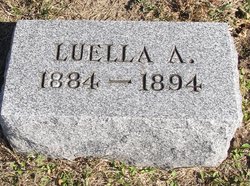
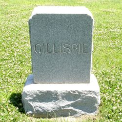
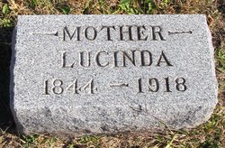
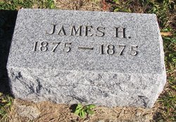
Luella Agnes “Lulu” Gillispie
| Birth | : | 1884 Brown County, Kansas, USA |
| Death | : | 14 May 1894 Brown County, Kansas, USA |
| Burial | : | Hart Cemetery, Reserve, Brown County, USA |
| Coordinate | : | 39.9519005, -95.5366974 |
| Description | : | The Brown County World Fri May 4, 1894: "The sympathy of the public is extended to Mr. and Mrs. Henry Gillespie. Their daughter, Lulu, 10 years old is slowly dying with a tumor. Monday the physician attempted to remove it but found that the cruel growth had so fastened itself to the liver and intestines that removal was impossible. The child suffers little, but her life is gradually slipping away." The Brown County World, Fri May 18, 1894: "Lulu Gillespie, daughter of Mr. and Mrs. H. J. Gillespie, died at the home of her sister, Mrs. W. G. Thompson Monday. Funeral services Wednesday... Read More |
frequently asked questions (FAQ):
-
Where is Luella Agnes “Lulu” Gillispie's memorial?
Luella Agnes “Lulu” Gillispie's memorial is located at: Hart Cemetery, Reserve, Brown County, USA.
-
When did Luella Agnes “Lulu” Gillispie death?
Luella Agnes “Lulu” Gillispie death on 14 May 1894 in Brown County, Kansas, USA
-
Where are the coordinates of the Luella Agnes “Lulu” Gillispie's memorial?
Latitude: 39.9519005
Longitude: -95.5366974
Family Members:
Parent
Siblings
Flowers:
Nearby Cemetories:
1. Hart Cemetery
Reserve, Brown County, USA
Coordinate: 39.9519005, -95.5366974
2. Cornelison Cemetery
Reserve, Brown County, USA
Coordinate: 39.9754105, -95.5485687
3. Oakland Cemetery
Padonia, Brown County, USA
Coordinate: 39.9273900, -95.5610900
4. Laus Creek Cemetery
Reserve, Brown County, USA
Coordinate: 39.9754105, -95.4699936
5. Hamlin Cemetery
Hamlin, Brown County, USA
Coordinate: 39.9206009, -95.6292877
6. Pleasant Hill Cemetery
Irving Township, Brown County, USA
Coordinate: 39.9435997, -95.4328232
7. Stumbo Cemetery
Brown County, USA
Coordinate: 39.9977798, -95.6298828
8. Pleasant Hill Cemetery
Hamlin, Brown County, USA
Coordinate: 39.9430428, -95.6484299
9. Pearson Point Cemetery
Falls City, Richardson County, USA
Coordinate: 40.0400800, -95.5688500
10. Hiawatha Cemetery
Hiawatha, Brown County, USA
Coordinate: 39.8601799, -95.5265198
11. Niles Cemetery
Hiawatha, Brown County, USA
Coordinate: 39.8730900, -95.6126300
12. Shelton Cemetery
Hamlin, Brown County, USA
Coordinate: 39.8852997, -95.6393967
13. Mount Hope Cemetery
Hiawatha, Brown County, USA
Coordinate: 39.8497009, -95.5156021
14. Nemaha Falls Cemetery
Richardson County, USA
Coordinate: 40.0313128, -95.6276913
15. Falls City Cemetery
Falls City, Richardson County, USA
Coordinate: 40.0593987, -95.5569000
16. Carson Cemetery
Hamlin, Brown County, USA
Coordinate: 39.8810200, -95.6483100
17. Campbell Cemetery
Reserve, Brown County, USA
Coordinate: 39.9905980, -95.3961750
18. Kenyon Cemetery
Robinson, Brown County, USA
Coordinate: 39.9122000, -95.3964600
19. Saint Thomas Episcopal Church Columbarium
Falls City, Richardson County, USA
Coordinate: 40.0608500, -95.6016000
20. Immaculate Conception Cemetery
Rulo, Richardson County, USA
Coordinate: 40.0480200, -95.4431800
21. Morrill Cemetery
Morrill, Brown County, USA
Coordinate: 39.9351311, -95.6932831
22. Falls City Pioneer Cemetery
Richardson County, USA
Coordinate: 40.0582500, -95.6156500
23. Zion Bethel Cemetery
Jefferson Township, Richardson County, USA
Coordinate: 40.0727997, -95.5017014
24. Brethren Church Cemetery
Morrill, Brown County, USA
Coordinate: 39.9808693, -95.6940079

