
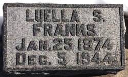
Luella Snyder Franks
| Birth | : | 25 Jan 1874 Glasco, Cloud County, Kansas, USA |
| Death | : | 5 Dec 1944 Topeka, Shawnee County, Kansas, USA |
| Burial | : | Corning Cemetery, Corning, Clay County, USA |
| Coordinate | : | 36.4132996, -90.5774994 |
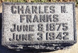
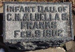
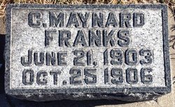
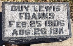
| Description | : | Glasco Sun, Dec. 14, 1944, page 1: MRS. LUELLA FRANKS Luella, daughter of H.C. and Phoebe Snyder, was born on the Snyder homestead, one-half mile west of Glasco, on January 25, 1874. She attended the public school of Glasco, and began teaching when very young and taught school for eight years in rural districts near Glasco. Luella Snyder was married to Mr. Charles N. Franks on December 25, 1898. To this union three children were born, a girl who died in infancy and two boys who died in very early childhood. Mr. and Mrs. Franks spent twenty-two years of their married life on a... Read More |
frequently asked questions (FAQ):
-
Where is Luella Snyder Franks's memorial?
Luella Snyder Franks's memorial is located at: Corning Cemetery, Corning, Clay County, USA.
-
When did Luella Snyder Franks death?
Luella Snyder Franks death on 5 Dec 1944 in Topeka, Shawnee County, Kansas, USA
-
Where are the coordinates of the Luella Snyder Franks's memorial?
Latitude: 36.4132996
Longitude: -90.5774994
Family Members:
Parent

Spouse
Siblings
Children
Flowers:


Nearby Cemetories:
1. Corning Cemetery
Corning, Clay County, USA
Coordinate: 36.4132996, -90.5774994
2. Allmandinger Cemetery
Corning, Clay County, USA
Coordinate: 36.4524994, -90.6038971
3. Redenbo Cemetery
Clay County, USA
Coordinate: 36.4077988, -90.5152969
4. Williams Cemetery
Corning, Clay County, USA
Coordinate: 36.4681015, -90.5622025
5. Cantwell Cemetery
Corning, Clay County, USA
Coordinate: 36.4081001, -90.5014038
6. Green Cemetery
Clay County, USA
Coordinate: 36.4641991, -90.6331024
7. Richwoods Cemetery
Corning, Clay County, USA
Coordinate: 36.4035988, -90.6632996
8. Moark Cemetery
Moark, Clay County, USA
Coordinate: 36.4738998, -90.5243988
9. Bond Cemetery
Knobel, Clay County, USA
Coordinate: 36.3297005, -90.5864029
10. Masterson Cemetery
Clay County, USA
Coordinate: 36.4733009, -90.6547012
11. Gilchrist Cemetery
Knobel, Clay County, USA
Coordinate: 36.3227997, -90.5886002
12. Black Cemetery
Success, Clay County, USA
Coordinate: 36.4831009, -90.6528015
13. Brown Cemetery
Clay County, USA
Coordinate: 36.4706001, -90.6694031
14. Sheely Cemetery
Butler County, USA
Coordinate: 36.5018997, -90.5397034
15. Saint Bernard Cemetery
Knobel, Clay County, USA
Coordinate: 36.3236008, -90.6232986
16. Eaton Cemetery
Naylor, Ripley County, USA
Coordinate: 36.5130997, -90.6063995
17. Hosea Cemetery
Knobel, Clay County, USA
Coordinate: 36.3208008, -90.6324997
18. Roberts Cemetery
Neelyville, Butler County, USA
Coordinate: 36.5056000, -90.5160980
19. Allen Cemetery
Knobel, Clay County, USA
Coordinate: 36.3119011, -90.6505966
20. Hitt Cemetery
Success, Clay County, USA
Coordinate: 36.4641991, -90.7127991
21. Acorn Cemetery
Sinsabaugh, Ripley County, USA
Coordinate: 36.4994800, -90.6994700
22. Kelsey Cemetery
Ripley County, USA
Coordinate: 36.5447006, -90.6264038
23. Marlin Cemetery (Now called Kelsey)
Naylor, Ripley County, USA
Coordinate: 36.5449272, -90.6273643
24. Pirtle Cemetery
Peach Orchard, Clay County, USA
Coordinate: 36.2957580, -90.6700160