
| Birth | : | 22 Mar 1896 Perry, Dallas County, Iowa, USA |
| Death | : | 10 Dec 1975 Estherville, Emmet County, Iowa, USA |
| Burial | : | East Side Cemetery, Estherville, Emmet County, USA |
| Coordinate | : | 43.4068985, -94.8264008 |
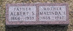
| Description | : | Mae Anderson Estherville – Funeral services for Mae Lelia Anderson, 79, Estherville, will be held 1:30 p.m. Monday at the Christian Church in Estherville with the Rev. James Harmon officiating and burial at the East Side Cemetery. She died Wednesday [December 10, 1975] evening at Holy Family Hospital. Mrs. Anderson was born March 22, 1896 at Perry to Albert Reed and Melinda Bair Reed and was educated in the Perry schools. She moved to Estherville in 1920 and was married to Henry Anderson June 4, 1953 at Estherville. She was a member of the Christian Church. Survivors include two sons, LeRoy York, Woods... Read More |
frequently asked questions (FAQ):
-
Where is Mae Lelia Reed Anderson's memorial?
Mae Lelia Reed Anderson's memorial is located at: East Side Cemetery, Estherville, Emmet County, USA.
-
When did Mae Lelia Reed Anderson death?
Mae Lelia Reed Anderson death on 10 Dec 1975 in Estherville, Emmet County, Iowa, USA
-
Where are the coordinates of the Mae Lelia Reed Anderson's memorial?
Latitude: 43.4068985
Longitude: -94.8264008
Family Members:
Parent

Spouse
Siblings

Children
Flowers:


Nearby Cemetories:
1. East Side Cemetery
Estherville, Emmet County, USA
Coordinate: 43.4068985, -94.8264008
2. East Side Memorial Cemetery
Estherville, Emmet County, USA
Coordinate: 43.4267750, -94.8265600
3. Oak Hill Cemetery
Estherville, Emmet County, USA
Coordinate: 43.3986015, -94.8518982
4. Norwegian Cemetery
Estherville, Emmet County, USA
Coordinate: 43.4291992, -94.8261032
5. Saint Patricks Cemetery
Estherville, Emmet County, USA
Coordinate: 43.3843994, -94.8283005
6. Estherville Lutheran Cemetery
Estherville, Emmet County, USA
Coordinate: 43.4298000, -94.8263000
7. Prosser Cemetery
Estherville, Emmet County, USA
Coordinate: 43.4422000, -94.7783000
8. Superior Township Cemetery
Superior, Dickinson County, USA
Coordinate: 43.4399986, -94.9533005
9. Wallingford Lutheran Cemetery
Wallingford, Emmet County, USA
Coordinate: 43.3128014, -94.7731018
10. Union State Line Cemetery
Dickinson County, USA
Coordinate: 43.4928017, -94.9156036
11. Center Township Cemetery
Emmet County, USA
Coordinate: 43.3608000, -94.6790000
12. Ellsworth Cemetery
Emmet County, USA
Coordinate: 43.5005989, -94.7249985
13. Richland Township Cemetery
Terril, Dickinson County, USA
Coordinate: 43.3565323, -94.9927821
14. Petersburg Cemetery
Jackson County, USA
Coordinate: 43.5224991, -94.9182968
15. Fairview Cemetery
Terril, Dickinson County, USA
Coordinate: 43.2977982, -94.9349976
16. Swan Lake Township Cemetery
Maple Hill, Emmet County, USA
Coordinate: 43.3850746, -94.6381378
17. High Lake Jack Creek Cemetery
Wallingford, Emmet County, USA
Coordinate: 43.3006500, -94.7000620
18. Saint Johns Lutheran Cemetery
Petersburg, Jackson County, USA
Coordinate: 43.5442009, -94.8780975
19. Lincoln Township Cemetery
Dolliver, Emmet County, USA
Coordinate: 43.4441986, -94.6204987
20. Graettinger City Cemetery
Graettinger, Palo Alto County, USA
Coordinate: 43.2550011, -94.7722015
21. Palestine Cemetery
Dolliver, Emmet County, USA
Coordinate: 43.4880000, -94.6408000
22. Saint Jacobs Cemetery
Graettinger, Palo Alto County, USA
Coordinate: 43.2546997, -94.7705994
23. Lake Fremont Cemetery
Dunnell, Martin County, USA
Coordinate: 43.5691986, -94.7746964
24. Lake Belt Cemetery
Ceylon, Martin County, USA
Coordinate: 43.5353012, -94.6742020